Warlingham Circular Walk
![]()
![]() This Surrey based village is located in the Tandridge district of the county. With a fine local nature reserve and access to the North Downs it's a good place to start a walk.
This Surrey based village is located in the Tandridge district of the county. With a fine local nature reserve and access to the North Downs it's a good place to start a walk.
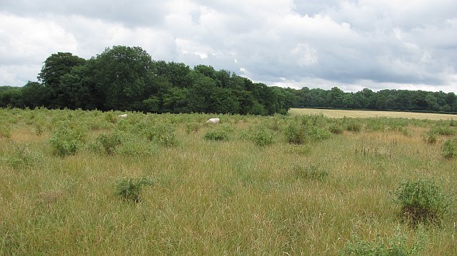
This circular walk from the village uses sections of the Vanguard Way, the North Downs Way and the Woldingham Countryside Circular Walk to explore the woodland and countryside to the south of the village. Along the way you'll enjoy fine views over the surrounding countryside of the North Downs.
The walk starts at the Blanchman's Farm Local Nature Reserve on Limpsfield Rd in the village. The reserve is a nice place for a stroll in the heart of the Warlingham. In the reserve there's a nature trail, two summer meadows, a pond, a central wooded area, hazel coppice, a newly planted orchard and horse grazing. It's also great for wildlife with roe deer, foxes and a variety of birds to look out for.
After exploring the reserve the route then follows footpaths south and then east towards Chelsham and Henley Wood.
The route then heads south towards Nore Hill and Botley Hill along the Vanguard Way. Botley Hill is notable as the highest point in the North Downs. There's some fine views and a 16th century farmhouse pub in this area.
The route then turns west along the Pilgrim's Way to Oxted Quarry and Gangers Hill. You then head north past Marden Park and Woldingham before returning to Warlingham.
Postcode
CR6 9LW - Please note: Postcode may be approximate for some rural locationsWarlingham Ordnance Survey Map  - view and print off detailed OS map
Warlingham Open Street Map  - view and print off detailed map
*New* - Walks and Cycle Routes Near Me Map - Waymarked Routes and Mountain Bike Trails>>
Warlingham OS Map  - Mobile GPS OS Map with Location tracking
Warlingham Open Street Map  - Mobile GPS Map with Location tracking
Walks near Warlingham
- Woldingham - A circular walk from Woldingham train station taking you into the Surrey Hills AONB
- Limpsfield Common - Limpsfield Common and Limpsfield Chart in the Surrey Hills have some nice woodland trails to try
- Coulsdon South Circular Walk - This circular walk from Coulsdon South train station makes use of some of the area's waymarked footpaths to take you on a tour of the hills, countryside and woods to the south of Coulsdon
- Farthing Downs - This large area of chalk grassland is located near Coulsdon in south London
- Botley Hill - This circular walk explores the area around Botley Hill, the highest point in the North Downs
- Oxted Circular Walk - This circular walk from Oxted explores the countryside and woodlands to the east of the Surrey town
- Betsoms Hill - This circular walk explores the area around Betsom's Hill and Westerham Hill near Biggin Hill in Kent.
- Selsdon Wood - This woodland and nature reserve in Croydon is criss crossed with a number of nice footpaths and walking trails
- Riddlesdown Common - This walk visits a pleasant green space in the Purley area of the London Borough of Croydon.
- Greensand Way - The Greensand Way runs from Haslemere in Surrey to Hamstreet in Kent following the ridge of greensand rock that crosses the two counties
- Vanguard Way - This 66 mile trail runs from the outskirts of London, through Ashdown Forest, Alfriston and Cuckmere Valley to the stunning East Sussex coast.
Route highlights include the lovely Ashdown Forest, the White Horse near Alfriston and the wonderful final coastal stretch that gives views of the Seven Sisters Cliffs and Tidemills beach - North Downs Way - This beautiful trail starts in Farnham, Surrey and heads east through the stunning North Downs to the historic city of Canterbury in Kent
- Happy Valley - This large park sits in a fine spot on the North Downs near Caterham and Coulsdon.
- Caterham - This Surrey town is located near Woldingham and Warlingham in the Tandridge district of the county.
Pubs/Cafes
The White Lion is an historic pub of some note. Parts of the building date from 1467, when it was a farm house with attached cottages. It has a delightful old interior with low beams and nooks and crannies. Outside there's a good sized garden area for warmer days. You can find them at 3 Farleigh Road, CR6 9EG.
Dog Walking
The woodland and country trails are ideal for a dog walk. The White Lion mentioned above is also dog friendly.


