Whitby to Robin's Hood Bay Walk
![]()
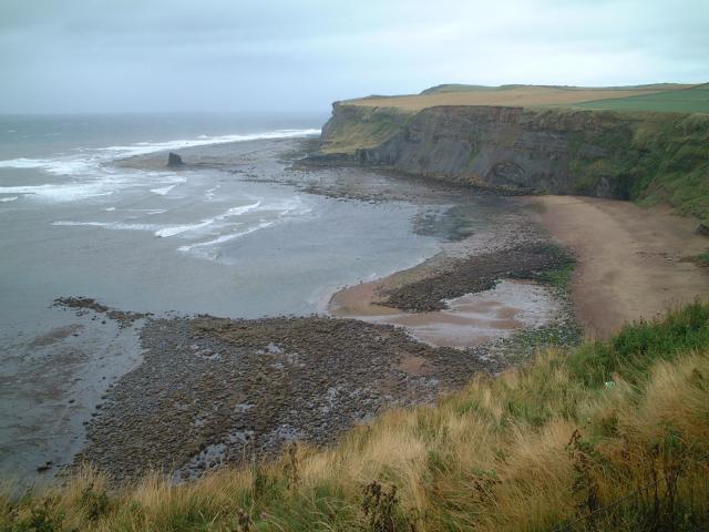
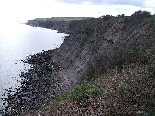
![]() This coastal walk follows a popular section of the Cleveland Way from Whitby to Robin's Hood Bay. It's a beautiful stretch of coast with pretty bays and cliff top views. The walk runs for about 7 miles on generally good, waymarked footpaths.
This coastal walk follows a popular section of the Cleveland Way from Whitby to Robin's Hood Bay. It's a beautiful stretch of coast with pretty bays and cliff top views. The walk runs for about 7 miles on generally good, waymarked footpaths.
The walk starts in Whitby on the River Esk and heads to Whitby Abbey. The atmospheric ruined abbey overlooks the North Sea on the East Cliff above Whitby. It's a very photogenic spot with the abbey ruins surrounded by coast, river and countryside.
The route continues to Saltwick Bay and the Whitby Lighthouse, before passing Oakham Beck and Rain Dale. Soon after you come to the fishing village of Robin Hood's Bay. The village is very picturesque with lots of old fishermen's cottages.
You could return the same way or turn it into a circular walk by following a track inland to Hawsker and Stainsacre. The trail can be picked up in the village just to the west of the coast path.
To extend your walk you can continue along the coast path to Ravenscar and visit Harwood Dale Forest. There's lots of footpaths and bridleways to explore the coniferous woodland with its pine and spruce trees, streams and ponds. You can also try the Ravenscar to Robin Hoods Bay Circular Walk which perfectly combines some fine inland moorland scenery and the coast.
Wainwright's Coast to Coast starts at Robin's Hood Bay so you could pick up this long distance trail and head inland towards Littlebeck and explore the North York Moors National Park. For example you could head just south of Littlebeck and visit the lovely Falling Foss waterfall.
Heading west along the coast path will take you to Runswick Bay where there is a delightful fishing village with a sandy beach and pretty little cottages.
You can virtually follow this stretch of coast using the google street view link below!
Whitby to Robin's Hood Bay Ordnance Survey Map  - view and print off detailed OS map
Whitby to Robin's Hood Bay Open Street Map  - view and print off detailed map
*New* - Walks and Cycle Routes Near Me Map - Waymarked Routes and Mountain Bike Trails>>
Whitby to Robin's Hood Bay OS Map  - Mobile GPS OS Map with Location tracking
Whitby to Robin's Hood Bay Open Street Map  - Mobile GPS Map with Location tracking
Explore the Area with Google Street View 
Pubs/Cafes
At the end of the walk you could enjoy some well earned refreshments at The Bay Hotel. The inn dates back to 1828 and is located in a lovely spot in The Dock at Robin Hood's Bay at the end of Alfred Wainwright's 192 mile Coast-to-Coast Walk from St. Bees in Cumbria. The bottom bar of the hotel has been renamed Wainwright's Bar in his memory. They serve good home cooked food and have an outdoor seating area for warmer days. You can find them at postcode YO22 4SJ for your sat navs.
Dog Walking
It's a fine bracing walk for dogs but do take care on the high cliff top paths. The Bay Hotel mentioned above is also dog friendly.


