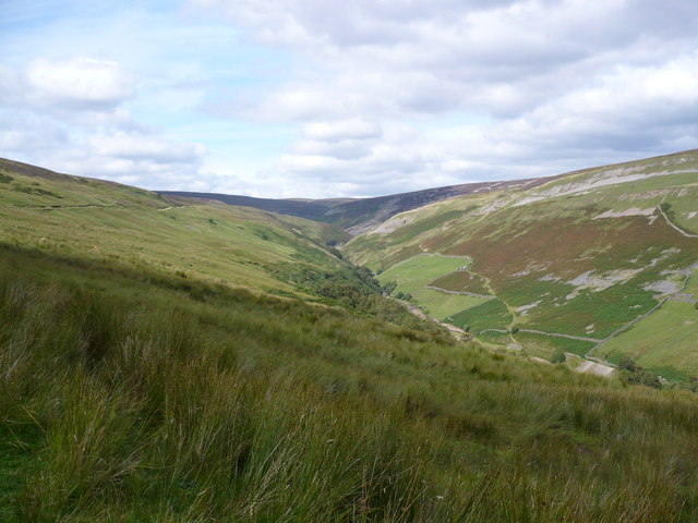
Gunnerside Gill
![]()
![]() This circular walk in Swaledale takes you through the lovely Gunnerside Gill. It's a beautiful valley with imposing scars, woodland, waterfalls and the pretty Gunnerside Beck running through the centre.
This circular walk in Swaledale takes you through the lovely Gunnerside Gill. It's a beautiful valley with imposing scars, woodland, waterfalls and the pretty Gunnerside Beck running through the centre.
The area has a fascinating industrial history having been a significant area for lead mining in the eighteenth and nineteenth centuries. You will pass several ruined buildings from this period including the remains of Blakethwaite Smelt Mill and the old mine offices.
This circular walk starts in the pretty village of Gunnerside where you will find a parking area, a pub and tea rooms for refreshments. You then follow footpaths north along Gunnerside Beck to Gunnerside Gill. The walk then crosses the beck and returns through some lovely Yorkshire Dales countryside.
Postcode
DL11 6LD - Please note: Postcode may be approximate for some rural locationsGunnerside Gill Ordnance Survey Map  - view and print off detailed OS map
Gunnerside Gill Open Street Map  - view and print off detailed map
Gunnerside Gill OS Map  - Mobile GPS OS Map with Location tracking
Gunnerside Gill Open Street Map  - Mobile GPS Map with Location tracking
Explore the Area with Google Street View 
Pubs/Cafes
Unfortunately the Kings Head in Gunnerside closed recently (as of 2019) but if you head a short distance west to Muker you can visit The Farmers Arms for refreshments instead. This traditional Yorkshire Dales pub boasts a welcoming atmosphere and prides itself on its’ well-kept local ales and tasty homemade food. With an open fire and a stone-flagged floor; muddy boots and well behaved dogs are always welcome. You can find the pub in Muker at postcode DL11 6QG for your sat navs.
Further Information and Other Local Ideas
The River Swale runs past Gunnerside so you could extent your walk along the nearby riverside path. Also nearby is the splendid Kisdon Force Waterfall Walk in Keld. Our 11 mile Circular Walk in Swaledale starts in the village and visits the gill and the waterfalls.
If you head east you can visit Reeth where there's a lovely riverside walk along both banks of the Swale. The beautiful Arkengarthdale can also be explored from the town. The dale is the northenmost of the Yorkshire Dales and includes nice trails along the Arckle Beck, the climb to the splendid Fremington Edge and Britain’s highest public house at the Tan Hill Inn.
For more walking ideas in the area see the Yorkshire Dales Walks page.
Cycle Routes and Walking Routes Nearby
Photos
Gunnerside Gill from Winterings End. Close by a well graded path that leads towards the Barbara Mine and other old workings in the gill.
Bouse Teams : Gunnerside Gill. Site of ore crusher and bouse teams on the east side of Gunnerside Gill. Belonging to the Old Gang Lead Mining company. By the 1860's the AD Mining company had a similar arrangement on the west side of the gill. The Sir Francis level was the last large scale mining project in 19th century Swaledale.
Elevation Profile


