National Cycle Route 41
![]()
![]() This is the complete Sustrans National Cycle Route 41 running from Bristol to Rugby.
This is the complete Sustrans National Cycle Route 41 running from Bristol to Rugby.
It runs for about 132 miles passing Gloucester, Tewkesbury, Stratford-upon-Avon and Warwick on the way.
You can download the full gpx for the route at the bottom of the page.
Cycle Routes on National Cycle Route 41
- Bristol to Gloucester - This ride starts on the River Avon in Bristol and takes you along the River Severn to Gloucester. You'll pass the impressive Clifton Suspension Bridge and Slimbridge Wetland Centre on the way
- Bristol to Portishead - Travel along the River Avon and through the stunning Avon Gorge on this ride from Bristol to the Somerset coast.
- Thornbury to Gloucester - This route follows National Cycle route 41 through the Gloucestshire countryside from Thornbury to Gloucester.
- Royal Leamington Spa to Rugby - This route follows National Cycle route 41 also called the Lias Line from Leamington Spa to Rugby.
The route starts by following the Grand Union Canal near Leamington Spa and passing Newbold Comyn Country Park before transferring to quiet country roads and then back onto the canal - Stroud to Gloucester - Follow National Cycle routes 45 and 41 from Stroud to Gloucester on this fairly easy route
- Stratford-Upon-Avon to Warwick - This route follows NCN route 41 through Warwickshire
- Draycote Water - Enjoy a circular waterside cycle or walk around the delightful Draycote Water Country Park near Rugby
- Grand Union Canal Walk - The route passes along this significant waterway in the midlands
- Leigh Woods - Enjoy cycling and walking trails in this forest and nature reserve in Bristol. The woods are located next to the trail along the Avon Gorge near the start of the route.
- Gloucester and Sharpness Canal - The route passes along the towpath of this canal near Frampton Severn and Gloucester.
- Newbold Comyn - This super park in Leamington Spa, lies on the River Leam and covers 300 acres.
National Cycle Route 41 Ordnance Survey Map  - view and print off detailed OS map
National Cycle Route 41 Open Street Map  - view and print off detailed map
National Cycle Route 41 OS Map  - Mobile GPS OS Map with Location tracking
National Cycle Route 41 Open Street Map  - Mobile GPS Map with Location tracking
Further Information and Other Local Ideas
In Warwick you can link with National Cycle Route 52 which runs north towards Coventry, Nuneaton, Coalville and Loughborough.
The trail links with the Cotswold Line Cycle Route which runs through the AONB from Worcester to Long Hanborough, just outside Oxford.
In Somerset the trail links with the Avon Cycleway. The long distance circular ride explores the area around Bristol, visiting the edge of the Cotswolds and the coast around Clevedon.
Near Southam in Warwickshire the route links with National Cycle Route 48 which runs through the Cotswolds to Moreton-in-Marsh and Tetbury.
Around Cheltenham and Gloucester you can link up with the Gloucestershire Cycle Spine.
Cycle Routes and Walking Routes Nearby
Photos
Birdingbury cycleway. Much of the former Rugby to Leamington Hastings railway line is now a cycleway, route 41 of the National Cycle Network according to the sign. This view is looking north-west at Birdingbury station.
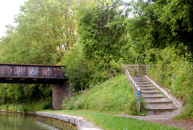
Cycleway and towpath, Grand Union Canal. Looking west at the disused railway bridge across the Grand Union Canal near Bascote. National cycle route 41 shares the canal towpath from Long Itchington to this point then runs up the stepped ramp to follow the trackbed of the dismantled railway towards Leamington Spa. The towpath itself continues under the bridge.
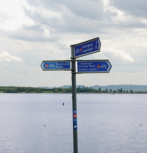
Draycote Water cycleway signpost near Rugby. Signpost at the point where the cycleway from Draycote village meets the Draycote Water perimeter road.
A view of the surfaced track through St. Nicholas Park, Warwick. Together with Charter Bridge across the River Avon, the cycleway and footway were opened in 1996. They provided a much-needed safe route to schools on both sides of the river. They also made possible some new recreational walks, and are well-used.
Stockton Locks near Long Itchington. The locks lifting the Grand Union Canal up to Napton Junction, seen from Stockton Road bridge.
Trackbed of Great Central Railway. Looking south along the walkway on the trackbed of the disused Great Central Railway near Lower Hilmorton Road.


