Bridgwater Walks - Near and Around
![]()
![]() This large Somerset market town has some nice waterside walking trails to try. There's also some fine architecture with a number of Georgian houses and the attractive Market Hall.
This large Somerset market town has some nice waterside walking trails to try. There's also some fine architecture with a number of Georgian houses and the attractive Market Hall.
This circular waterside walk takes you along the Bridgwater and Taunton Canal and the River Parret Trail which run through the town.
The walk starts in the town centre at the Bridgwater Docks Marina in the town centre. Here you can pick up the canal towpath and follow it south. The route then crosses to the river where you can pick up another waterside trail and follow it back into the town. To extend the walk you could follow the waymarked River Parrett trail north to meet with the river at Combwich. The route then continues to the Bridgwater Bay National Nature Reserve.
Bridgwater Ordnance Survey Map  - view and print off detailed OS map
Bridgwater Open Street Map  - view and print off detailed map
*New* - Walks and Cycle Routes Near Me Map - Waymarked Routes and Mountain Bike Trails>>
Bridgwater OS Map  - Mobile GPS OS Map with Location tracking
Bridgwater Open Street Map  - Mobile GPS Map with Location tracking
Walks near Bridgwater
- Bridgwater and Taunton Canal - Follow the towpath of the Bridgwater and Taunton Canal on this easy walk or cycle in Somerset
- River Parret Trail - Follow the River Parrett from the source in Chedington in Dorset to the mouth in Bridgwater Bay, Somerset.
The route first heads to Langport passing Haselbury and the 16th century English Heritage owned Muchelney Abbey - Durleigh Reservoir - This circular walk takes you around Durleigh Reservoir in Bridgwater, Somerset.
The walk starts in the small village of Durleigh, located on the western fringes of the town of Bridgwater - Macmillan Way - This epic long distance path links Boston in Lincolnshire to Abbotsbury in Dorset
- Samaritans Way South West - Starting at Bristol follow the Samaritans Way to Lynton, in Devon, and visit the Avon Gorge, the Chew Valley, the Cheddar Gorge, the Mendips, the Quantock Hills and the Brendon Hills
- Bridgwater Bay National Nature Reserve - Explore this beautiful nature reserve on this short walk in the Somerset Levels
- Steart Marshes - This circular walk explores the Steart Marshes area of the Bridgwater Bay National Nature Reserve on the Somerset coast
- North Petherton - This Somerset based town sits in a nice position on the edge of the Quantocks
- Taunton - Taunton is the county town of Somerset and a lovely place to explore on foot
- Somerset Space Walk - This waymarked walk runs from Bridgwater to Taunton along the Bridgwater and Taunton Canal
- Taunton Heritage Trail - This waymarked circular walk visits a number of historic sites in the Somerset town of Taunton.
Further Information and Other Local Ideas
The Somerset Space Walk runs along the towpath of the Bridgwater canal. The route is lined with a number of interesting sculptures representing the planets of the Solar System. You can see the scale model of the sun at Maunsel Lock and the description panels next to the sculptures to find out more.
The North Petherton Walk skirts the edge of the town. The circular route explores the area surrounding the small town which is located just to the south on the edge of the Quantocks .
For more walking ideas in the area see the Somerset Walks pages.
Photos
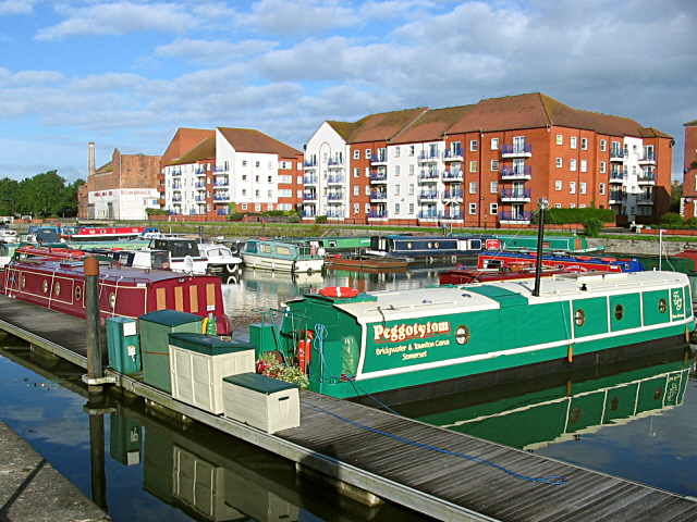
Bridgwater Docks Bridgwater Docks, now a marina. The first stage of an abortive project to link the Bristol Channel with the south coast by canal.
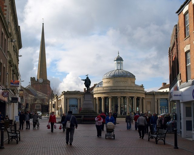
Cornhill, Bridgwater. The way in which Fore Street funnels out to give this view of St Mary's church and the rotunda of the market hall is worthy of an Italian townscape, though the modest scale of the church supporting the fine spire is very English provincial. The market hall has been described as a "spectacular shallow-domed circular portico".
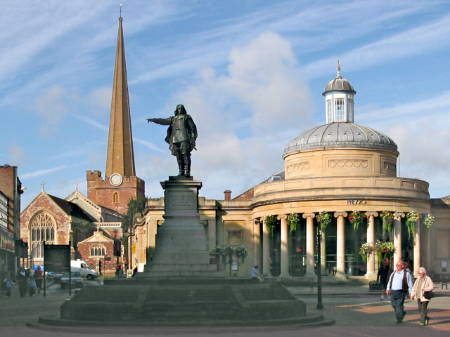
Bridgwater Market Hall. One of Somerset's most charming buildings. It has Ionic columns, and is surmounted by a domed drum with a hexagonal lantern and finial . It's now occupied by Prezzo, but the market hall behind it remains in use as such. Pevsner (1958) says "the whole seems just right in scale and modest formality for a country town of some pride and traditions".
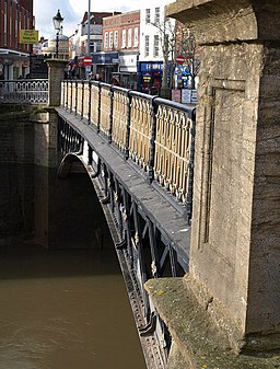
Town bridge. The one that gives the town its name. But this is the third on the site; a stone bridge was replaced by a cast-iron one in 1797; this structure dates from 1883


