Circular Walk around Hemel Hempstead - Canal and Country
![]()
![]() This circular walk from Hemel Hempstead explores the countryside to the east of the town, skirting the edge of the Chilterns Hills. On the way you'll enjoy waterside paths along the Grand Union Canal to Berkhamsted before exploring the woodland on Berkhamsted Common. The walk makes use of two of the waymarked footpaths which run through the area - the Grand Union Canal Walk and the Chiltern Way.
This circular walk from Hemel Hempstead explores the countryside to the east of the town, skirting the edge of the Chilterns Hills. On the way you'll enjoy waterside paths along the Grand Union Canal to Berkhamsted before exploring the woodland on Berkhamsted Common. The walk makes use of two of the waymarked footpaths which run through the area - the Grand Union Canal Walk and the Chiltern Way.
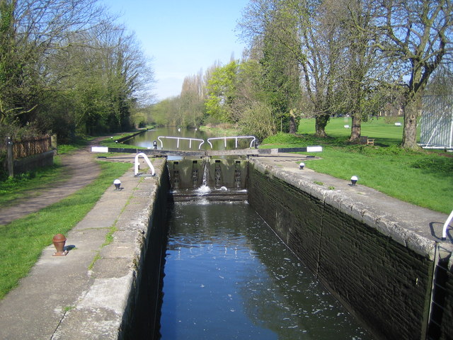
The walk starts on the canal just to the south of the town centre at Two Waters. From here you can follow the towpath west through Boxmoor where there is a lock, weir and views over the River Bulbourne. The route continues to
Berkhamsted where you will pass the ruins of the noteworthy Berkhamsted Castle. The Norman motte-and-bailey castle was built to obtain control of a key route between London and the Midlands during the Norman conquest of England in the 11th century.
At Dudswell the route leaves the canal to pick up the Icknield Way Path, following it north east to Norcott Hill. Here you follow bridleways onto the expansive Berkhamsted Common. The area is made up of attractive Silver birch woodland and gorsey heath with miles of ancient tracks to follow.
After passing through the common the route continues through Potten End before turning south east through the outskirts of Hemel Hempstead to return to the canal. It is then a short walk back to the town centre.
Part of this route skirts the edge of the Ashridge Estate which is a great place for walkers. You can follow the waymarked Ashridge Boundary Trail to explore the acres of woods and common land.
Hemel Hempstead Ordnance Survey Map  - view and print off detailed OS map
Hemel Hempstead Open Street Map  - view and print off detailed map
Hemel Hempstead OS Map  - Mobile GPS OS Map with Location tracking
Hemel Hempstead Open Street Map  - Mobile GPS Map with Location tracking
Walks near Hemel Hempstead
- Grand Union Canal Walk - Follow the towpath of Britain's longest canal from London to Birmingham on this fabulous waterside walk
- Chiltern Way - This is the original 125 mile circuit of the Chilterns AONB taking you through Hemel Hempstead, Chalfont St Giles, Marlow, Hambleden, Turville, Fingest, Bix Bottom, Ewelme, the Ridgeway, Stokenchurch, Great Hampden, Aldbury, the Dunstable Downs Country Park, Sharpenhoe Clappers and Harpenden
- Ashridge Boundary Trail - This walk takes you on a tour of the National Trust owned Ashridge Estate in the Chiltern Hills
- Berkhamsted Common - This large area of common land has some nice waymarked footpaths to try
- Icknield Way Path - The Icknield Way Path starts at Ivinghoe Beacon in Buckinghamshire and heads to Knettishall Heath in Suffolk along prehistoric pathways
- Nickey Line-Hemel-Hempstead to Harpenden - This short off road cycle or walking route runs along the Nickey Line - a disused railway track running from Hemel Hempstead to Harpenden
- Whipsnade Tree Cathedral - This extraordinary 10 acre park in Whipsnade is planted in the form of a cathedral, using grass avenues for the nave, chancel, transepts, chapels and cloisters and 'walls' with different species of trees
- Kings Langley - This attractive Hertfordshire based village has some nice canal and country trails to try
- Chipperfield Common - The 117 acre common in Chipperfield has some waymarked woodland walking trails
Further Information and Other Local Ideas
If you follow the canal south you'll some come to the neighbouring village of Kings Langley where there's a 14th century church, a local common and some pretty locks and weirs along the canal.
To the south west there's a series of nice trails across the picturesque Chipperfield Common.
For more walking ideas in the area see the Hertfordshire Walks and Chilterns Walks pages.
Photos
Grand Union Canal: at Hemel Hempstead The canal basin viewed looking towards the Two Waters Road bridge
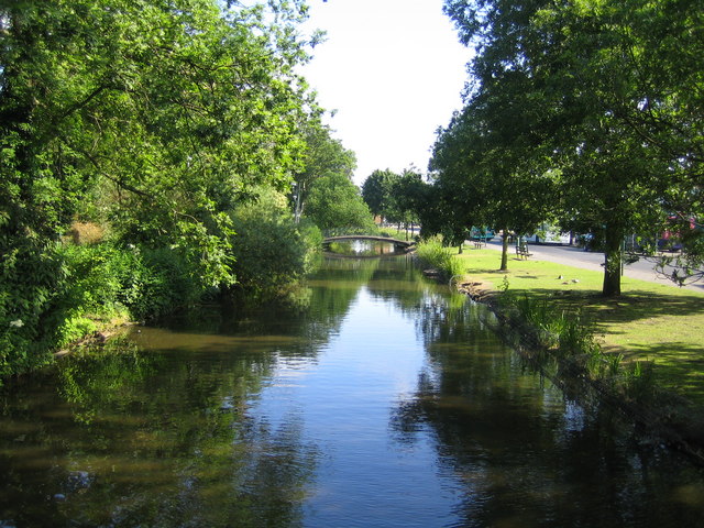
River Bulbourne In Two Waters, Hemel Hempstead, upstream of the confluence with the River Gade, and viewed looking upstream.


