Lowdham Walks
![]()
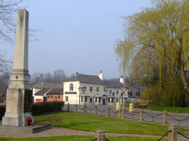
![]() This picturesque Nottinghamshire village is located in a pleasant rural spot in between Nottingham and Southwell.
This picturesque Nottinghamshire village is located in a pleasant rural spot in between Nottingham and Southwell.
The historic village includes a railway station on the Nottingham to Lincoln Line, a Grade I listed church that dates back to the 13th century times and a few nice pubs to relax in after your exercise.
This circular walk takes you west of the village to explore the attractive countryside in the valley of the Cocker Beck.
The walk starts in the village and heads west, passing the old hall and the church. You continue west along a footpath before turning south to pick up a trail along the Cocker Beck. This will take you towards the neighbouring village of Lambley where you could pay a visit to the lovely Lambley Dumbles.
This route heads north along Green Lane before turning east along a bridleway which runs past the Lowdham Grange prison. Shortly after you return to Lowdham.
Postcode
NG14 7DU - Please note: Postcode may be approximate for some rural locationsLowdham Ordnance Survey Map  - view and print off detailed OS map
Lowdham Open Street Map  - view and print off detailed map
Lowdham OS Map  - Mobile GPS OS Map with Location tracking
Lowdham Open Street Map  - Mobile GPS Map with Location tracking
Walks near Lowdham
- Lambley Dumbles - This walk explores the delightful Lambley Dumbles in Nottinghamshire
- Nottingham Circular Walk - This long circular walk makes use of various waymarked footpaths to take you on a tour of the city's rivers, canals, nature reserves and parks.
The walk starts at the train station and heads a short distance south to the River Trent - Nottingham Canal - Enjoy a walk or cycle along this pretty canal in Nottingham
- Southwell Trail - This traffic free cycling and walking trail links Southwell to Bilsthorpe in the Sherwood Forest area of Nottinghamshire
- Trent Valley Way - Follow the River Trent from Long Eaton in Derbyshire to West Stockwith in Nottinghamshire on this lovely waterside walk
- Gunthorpe - This village near Nottingham is a popular place for riverside strolls
- Shelford - This attractive Nottinghamshire village has some nice river and country trails to try
- West Bridgford - This Nottinghamshire based market town is located just south of the city of Nottingham
- Radcliffe on Trent - This village near Nottingham has some fine riverside trails and two fine local country parks to visit.
- Fiskerton - This rural Nottinghamshire village has some pleasant riverside and and countryside trails to try
- Burton Joyce - This Nottinghamshire village has some nice riverside trails and peaceful footpaths across the Burton Meadows.
- Bingham Linear Walk - This Nottinghamshire based market town is well positioned for exploring the countryside of the River Trent Valley
Pubs/Cafes
The Railway is a good choice for some post walk rest and refreshment. The award winning gastro pub dates back to 1876 and includes a charming interior with low ceilings, wooden floors, interesting features and roaring log fires in the winter. Outside there's a sun trap garden terrace if the sun is shining. You can find them on Station Road with a postcode of NG14 7DU for your sat navs.
Dog Walking
The country trails make for a fine dog walk and the Railway pub mentioned above is also dog friendly.
Further Information and Other Local Ideas
If you head east to Hoveringham you could pick up the Trent Valley Way and enjoy more waterside trails along the River Trent. If you followed it south it would take you to the worthy village of Gunthorpe. Just east of here there's also the worthy village of Car Colston. The village is an interesting place for a stroll with two picturesque village greens, the larger of which is thought to be the biggest green in England. Near here there's also the town of Bingham where you can try the Bingham Linear Walk. The pleasant route runs along a disused railway line through the town and then out into the countryside where there are views of the River Smite.
Photos
Lambley Reed Pond. The Conservation Area report of Gedling Borough Council comments: "The reserve is an area of pasture with a large stream-fed pond in the middle. The pond was originally a medieval stew or fish pond that was later filled in, before being re-opened in 1974. The pond and pasture combine to make an attractive natural space adjacent to the village." The pasture is used for cattle grazing and the reserve is managed by the Notts Wildlife Trust. Note the work being carried out to improve the drinking area for the cattle using the adjacent pasture.


