Newport Pagnell Walks
![]()
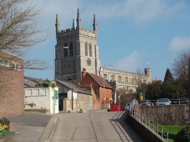
![]() This Buckinghamshire based town is located on the eastern side of Milton Keynes. There's some lovely local parks and riverside trails to enjoy in this scenic area. The town also has a fascinating history with a fine old church and a noteworthy ancient bridge to see.
This Buckinghamshire based town is located on the eastern side of Milton Keynes. There's some lovely local parks and riverside trails to enjoy in this scenic area. The town also has a fascinating history with a fine old church and a noteworthy ancient bridge to see.
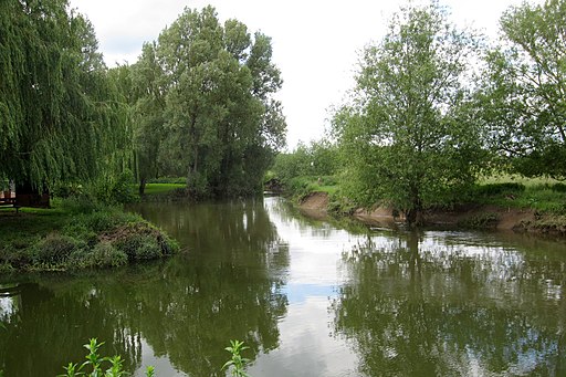
This short walk in the town takes you to the River Great Ouse and the pretty Ousebank Gardens on the River Ouzel. You can then cross the river to visit Castle Meadows where there are some pleasant footpaths.
Ousebank Gardens are very pretty with wildlife, picnic areas and nice views of the old church.
To continue your walking around Newport Pagnell head west to visit the lovely Linford Lakes where you can enjoy waterside trails along the Grand Union Canal. Just to the south there's Willen Lake, an excellent place for easy walks and bird watching near the town.
Postcode
MK16 9JJ - Please note: Postcode may be approximate for some rural locationsNewport Pagnell Ordnance Survey Map  - view and print off detailed OS map
Newport Pagnell Open Street Map  - view and print off detailed map
Newport Pagnell OS Map  - Mobile GPS OS Map with Location tracking
Newport Pagnell Open Street Map  - Mobile GPS Map with Location tracking
Walks near Newport Pagnell
- Emberton Country Park - Enjoy 200 acres of parkland and lakes in Milton Keynes on this short circular walk
- North Bucks Way - This long distance walk through Buckinghamshire visits a number of pretty villages and takes you though the beautiful countryside of the Vale of Aylesbury
- Milton Keynes Boundary Walk - Enjoy rivers, canals, woodland and beautiful countryside on this walk around the boundary of Milton Keynes
- Linford Lakes - Enjoy a cycle or walk via country lanes around the pretty Linford Lakes area in the Ouse Valley, Milton Keynes
- Furzton Lake - Enjoy a short cycle or walk around this pretty lake in Milton Keynes
- Grafton Way - Follow the Grafton Way from Wolverton, Milton Keynes to Greens Norton in Northamptonshire
- Willen Lake - Willen Lake is Milton Keynes most popular park with a super waterside cycling and walking path to enjoy
- Caldecotte Lake - Enjoy and easy cycle or walk around this pretty lake in Milton Keynes
- Grand Union Canal Walk - Follow the towpath of Britain's longest canal from London to Birmingham on this fabulous waterside walk
- Ouse Valley Way - Follow the River Great Ouse from the source at Brackley, Northamptonshire, to the mouth at The Wash at King's Lynn
- Aspley Woods - These 800 acre woods near Milton Keynes have some good mountain bike trails and miles of footpaths.
- Howe Park Wood - These pretty bluebell woods in Milton Keynes have some nice shady trails, ponds and lots of wildlife to look out for
- Cosgrove - This canalside Northamptonshire based village is a nice place to start a walk
Pubs/Cafes
The King's Arms is a nice place for refreshment after your exercise. They do a fine Sunday lunch and have a lovely large garden area to relax in on warmer days. There's also a good selection of ales and a large car park. You can find them on Severn Drive at a postcode of MK16 9BY for your sat navs.
Dog Walking
The local park and meadows make for a pleasant dog walk. The King's Arms mentioned above is also dog friendly.
Photos
River Lovat (Ouzel) by the Battery. John Bunyan, author of Pilgrim’s Progress, served in the town as a garrison soldier in 1643. Traces of the garrison’s fortifications can still be seen today.
Reflections of Old Age. Tickford Bridge in Newport Pagnell is the oldest iron bridge in the country still carrying vehicular traffic.


