Rolleston Walks
![]()
![]() This Nottinghamshire based village has some nice riverside trails along the River Greet and River Trent.
This Nottinghamshire based village has some nice riverside trails along the River Greet and River Trent.
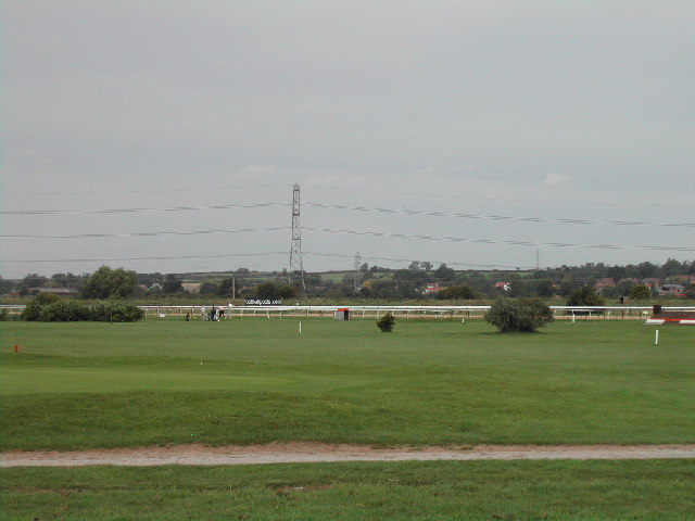
The settlement is located close to both Southwell and Newark River. It includes a train station and the Southwell racecourse.
This figure of eight loop walk from the village visits the neighbouring settlements of Upton and Fiskerton. On the way there's nice waterside sections along the River Greet and River Trent.
The walk starts in the village where you can pick up the Trent Valley Way and follow the waymarked footpath north to Upton, passing the Southwell Racecourse on the way.
The route then heads through the village before turning south to Upton Mill and the River Greet. Follow the river south east and it will take you back to Rolleston. Here you can pick up the Trent Valley Way again and follow it south to the River Trent. The trail will take you west to Fiskerton.
After exploring Fiskerton you can follow a country footpath east back to the village.
Postcode
NG25 0TS - Please note: Postcode may be approximate for some rural locationsRolleston Ordnance Survey Map  - view and print off detailed OS map
Rolleston Open Street Map  - view and print off detailed map
Rolleston OS Map  - Mobile GPS OS Map with Location tracking
Rolleston Open Street Map  - Mobile GPS Map with Location tracking
Walks near Rolleston
- Fiskerton - This rural Nottinghamshire village has some pleasant riverside and and countryside trails to try
- Southwell Trail - This traffic free cycling and walking trail links Southwell to Bilsthorpe in the Sherwood Forest area of Nottinghamshire
- Newark River Walk - Enjoy a short stroll around the riverside park in Newark on Trent on this easy walk in Nottinghamshire
- Sherwood Forest Country Park - Explore 450 acres of peaceful woodland in this famous park and Nature Reserve in Nottinghamshire
- Sherwood Pines Forest Park - Enjoy several waymarked cycling and walking trails in this large woodland area in Mansfield
- Vicar Water Country Park - Explore 200 acres of rare heathland, mature woodland and species rich grassland in this country park near Mansfield
- Rufford Abbey Country Park - Visit Rufford Country Park near Mansfield and explore 150 acres of historic parkland
- Radcliffe on Trent - This village near Nottingham has some fine riverside trails and two fine local country parks to visit.
- Shelford - This attractive Nottinghamshire village has some nice river and country trails to try
- Holme Pierrepont Country Park - Enjoy a waterside walk or cycle in this splendid 270 acre country park in Nottingham
- Colwick Country Park - Enjoy several miles of lovely, waterside walking and cycling in this country park in Nottingham
- Lambley Dumbles - This walk explores the delightful Lambley Dumbles in Nottinghamshire
- Gunthorpe - This village near Nottingham is a popular place for riverside strolls
- Gedling Country Park - Enjoy a series of well laid out cycling and walking trails in this 240 acre country park in Nottingham
- Robin Hood Way - Follow in the footsteps of this legendary figure on this super walk through Sherwood Forest and the Nottinghamshire countryside
- Lowdham - This picturesque Nottinghamshire village is located in a pleasant rural spot in between Nottingham and Southwell.
Further Information and Other Local Ideas
For more walking ideas in the area see the Nottinghamshire Walks page.
Photos
Trent Valley Way approaching the church of St Peter and St Paul, Upton. This is the first real hillslope the Way has encountered on the north-west side of the Trent.


