Chapel en le Frith Walks
![]()
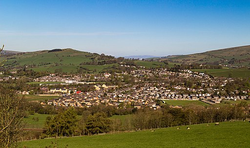
![]() This small Derbyshire town is located close to some classic Peak District walks, with stunning scenery in all directions.
This small Derbyshire town is located close to some classic Peak District walks, with stunning scenery in all directions.
This circular walk takes you from the town to Combs Reservoir where there are nice trails running along the water and the Meveril Brook. You can extend the walk by heading north and climbing Eccles Pike. From here there are fabulous views over the Peak District towards Windgather Rocks, Combs Edge, Combs Reservoir, Cat’s Tor and Shining Tor. At the summit you will find a topograph which shows all the sights you can see from the top.
The popular climb to Chinley Churn is also just to the north of Eccles Pike and offers more great Peak District views. To the west of the town you'll find Whaley Bridge and Toddbrook Reservoir which has some nice trails to try. This includes the Midshires Way long distance footpath which runs past the reservoir.
To the east of the village you can pick up the Pennine Bridleway long distance trail and follow it towards Jacob's Ladder and the epic Kinder Scout.
Postcode
SK23 0EZ - Please note: Postcode may be approximate for some rural locationsChapel en le Frith Ordnance Survey Map  - view and print off detailed OS map
Chapel en le Frith Open Street Map  - view and print off detailed map
*New* - Walks and Cycle Routes Near Me Map - Waymarked Routes and Mountain Bike Trails>>
Chapel en le Frith OS Map  - Mobile GPS OS Map with Location tracking
Chapel en le Frith Open Street Map  - Mobile GPS Map with Location tracking
Walks near Chapel en le Frith
- Eccles Pike - This is a popular climb to Eccles Pike from Whaley Bridge in the Peak District
- Chinley Churn and Cracken Edge - Climb Chinley Churn and enjoy super views over the Peak District towards Kinder Scout on this circular walk.
The walk starts from Chinley train staion and takes you over Cracken Edge to Chinley Churn - Pennine Bridleway - This fabulous 120 mile long trail runs through the beautiful Derbyshire Peak District, through Lancashire and on into Yorkshire.
It is suitable for mountain bikers, horse riders and walkers taking you on a tour through some of the most beautiful parts of the country - Combs Reservoir - This circular walk takes you around Combs Reservoir near Chapel-en-le-Frith on the edge of the Peak District National Park
- Kinder Downfall - Climb to the tallest waterfall in the Peak District on this circular walk from the Peak District village of Hayfield
- Kinder Reservoir - This walk takes you to Kinder Reservoir from Hayfield along the Snake Path
- Kinder Scout - Explore the Kinder plateau on this exhilarating and challenging circular walk from the popular village of Edale
- Jacob's Ladder - A circular walk from Edale visiting Jacob's Ladder, Edale Cross, Mount Famine, Rushup Edge and Lord's Seat
- Toddbrook Reservoir - Enjoy a short waterside walk along this pretty reservoir in Whaley Bridge
- Midshires Way - This route follows public bridleways and quiet country lanes through Middle England, from Bledlow, near Aylesbury in Buckinghamshire, to Stockport in Greater Manchester
- Errwood Reservoir and Fernilee Reservoir - Enjoy some lovely waterside walking along these two reservoirs in the Goyt Valley area of the Peak District
- Castle Naze - This walk visits an elevated fort near Chapel en le Frith in the White Peak area of the Peak District.
- Lamaload Reservoir - This circular walk takes you around the pretty Lamaload Reservoir near Macclesfield in the Peak District National Park
Pubs/Cafes
The Fickle Mermaid does a fine Sunday lunch which you can enjoy with a view of the Derbushire countryside from the lush garden. You can find them at Foresters Way with a postcode of SK23 0RB for your sat navs.
For some fine real ale head to The Old Cell on the historic market place. The micro pub can be found at postcode SK23 0EN.
Dog Walking
The footpaths make for a fine dog walk. The Fickle Mermaid mentioned above is also dog friendly with water bowls and biscuits available.
Further Information and Other Local Ideas
Head south west and there's more nice waterside trails around Lamaload Reservoir, Errwood Reservoir and Fernilee Reservoir.
Just south of the train station there's some splendid rock formations and an excellent viewpoint to be found at Castle Naze. The Promontory fort on Combs Edge commands fine views over the surrounding area.
For more walking ideas in the area see the White Peak Walks and Peak District Walks page.
Photos
Chapel-en-le-Frith High Street. The town was established by the Normans in the 12th century, originally as a hunting lodge within the Forest of High Peak.
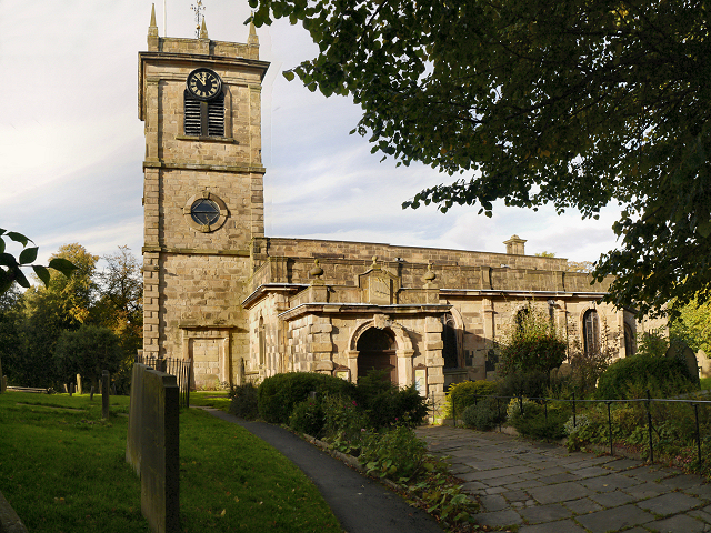
Church of St Thomas of Canterbury, Chapel-en-le-Frith. The current building is now almost entirely of 18th-century construction though there is a crypt dating back to the 13th century.


