Stocksfield Walks
![]()
![]() This Northumberland based village is located on the River Tyne between Riding Mill and Ovingham.
This Northumberland based village is located on the River Tyne between Riding Mill and Ovingham.
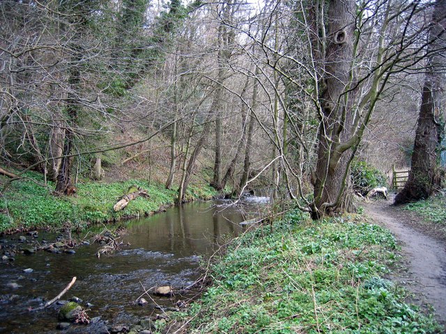
This short walk from the village takes you south along the Stocksfield Burn to the remains of the old Riding Mill. On the way there's the picturesque fords and some nice countryside views to enjoy.
To continue your walking in the area you could head north to Bywell where you could explore the 15th century Bywell Castle.
The River Tyne Trail also runs through the village. This long distance footpath runs along the river from Tynemouth to Tyne Head.
Head east and there's the popular Tyne Riverside Country Park where there's walking and cycling routes along the scenic river.
Stocksfield Ordnance Survey Map  - view and print off detailed OS map
Stocksfield Open Street Map  - view and print off detailed map
Stocksfield OS Map  - Mobile GPS OS Map with Location tracking
Stocksfield Open Street Map  - Mobile GPS Map with Location tracking
Walks near Stocksfield
- Riding Mill - This walk from the Northumberland village of Riding Mill takes you along a pleasant section of the River Tyne to Dilston via Corbridge
- River Tyne Trail - This waymarked long distance trail runs from the coast at Tynemouth to the source of the Tyne at Tyne Head, just south of Garrigill in the North Pennines.
- Chopwell Woods - Enjoy miles of cycling and walking trails in this large forest near Gateshead
- Ovingham - These two neighbouring villages are located in a pleasant spot on the River Tyne in Northumberland.
- Tyne Riverside Country Park - This park follows the River Tyne for four miles through 200 acres of meadows, chalk grassland, woodland and river bank
- Wylam - This pleasant riverside village is located in a lovely spot, a few miles west of Newcastle
- Whittle Dene Reservoir - Enjoy a circular walk around this scenic group of reservoirs next to Hadrian's Wall
- Newburn to Wylam Walk - This circular walk takes you from Newburn to Wylam along a section of the River Tyne
- Gateshead - This major north east town has a number of good options for walkers with two significant waymarked trails running through the area
- Colt Crag Reservoir - This walk visits the lovely Colt Crag Reservoir near Hexham and Corbridge in Northumberland.
- Sweethope Loughs - This walk visits the Sweethope Loughs in Northumberland, near Bellingham.
- Keelmans Way - This 10 mile walking and cycling trail runs along the River Tyne from Wylam to the upper reaches of the Tyne and the Derwent Walk Country Park in Gateshead.
- Ponteland - This Northumberland based town is located just east of Newcastle
- Derwent Walk Country Park - The Derwent Walk is a former railway path running from Swalwell, near Gateshead, to Consett alongside the River Derwent and is suitable for walkers and cyclists
- Derwent Valley Walk - This lovely railway path runs from Swalwell, near Gateshead, to Consett alongside the River Derwent and is suitable for walkers and cyclists.
You will pass the villages of Rowlands Gill, Hamsterley and Ebchester on the way - Causey Arch - Visit the the oldest surviving single-arch railway bridge in the world and enjoy woodland trails along the Causey Burn on this lovely circular walk in Stanley
- Hedley on the Hill - This Northumberland based village is located west of Newcastle upon Tyne, near the valley of the River Derwent.
Pubs/Cafes
The Blue Bell Inn is a fine country pub located on a steep hill above Stocksfield. They serve a fine Sunday lunch and have a nice garden area for warmer days. You can find them at West Mickley with postcode NE43 7LP for your sat navs.


