National Cycle Route 45
![]()
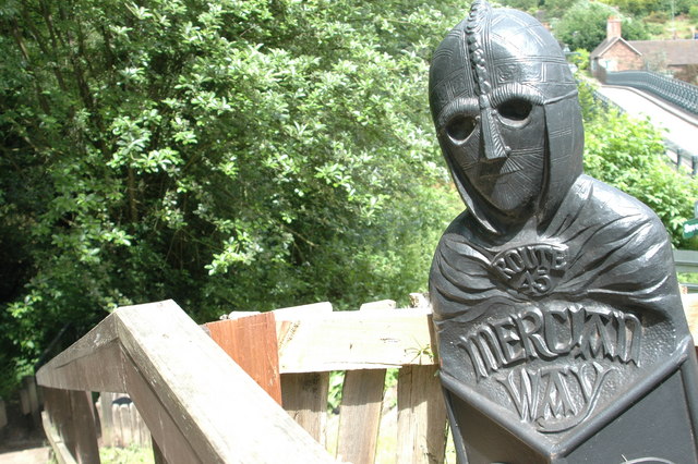
![]() This is the complete route for Sustrans Route 45 of the National Cycle Network. The route is also known as the Mercian Way and runs from Chester to Salisbury through Shropshire and Worcestershire.
This is the complete route for Sustrans Route 45 of the National Cycle Network. The route is also known as the Mercian Way and runs from Chester to Salisbury through Shropshire and Worcestershire.
Scroll down for the full gpx file and route videos.
The first section runs from Chester to Whitchurch, passing the Shropshire Union Canal, Peckforton Castle and Peckforton Hills, Bickerton Hill and Maiden Castle and the lovely Comber Mere on the way.
The next runs to the historic town of Shrewsbury passing
Moreton Corbet Castle and Haughmond Hill as you go.
You continue past the iconic Wrekin hill before heading to the towns of Telford and Bridgnorth. Near here you'll pass the pretty Chelmarsh Reservoir and enjoy a riverside stretch through Severn Valley Country Park.
The route continues south to the woodland trails in the Wyre Forest near the towns of Kidderminster, Bewdley and Stourport.
The route goes on to visit Droitwich Spa, Worcester,Tewkesbury and Gloucester. You then head through the Cotswolds, passing Stroud, Minchinhampton, the Source of the Thames near Kemble, Cirencester, South Cerney, Cricklade and the Cotswold Water Park where there's a series of lakes to cycle around.
The next stage runs through Swindon passing Coate Water Country Park, Barbury Castle Country Park and the fascinating Avebury Stones.
The final section runs through Pewsey and Amesbury before finishing in Salisbury where there's a famous cathedral and the nearby Stonehenge to visit.
Cycle Routes on the National Cycle route 45
- Whitchurch to Chester - This route starts by the railway station in Whitchurch and follows the trail through Shropshire and into Cheshire
- Oswestry to Whitchurch - This route starts in Oswestry near the Welsh border and follows signed regional cycle routes and NCN route 45 to Whitchurch via Ellesmere
- Shrewsbury to Whitchurch - This route starts in Shrewsbury by the Kingsland Bridge on the River Severn, first following National Cycle Route 81 and then the trail to Whitchurch in North Shropshire.
Aside from the start which follows the River Severn along the Shropshire Way the route is mainly on quiet country roads - Shrewsbury to Telford - Follow National Cycle routes 81, 45 and 55 through Shropshire on this pleasant ride
- Kidderminster to Bridgnorth - This route follows National Cycle routes 54 and 45 from Worcestershire into Shropshire
- Worcester to Droitwich Spa - This lovely short route follows the trail from Worcester to Droitwich Spa
- Gloucester to Tewkesbury - This route follows the trail through the Vale of Gloucester.
- Stroud to Gloucester - Follow National Cycle routes 45 and 41 from Stroud to Gloucester on this fairly easy route
- Cirencester to Stroud - Follow National Cycle routes 48 and 45 through the beautiful Cotswolds region on this attractive route which takes you close to the source of the River Thames
- Swindon to Cirencester - This route follows the trail from Wiltshire to Gloucestershire taking you through a lovely part of the Cotswolds
- Salisbury to Swindon - This ride takes you through the heart of Wiltshire along the trail with the famous Stonehenge as a major route highlight
National Cycle Route 45 Ordnance Survey Map  - view and print off detailed OS map
National Cycle Route 45 Open Street Map  - view and print off detailed map
National Cycle Route 45 OS Map  - Mobile GPS OS Map with Location tracking
National Cycle Route 45 Open Street Map  - Mobile GPS Map with Location tracking
Further Information and Other Local Ideas
The route links up with National Cycle Route 46 in the Worcester and Droitwich Spa area.
In the Malpas and Chester area of Cheshire you can link with the Cheshire Cycleway. The popular circular ride explores the best parts of the county on a series of quiet country lanes and off road paths.
Around Chester you can link up with National Cycle Route 5. The signed Sustrans trail runs for just over 360 miles from Reading to North Wales via Cheshire.
Near Tetbury and Cirencester the route links with National Cycle Route 48 which runs through the Cotswolds to Moreton-in-Marsh.
Cycle Routes and Walking Routes Nearby
Photos
Forestry road, Wyre Forest. The road is used by authorised motor vehicles, mainly in connection with the forestry operations going on in this part of the forest.
Cyclepath, Stratford sub Castle. A little oddly, this is a public footpath followed by NCN cyclepath 45, but it has obviously been designated as "dual use". NCN45 seems to share with the A45 a prodigious cross-country route. Here it passes a paddock as it approaches Stratford Road. The houses are on Castle Keep (the name of a modern close).
Cycle route 45, M&SWJR trackbed, Swindon. The Midland and South Western Junction Railway ran along this track from the 19th century until the 1970s. Although the line closed to passenger traffic in 1961 this section, which ran from Rushey Platt to Swindon Old Town , remained open for freight traffic shipping materials for the construction of the M4 motorway in the early 1970s. It is now part of the National Cycle Network. The path leading down to the left provides access to a restored section of the Wilts and Berks Canal.
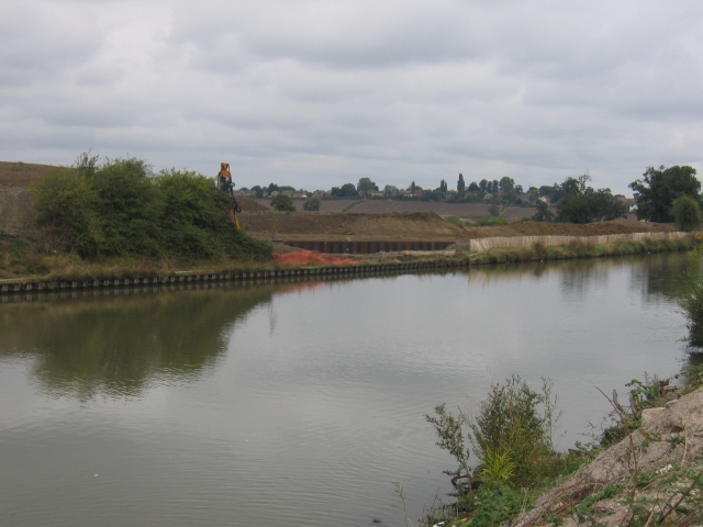
Gloucester and Sharpness Canal Two Mile Bend. The canal runs parallel to the Bristol Road out of Gloucester in this square before executing a sharp "S" bend to the left of the photographer. The excavations visible on the other side of the canal are to straighten out this sharp bend, unfortunately not led by the needs of the sea going ships which have used this canal, but instead to gain the necessary clearances to build a new western road bypass for Gloucester!


