Nottinghamshire Cycle Routes
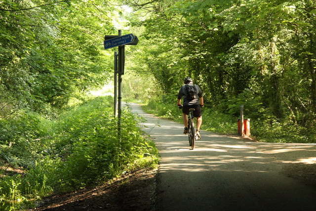
Nottinghamshire has a number of quiet lanes and tracks ideal for cycling.
Highlights include the lovely Clumber Country Park designed by Capability Brown and of course Sherwood Forest home of Robin Hood.
Use the links to view full route information including elevation profiles, interactive maps and GPS downloads.
You can also view an overview map of all the routes in the using the Nottinghamshire Cycle Map>>
There are several National Cycle Networksigned routes in the county many of which have been mapped and can be viewed and downloaded below.
For more information on cycle routes in Nottinghamshire including tips, advice and free cycle maps please click here
*New* - Walks and Cycle Routes Near Me Map - Waymarked Routes and Mountain Bike Trails>>
| Route Name | Photo | Distance | Description |
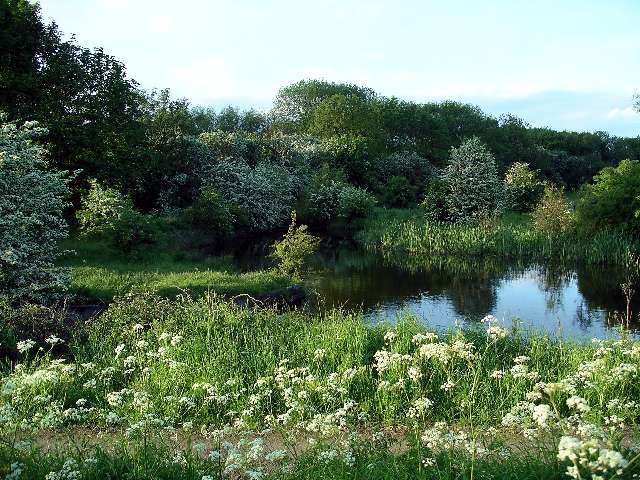
| Bestwood Country Park | 4.3 miles (7 km) | Bestwood Country Park is located on the outskirts of the city of Nottingham and consists of 650 acres of open green space. The park includes Mill Lakes, where you can follow the waterside trail and look out for the wide variety of water birds that visit the park. There are also wildflower meadows and peaceful forest trails through ancient oak woodland to enjoy. National Cycle Route 6 runs along Mill lakes and the Robin Hood Way walking trail also runs right through the park. You could follow the trail to the nearby Burntstump Country Park for more pleasant woodland walking trails. Following the trail west would take you to the lovely Collier's Wood Nature Reserve and Moorgreen Reservoir. View Full Details>> | |
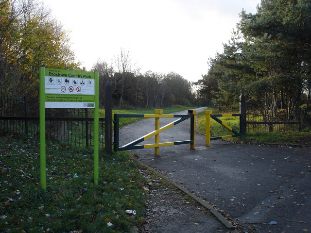
| Broxtowe Country Park | 1.6 miles (2.5 km) | This country park in Nottingham has some nice cycling and walking trails to try. The park covers 46 hectares and includes nice surfaced trails, open grassland and woodland areas with bluebells in the spring. There's also lots of pretty wildflowers and woodland birds to look out for. Keep your eyes peeled for Green woodpeckers and Ramsons (wild garlic). The park is also home to a great BMX track with tracks and jumps to cater for all ages and abilities. To continue your exercise you could head to West Bridgford and visit Holme Pierrepont Country Park and Colwick Country Park for more nice cycling and walking paths. View Full Details>> | |
| Clumber Country Park | 5 miles (8 km) | Enjoy a peaceful walk or cycle around the fabulous Clumber Park in Worksop. Clumber Park contains over 3,800 acres of woodland, open heath and rolling farmland. There is also a beautiful serpentine lake and a picturesque avenue of lime trees that runs for 2 miles. Also of interest is the picture postcard Hardwick Village, the Gothic Clumber Chapel and the Walled Kitchen Garden. The route below is devised for walkers but the park is excellent for cycling, particularly around the lake area. You can hire bikes and pick up route guides from within the park - please click here for more information. The routes are nice and safe so ideal for families. National Cycle Route 6 also passes through the park linking it to Sherwood Forest - see the Nottingham to Worksop cycle route for more information. You can also visit the park from nearby Mansfield using the signed route. Our Mansfield Cycle Route starts just east of the town at the lovely Vicar Water Country Park. It's a nice way to visit both parks on your bike in a day. To extend your walking in the area you could follow the Robin Hood Way north west from the park and visit the nearby Welbeck Estate. Here you'll find two pretty lakes and a large deer park with resident white deer. View Full Details>> | |
| Colwick Country Park | 2.5 miles (4 km) | Enjoy several miles of lovely, waterside walking and cycling in this country park in Nottingham. The park contains two large lakes, a marina, woodland and meadows. The River Trent also runs through the park so there is scope for continuing your walk along the Trent Valley Way walking route. There is also an excellent visitor centre with cycle hire available. To extend your exercise you could visit the nearby Holme Pierrepont Country Park where there are more good cycling and walking trails. You could also head to Broxtowe Country Park where there's some nice woodland trails and a BMX track to try. The park is located to the south of Nottingham city centre near to Nottingham Midland Railway station. View Full Details>> | |
| Cotgrave Country Park | 2.2 miles (3.5 km) | This lovely country park near Nottingham is the perfect place for a peaceful cycle or walk. The park includes woodland, wetland, lakes and informal grassland while the Grantham canal also runs through the park. You could continue your exercise along the Grantham Canal and visit the nearby village of Hickling where there's a nice canalside pub. If you head a couple of miles north where you'll find the Holme Pierrepont Country Park and Colwick Country Park. View Full Details>> | |
| Derby to Nottingham | 18.6 miles (30 km) | This easy route takes you between two major English cities. The routes starts on the banks of the River Derwent in Derby and the follows National Cycle Route 6 to Long Eaton and then Nottingham, finishing on the banks of the River Trent. Much of the route follows the River Derwent with the lovely Attenborough Nature Reserve a further route highlight. The final stretch into Nottingham is particularly enjoyable taking you through the lovely university park, before a pleasant stretch along the River Trent brings the ride to a close. View Full Details>> | |
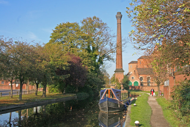
| Erewash Canal | 11.8 miles (19 km) | Follow the Erewash canal through south Derbyshire on this waterside cycling and walking route. The canal runs from Trent Lock near Long Eaton to the Langley Mill (Great Northern) basin. You can follow the towpath all the way on your bike or on foot. It's a nice easy route that runs for about 12 miles so it's a good family cycle ride or long walk. On the way you'll pass old mills, pretty locks and a number of stone bridges. The areas around Nutbrook Junction and Trowell Marsh are nature reserves where you can look out for a wide variety of wildlife. There's also nice views of the River Erewash and the surrounding countryside. The canal forms part of the larger Erewash Valley Trail so it's easy to extend your exercise on this circular route. You start off at Trent Lock on the border of Derbyshire, Leicestershire and Nottinghamshire. It's a major canal junction where several significant waterways meet including the River Soar, the Trent and Mersey Canal, the River Trent and the Erewash Canal. The canal then weaves its way through the town of Long Eaton to Sandiacre. You continue north to Ilkeston, passing Gallows Inn and the impressive Bennerley Viaduct, before finishing at Langley Mill at the basin of the Erewash Canal. You can virtually follow part of the route along the canal from Trent Lock by clicking on the google street view link below. To continue your walking in the area you can visit the lovely Attenborough Nature Reserve which is located near the start of the canal at Long Eaton. You can follow the Trent Valley Way along the River Trent to reach the reserve. The Beeston Canal can also be picked up at the eastern end of the reserve, next to the pretty Beeston Lock. The canal also forms part of the Nutbrook Trail Cycle Route which runs up to Shipley Country Park on a dismantled railway line. View Full Details>> | |
| Erewash Valley Trail | 28 miles (45 km) | This splendid cycling and walking trail explores the canals, countryside, towns and villages of south Derbyshire and Nottinghamshire. It's a circular route with miles of great traffic free sections so it's ideal for families or anyone looking for a safe cycle ride. Walkers can also enjoy the nice surfaced trails along the canals and through the nature reserves on this varied route. As a circular route there are several options for a start point. This route starts at Trent Lock on the Erewash Canal just south of the town of Long Eaton. Trent Lock is a significant canal junction where the River Soar, the Trent and Mersey Canal, the River Trent and the Erewash Canal meet (you can virtually explore this section on the street view link below). You then follow the canal towpath north through the town of Long Eaton to Sandiacre. You continue to Ilkeston, passing Gallows Inn and the impressive Bennerley Viaduct, before coming to Langley Mill at the basin of the Erewash Canal. It's a nice section with lots of pretty locks, stone bridges and views of the River Erewash. At Langley Mill you turn south and pick up the Nottingham Canal heading to Cossal and Trowell. The disused canal has now been declared as a nature reserve which attracts lots of dragonflies, damselflies and birdlife. The canal leads you towards Stapleford Hills and Bramcote Hills Park. The park includes a mix of woodland and parkland with a nice walled garden. You'll also pass the geologically fascinating Hemlock Stone. The stone is an outcrop of New Red Sandstone, deposited more than 200 million years ago in the Triassic Period. It's worth stopping to have a look at the plaque and stone on Stapleford Hill before continuing. From the park you continue through Stapleford and Chilwell to the lovely Attenborough Nature Reserve. Here you'll find 350 acres of lakes, wetland, woodland, grassland and scrub with a huge variety of wildlife to look out for. The Beeston Canal can also be picked up at the eastern end of the reserve, next to the pretty Beeston Lock. The final waterside section takes you along the River Trent to Trent Lock and the finish point. Towards the end of the route you pass along the Trent Valley Way so this is a good option if you would like to continue your walking in the area. The trail also forms part of the Nutbrook Trail Cycle Route which runs along the Erewash Canal before bearing right near Stapleford and heading up to Shipley Country Park on a dismantled railway line. View Full Details>> | |
| Grantham to Newark-On-Trent | 24.9 miles (40 km) | This route follows National Cycle routes 15 and 64 through Lincolnshire, Leicestershire and Nottinghamshire. You start by the tourist information centre in Grantham and soon join the towpath of the Grantham Canal which takes you as far as Muston. From here you follow quiet roads to Bottesford. The route continues through the countryside on country lanes, joining National Cycle Route 64 just after Orston. A couple of miles later at Cotham you begin a short stretch on a dismantled railway line which takes you all the way to the finish point at Newark-On-Trent rail. View Full Details>> | |
| Holme Pierrepont Country Park | 3.1 miles (5 km) | Enjoy a waterside walk or cycle in this splendid 270 acre country park in Nottingham. The park includes several large lakes and the delightful Skylark Nature Reserve. You can hire a bike or just go for a stroll along the lovely, lakeside paths. The River Trent also runs through the park so there is scope for continuing your walk along the Trent Valley Way walking route. Adjacent to Holme Pierrpont is Colwick Country Park which is another option for extending your outing. You could also head to Broxtowe Country Park where there's some nice woodland trails and a BMX track to try. The park is the home of the National Watersports Centre so you could have a go at kayaking or windsurfing. Holme Pierrepont is located just to the south of Nottingham city centre. View Full Details>> | |
| Lincoln to Newark-On-Trent | 23.6 miles (38 km) | Travel from Lincolnshire into Nottinghamshire on National Cycle Route 64. The route starts near Lincoln tourist information centre and heads east to Skellingthorpe wood on off roads tracks, and a pleasant stretch along the Fossdyke Canal. You then turn south towards Newark following a series of quiet country roads with a section along the River Trent taking you to the finish point at the train station. View Full Details>> | |
| Long Eaton to Langley Mill | 12.4 miles (20 km) | This lovely ride starts at the Nutbrook Trail just north of Long Eaton rail station following it north to Langley Mill. The trail follows the Erewash Canal and also includes a section through Shipley Country Park which makes it ideal for a leisurley afternoon's cycling. View Full Details>> | |
| Melton Mowbray to Newark-On-Trent | 34.2 miles (55 km) | Follow National Cycle Route 64 and National Cycle Route 15 from Leicestershire into Nottinghamshire. You start near the train station in Melton Mowbray and head north passing Melton Country Park and the village of Scalford. The route follows country roads passing Knipton Reservoir and Belvoir Lake on the way to Woolsthorpe where you join the Grantham Canal and National Cycle route 15, taking you to Bottesford. A series of country roads, followed by a pleasant off road stretch along a dismantled railway line then take you into Newark-On-Trent, finishing at the train station. View Full Details>> | |
| National Cycle Route 6 Mansfield | 16.8 miles (27 km) | This ride in the Mansfield area takes you along National Cycle Route 6 from Vicar Water Country Park to Worksop. It's a fine section of the cycle network, running through Sherwood Forest Country Park and Clumber Park on nice traffic free trails. The route starts at Vicar Water Park, just to the east of Mansfield. From the eastern end of the lake you can pick up Route 6 which runs pas Sherwood Pines towards Clipstone. Around here you follow woodland trails north through Sherwood Forest Country Park to Clumber Park. The splendid park contains over 3,800 acres of woodland, open heath and rolling farmland. There is also a beautiful serpentine lake and a picturesque avenue of lime trees that runs for 2 miles. The route crosses the lake at Clumber Bridge and continues north to Worksop where you can enjoy a waterside ride along the Chesterfield Canal. View Full Details>> | |
| National Cycle Route 647 | 27.3 miles (44 km) | This route follows National Cycle Route 64 and National Cycle Route 647 from Lincoln to Clumber Country Park, passing the impressive Fledborough Viaduct on the way. View Full Details>> | |
| Newark to Cotham | 5.2 miles (8.4 km) | This cycle route follows a dismantled railway line between Newark-on-Trent and Cotham in Nottinghamshire. View Full Details>> | |
| Nottingham Canal | 8.1 miles (13 km) | Enjoy a walk or cycle along this pretty canal in Nottingham. The route runs along the Erewash Valley Trail from Langley Mill to the outskirts of Nottingham. It's a nice flat ride which is ideal for families. The route starts at Langley Mill and heads south to Cossall and Trowell. This area has now been declared as a nature reserve which attracts lots of dragonflies, damselflies and birdlife. On the Trowell section are the remains of Swansea bridge, one of the original stone bridges, which was built around 1793–95. From here you can see the original stone built lock keepers cottages. The route finishes very close to Wollaton Park where you can extend your outing. View Full Details>> | |
| Nottingham to Worksop | 40.4 miles (65 km) | This route takes you along National Cycle Route 6 from the city of Nottingham through Sherwood Forest to the town of Worksop.
You start in Nottingham and head through the outskirts to Bestwood where you join a pleasant off road section through Bestwood Country Park. The ride then passes through Hucknall before joining the Linby Trail for another relaxing traffic free section. From here you continue to Ravenshead passing through Papplewick's Newstead Abbey with its parkland and historic Abbey. A short on road section to Blidworth takes you onto a splendid off road section along the Robin Hood Way through Sherwood Forest. You'll pass the Major Oak in the forest rumoured to be the base of Robin Hood and there are also great views around Clumber Park. View Full Details>> | |
| Rotherham to Worksop | 21.7 miles (35 km) | This ride takes you along National Cycle Route 6 from Yorkshire into Nottinghamshire. You start near the train station in Rotherham on the River Rother and head south towards Moorgate. The route then passes through Ulley Country Park with its lovely reservoir and wildlife. Quiet roads then take you through Aston before a lovely traffic free stretch through Rother Valley Country Park - an award winning 750 acre park with a nature reserve, lakes and bridleways. The route continues east on country roads, passing Harthill Reservoir, Pebley Reservoir and Old Spring Wood on the way to Shirehoaks where a pleasant roll along the Chesterfield Canal takes you into Worksop, finishing at the train station. View Full Details>> | |
| Rushcliffe Country Park | 1.9 miles (3 km) | Explore over 200 acres of cycling and walking trails in this popular country park in Ruddington near Nottingham. In the park you will find wildflower meadows, grassland, conservation and landscaped areas. There is also a 2 hectare lake where you can see mute swans, great crested grebes and various duck species. Also look out for skylarks, finches, cuckoos, kestrels, sparrow hawks, reed buntings, reed warblers and sedge warblers. View Full Details>> | |
| Sherwood Forest Country Park | 6.2 miles (10 km) | Explore 450 acres of peaceful woodland in this famous park and Nature Reserve in Nottinghamshire. In Sherwood Forest you'll pass the 800 year old Major Oak which is rumoured to be the base of Robin Hood. There are also excellent facilites with a Visitor Centre and cafe. This circular trail runs for about 6 miles using the waymarked paths around the visitor centre which is located just north of Edwinstowe. There's a good sized car park located here too. There are numerous cycling and walking tracks running through the park with National Cycle Route 6 passing through the centre of the park (see the Nottingham to Worksop Cycle Route). The Robin Hood Way Walk also passes right through the park. Our Mansfield Cycle Route passes through the park and will take you to the nearby Clumber Park where there's miles of nice trails and a beautiful lake. View Full Details>> | |
| Sherwood Pines Forest Park | 5 miles (8 km) | Enjoy several waymarked cycling and walking trails in this large woodland area in Mansfield. View Full Details>> | |
| Silverhill Wood | 2 miles (3.2 km) | Climb to the highest point of Nottinghamshire on this pleasant walk around Silverhill Wood Country Park. The park was built on two former colliery sites and includes a series of good footpaths taking you to woodland, ponds and an excellent viewpoint with fine views over the surrounding area. The walk starts from the car park which is on Silverhill Lane at the southern end of the site. From here you can pick up the woodland trails taking you up to the 204.3 m (670 ft) summit where there's lovely views over 5 counties. You can also see Lincoln Cathedral and the parkland of the nearby Hardwick Hall. The summit includes a bronze statue named 'Testing for Gas' which depicts a kneeling coal miner with a Davy lamp. The statue commemorates coal mining at the 85 Nottinghamshire collieries. After taking in the views the route descends to the two pretty ponds on the eastern side of the site. From here it's a short walk back to the car park. The park is great for wildlife. Look out for deer, butterflies, buzzard, kestrel and green woodpecker as you make your way around the site. This route is designed for walkers but there are tracks suitable for cyclists as well. See the maps below for details of the tracks you can follow around the park. View Full Details>> | |
| Southwell Trail | 6.8 miles (11 km) | This traffic free cycling and walking trail links Southwell to Bilsthorpe in the Sherwood Forest area of Nottinghamshire. It's a good one for families as the path is well defined, flat and safe. It runs for just about 7 miles along a disused railway line which was closed in 1968. On the way you'll pass the villages of Farnsfield, Kirklington and Maythorne with views of the River Greet as well. The trail runs next to the Robin Hood Way so you could pick this up and head into Sherwood Forest to extend your outing. View Full Details>> | |
| Teversal Trail | 4.3 miles (7 km) | Enjoy cycling and walking along these former railway lines, located on the Nottinghamshire/Derbyshire border. It's a nice flat path, with good views of the surrounding countryside to enjoy on the way. The circular route starts from the Teversal Trails visitor centre on Carnarvon Street in the Ashfield district of Nottinghamshire. The centre has lots of information on the walks and cycle routes in the area. There's plenty of parking and a nice cafe for refreshments at the end of your exercise. From the centre you head north along the old railway toward Upper Pleasley where you will find Pleasley Pit Country Park in Derbyshire. The former colliery site has been converted into a lovely country park and local nature reserve with ponds, reed beds, grassland and woodland. At the park the route turns south towards the village Skegby where there are a number of interesting old buildings to see. Just before reaching the village you turn west, passing Coppy Wood before returning to the visitor centre. View Full Details>> | |
| Vicar Water Country Park | 2.5 miles (4 km) | Explore 200 acres of rare heathland, mature woodland and species rich grassland in this country park near Mansfield. The park offers spectacular views across to Derbyshire and Lincolnshire and is home to an abundance of wildlife including herons, kingfishers, foxes, hares, tawny owls, nightjar and woodpeckers. There are also two bodies of water - Vicar Pond and Vicar Water.
Vicar Water has super footpaths and bridleways making it ideal for a short cycle or walk. National Cycle Network number 6 runs through the park so you could continue your cycle along the Nottingham to Worksop cycle route. You could also visit the nearby Sherwood Pines Forest Park and enjoy several waymarked cycling and walking trails. View Full Details>> | |
| Wollaton Park | 3.7 miles (6 km) | This super deer park in Nottingham is ideal for a short cycle or walk in delightful surroundings. The park is located on the western edge of the city centre and consists of an exquisite Elizabethan mansion surrounded by acres of parkland, woodland, lakes, formal gardens and the deer park. In the splendid Wollaton Hall you will find the Nottingham Natural History Museum, with Nottingham Industrial Museum located in the surrounding out-buildings. In the film The Dark Knight Rises Wollaton Hall was used as Wayne Manor, the extravagant home of Bruce Wayne. To extend your exercise you could pick up the Nottingham Canal and enjoy a cycle or walk to Langley Mill. The canal forms part of the longer circular Erewash Valley Trail which takes you on a super tour of the area on traffic free paths. View Full Details>> |
Your Submitted Routes
| Route Name | Distance | Difficulty |
| Hucknall - Derby - Hucknall | 56 miles (90 km) | **** |
| Hucknall - Matlock | 45 miles (71.8 km) | *** |

