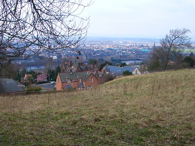
Kinnoull Hill Woodland Park
![]()
![]() Follow numerous, peaceful woodland trails through this lovely park in Perth. From Kinnoull Hill there are fabulous views of the River Tay and the surrounding countryside.
Follow numerous, peaceful woodland trails through this lovely park in Perth. From Kinnoull Hill there are fabulous views of the River Tay and the surrounding countryside.
The park contains an Arboretum with a number of magnificent trees including large exotic conifers and Wellingtoniae.
Also look out for the fine wooden animal sculptures that dot the pathways through the woodland and the Bronze Age Fort on Deuchny Hill.
The route below starts at the car park at Corsiehill and takes you up Kinnoull Hill to the Kinnoull Tower. From the 222 metre high point there are some magnificent views of the Tay Estuary toward Dundee and Fife, the Ochils, Ben Vorlich and Ben Lawers, the Grampians, Ben Lawers, Schiehallion and the Lochnagar massif. The route then takes you onto Deuchny Wood, before returning to the start point on woodland paths.
If you are on a bike you can head to the Deuchny Hill where there is a mountain bike park. Deuchny Wood also has a number of trails perfect for some off road cycling.
The park is located less than a mile east of the city centre of Perth, just over the bridge across the River Tay.
Please click here for more information
Kinnoull Hill Woodland Park Ordnance Survey Map  - view and print off detailed OS map
Kinnoull Hill Woodland Park Open Street Map  - view and print off detailed map
Kinnoull Hill Woodland Park OS Map  - Mobile GPS OS Map with Location tracking
Kinnoull Hill Woodland Park Open Street Map  - Mobile GPS Map with Location tracking
Further Information and Other Local Ideas
National Cycle Route 77 runs through the park providing an opportunity to explore the area further by bike. It runs between Pitlochry and Dundee along a route known as the 'Salmon Run'.
Cycle Routes and Walking Routes Nearby
Photos
Descending from the hill. From the lower slopes of Kinnoull Hill at Barnhill there is a good view over Perth, with the red brick building of Balnacraig School prominent at the field edge.


