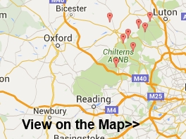
Surrey Hills AONB Walks
Use the links to view full route information including elevation profiles, interactive maps and GPS downloads.
You can also view an overview map of all the routes in the using the Surrey Hills Walk Map>>
*New* - Walks and Cycle Routes Near Me Map - Waymarked Routes and Mountain Bike Trails>>
| Route Name | Photo | Distance | Description |
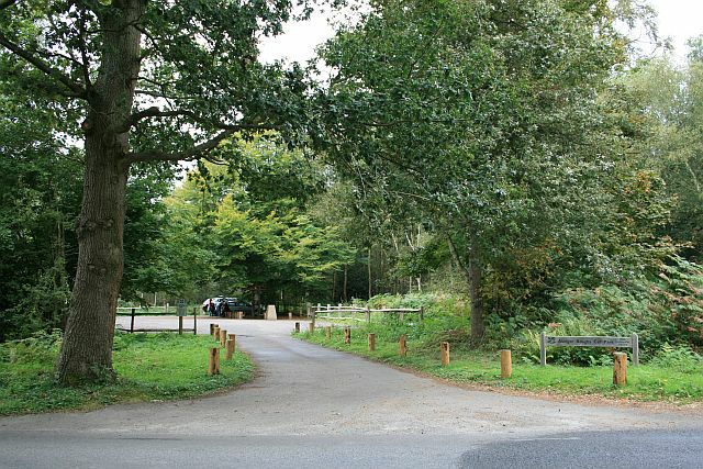
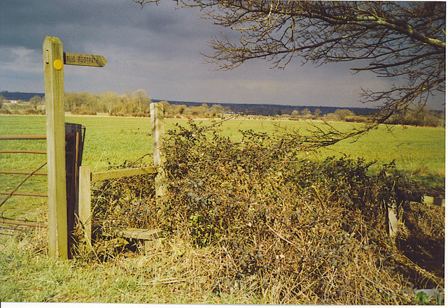
| Abinger Common | 5.5 miles (8.8 km) | Enjoy a walk across Abinger and Wotton Commons before a climb to Leith Hill on this circular walk in the Mole Valley. There's miles of nice woodland trails, ponds, streams and great views from the many viewpoints on the expansive common. It's quite a challenging walk with several hill climbs so a good level of fitness is required. The walk starts at the Abinger Hatch pub to the north west of the common. You can also start at the Friday Street car park close to the pretty Mill Pond. From here you can pick up the trails heading south across Abinger Bottom to Wotton Common. You then climb to the highest point in the South East on Leith Hill where you will find an 18th century Gothic tower, with panoramic views northwards to London and south to the English Channel. After taking in the views the route descends to Duke's Warren and Whiteberry Hill, before crossing Broadmoor and returning to the car park. After your walk you can enjoy refreshments at the Stephan Langton Inn on Friday Street. The country pub is located just south of the mill pond and serves Modern British cuisine and craft ales. The Greensand Way long distance trail runs through the southern end of the common so you can pick this up to extend your walking in the area. Heading west will take you to Hurt Wood and Winterfold Forest in Peaslake. Here you'll find miles of great mountain bike trails and footpaths. Also nearby is the climb to Holmbury Hill where there are more wonderful views over the Surrey Hills to enjoy. View Full Details>> | |
| Abinger Roughs | 1.9 miles (3 km) | This circular walk in Abinger Hammer takes you around an attractive, elevated woodland area. Start your walk from the car park at the eastern end of the site. From here you can pick up nature trails heading west towards Arbinger Hammer. There's a series of nice shady woodland paths and in the spring months you can see carpets of bluebells and lots of lovely Rhododendrons flowering. The Roughs also include magnificent oak trees, open glades and fine views over the North Downs from the high points. At the western side of the woods you will find the delightful village of Arbinger Hammer. In summer the village green is popular with people picnicing on the grass whilst watching a game of cricket in surroundings which are quintessentially English. The River Tillingbourne also flows through the village. Brown trout regurlarly swim in the stream and the occasional larger rainbow trout can also be sighted. You can enjoy refreshments in the delightful Abinger Hammer Village Shop & Tea Rooms which has a nice garden from which you can watch the cricket. View Full Details>> | |
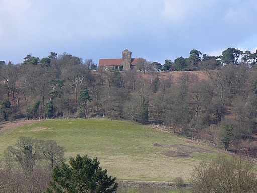
| Albury Park | 2.5 miles (4 km) | Explore the Albury Estate on this pleasant walk in Surrey. There's 150 acres of parkland with lots of walking trails to try. Features include peaceful woodland, pretty lakes and the River Tillingbourne. There is also the Grade II listed Albury country house and the Saxon Old St Peter and St Paul's Church to see. The walk starts from the Grade I listed church and follows footpaths through woodland and parkland to the nearby village of Shere. Here you will find a Norman church, old village houses and a tea room for refreshments. The walk then follows the Fox Way and other footpaths to return you to Albury. If you'd like to extend your walk then you could continue along the Fox Way to the nearby Blackheath Common. The tranquil Silent Pool is also nearby. View Full Details>> | |
| Blackheath Common | 2.5 miles (4 km) | This large area of heathland and woodland near Albury is very popular with walkers and cyclists. There's 250 acres to explore on a myriad of footpaths and bridleways. The area consists of lowland heathland, woodland and acid grassland. You can park at the Blackheath car park on Blackheath Lane to start your circular walk across the common. Chilworth railway station is also just to the north of the common. This is another good start point if you are coming by public transport. The paths then take you across the common and through Blackheath Forest. There's some nice sandy paths and lots of pretty heather to look out for in the late summer. View Full Details>> | |
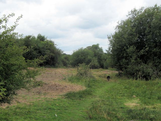
| Bookham Commons | 2.5 miles (4 km) | This large area of common land is located just to the west of Leatherhead. It's a good place for walking with miles of trails taking you to grassland, ancient woodland and picturesque ponds. The common includes bridleways which are suitable for cyclists as well. View Full Details>> | |
| Bourne Woods Farnham | 2.2 miles (3.5 km) | Enjoy a walk around these attractive woods in Farnham, Surrey. View Full Details>> | |
| Box Hill and Westhumble | 7.5 miles (12 km) | This circular walk starts from the Box Hill and Westhumble train station in the Surrey Hills. View Full Details>> | |
| Box Hill Circular Walk | 7.9 miles (12.7 km) | The Box Hill area is a magnet for walkers with miles of heathland, woodland and country trails to try. With views of the Surrey Hills and the North Downs it's a place where you can walk for hours with wonderful scenery. This circular walk visits several highlights of the area including Box Hill Country Park, Norbury Park and Headley Heath. The route runs for about 8 miles with some moderate hill climbs on the way. View Full Details>> | |
| Box Hill Country Park | 2.5 miles (4 km) | This park is run by the National Trust and has a number of splendid walking trails to enjoy. There are panoramic views of the western Weald and a riverside stroll along the River Mole. There are also excellent facilities with the Box Tree cafe and shop which sells local produce. Box Hill is located just north of Dorking in Surrey. This circular walk visits some of the highlights of the park including the popular Stepping Stones, Broadwood's Tower and lovely woodland of the Happy Valley. The walk starts from the visitor centre near to Box Hill Fort. This scheduled ancient monument is a relic from the 1890s, when a chain of such sites were built to defend London in case of invasion by France or Russia. Follow the waymarked trails south and then west past the Swiss Cottage, the former home of John Logie Baird, the inventor of television. One of his earliest transmissions was from the top of Box Hill. After passing the cottage you pick up a riverside trail along the River Mole. This will pass the stepping stones which are a popular beauty spot in the park. The walk then heads east to explore the Happy Valley area of the park. Here you'll find a series of nice woodland trails with some moderate climbs to Flint Hill. There's lovely views of the Surrey Hills from the high points which climb to a height of over 500ft. This includes the Salomons memorial viewpoint which is probably the most well known spot in the park, attracting almost 1 million visitors each year. It's named after Leopold Salomons, who gave 230 acres of Box Hill land to the National Trust in 1914. The views over the lush green fields, rolling hills and expansive woodland below are simply wonderful. Atfer taking in the views the walk descends back to the car park and visitor centre where you can enjoy refreshments at the cafe. View Full Details>> | |
| Chiddingfold | 11.2 miles (18 km) | This pretty Surrey based village is located in the Waverley area of the county. There's a nice village green, a beautiful landscaped open garden and one of the oldest pubs in England to see here. For walkers there's miles of good trails in the surrounding countryside and woodland. View Full Details>> | |
| Chinthurst Hill | 0.9 miles (1.5 km) | This walk visits a lovely nature reserve and viewpoint in the Surrey Hills AONB. The reserve is run by Surrey Wildlife Trust and includes an old tower, woodland trails, a fine country house, a viewpoint toposcope and lots of interesting flora and fauna. View Full Details>> | |
| Colley Hill | 1.9 miles (3 km) | Climb to the 722 ft (220 m) summit of Colley Hill on this walk in the North Downs. Colley Hill is located just to the west of Reigate Hill. It's a satisfying climb with great views over Surrey to the South Downs. You start off at the Wray Lane car park near Gatton Park and follow the North Downs Way west to the hill summit. You'll pass Reigate Fort, woodlands and grassland with pretty wildflowers in the summer. As you climb you can enjoy great views of Box Hill and Leith Hill. You'll also pass the interesting Inglis Memorial. If you'd like to extend your walk then the Reigate Hill and Gatton Park Walk also starts from the Wray Lane car park. View Full Details>> | |
| Coulsdon South Circular Walk | 9 miles (14.5 km) | This circular walk from Coulsdon South train station makes use of some of the area's waymarked footpaths to take you on a tour of the hills, countryside and woods to the south of Coulsdon. The route run for just over 8 miles and is a great way to enjoy some nice North Downs scenery from the outskirts of London. Starting from the train station you immediately pick up the London Loop and follow it south across Farthing Downs. The downs are a large area of chalk grassland surrounded by attractive woodland and countryside. The trail then leads through Happy Valley Park where you will find Devilsden Wood and more chalk grassland with interesting flora such as the rare man orchid and round-headed rampion. You then branch of to the east to visit Coulsdon Common. The (127 acre) public open space has some nice woodland and grassland to explore. The path continues past Dean Hill and Piles Wood before coming to Chaldon. Near here you pick up a section of the North Downs Way. Follow this west past Hilltop Farm before picking up the Downland Circular Walk. This will take you north past Tollsworth Manor, a 15th Century Grade II listed house with a 17th and 19th century extension. The final section takes you north past Alderstead Heath to return to Farthing Downs and the train station. View Full Details>> | |
| Denbies Hillside | 1.9 miles (3 km) | Explore this lovely area of the North Downs on this short circular walk. You can start the walk from the Denbies Hillside car park on Ranmore Common. There's waymarked trails, woodland paths and great views of Leith Hill and Dorking from the high points. There's also lots of interesting plants and wildlife to look out for. Several species of orchid grow on the hillside and there are a vairiety of butterflies to see in the summer months. The area also includes the Denbies Wine Estate which contains the largest vineyard in England, representing more than 10 per cent of the plantings in the whole of the United Kingdom. There's an excellent visitor centre with a working winery where you can learn all about the wine making process. View Full Details>> | |
| Devil's Punch Bowl | 5 miles (8 km) | This circular walk in the Surrey Hills AONB takes you through Hindhead Common, up Gibbet Hill and to the Devil's Punch Bowl - a large natural amphitheatre and beauty spot. The area is National Trust owned so there is a car park, cafe, information boards and a series of well marked footpaths. You start at the car park and head through the Devil's Punch Bowl which has become a natural nature reserve, filled with heathland, streams and woodland. You then climb Gibbet Hill, the second highest hill in Surrey at 272 metres (892 ft). From here there are magnificent views over the punchbowl, Thursley, Hankley Common, Crooksbury Hill, the South Downs, Godalming and Guildford. The hills of Haslemere and Black Down can also be seen, while on a clear day the iconic buildings of London are also visible. View Full Details>> | |
| Dorking | 8.1 miles (13 km) | A long circular walk around the Surrey Hills town of Dorking, making use of some of the fine waymarked trails which run through the area. You'll follow sections of the Mole Gap Trail, the North Downs Way and the Greensand Way to take you on a walking tour of the surrounding countryside. There's some splendid North Downs scenery and a visit to the popular Box Hill Country Park to enjoy. The walk starts in the town centre at the beginning of the Mole Gap Trail. The path leads north through the lovely Denbies Hillside. The National Trust run area includes waymarked trails, woodland paths and great views of Leith Hill and Dorking from the high points. On your left you'll also pass the Denbies Wine Estate which contains the largest vineyard in England, representing more than 10 per cent of the plantings in the whole of the United Kingdom. Near Westhumble the route picks up the North Downs Way and heads east towards Box Hill Country Park. The park has miles of woodland paths and nice riverside trails along the River Mole where you can find the picturesque stepping stones. There's also the Box Tree cafe and fine views over the Weald to enjoy here. You continue along the path towards Betchworth, turning south at Brockham Hills. The footpaths will take you to the village of Brockham where there's a pretty village green and nice views of the River Mole which flows west through the village. Here you pick up the Greensand Way and follow it west back into Dorking. View Full Details>> | |
| Elstead | 6.8 miles (11 km) | This Surrey Hills based village is a great place for walkers with several expansive areas of common land within walking distance. View Full Details>> | |
| Farnham | 8.1 miles (13 km) | The Surrey town of Farnham has numerous choices for walkers. There's several woods, commons, hill climbs and waymarked trails to try. The town is also the starting point for the epic North Downs way which runs all the way to Canterbury. This walk makes use of the North Downs Way and the Greensand Way to visit one of the highlights of the area at Frensham Country Park. The National Trust owned site includes the popular Frensham Ponds and lots of nice walking trails. On the way you'll visit the River Wey, the Moor Park Nature Reserve, the attractive village of Tilford and Tilford Common. The route also passes close to the noteworthy Waverley Abbey. View Full Details>> | |
| Fox Way | 39.1 miles (63 km) | This circular walk takes you on a tour of the countryside, woodland and canals surrounding Guildford in Surrey. You will pass through the stunning North Downs and Surrey Hills AONBs, visting a series of pretty villages, historical sites and sites of scientific interest. The walk starts and ends at the village of Ripley and first visits the Silent Pool. This interesting site is run by the Surrey Wildlife Trust as part of the Albury Estate. It's peaceful, eerie charm is popular with walkers and passers by as it's linked to a folklore tale that says King John abducted a woodcutter’s daughter who drowned in the pool. According to local legend, the maiden can be seen at midnight. The path then heads on through the attractive village of Shere. There's nice pubs for refreshments here, lots of pretty cottages, shops including a blacksmith and trekking shop, a tea house, art gallery, and a noteworthy Norman church. From here it is not far to another highlights on the walk at Blackheath Common. With 250 acres of attractive heathland it is popular with local cyclists and walkers. You'll also pass the delightful Albury Park with its peaceful woodland, pretty lakes and Saxon Church. View Full Details>> | |
| Frensham Ponds | 5.3 miles (8.5 km) | This park is run by the National Trust and contains the lovely Frensham Ponds which attract a variety of rare birds such as the reed bunting, sedge warbler, great crested grebe, nightjars and woodlarks. View Full Details>> | |
| Friday Street | 4.2 miles (6.7 km) | This pretty little hamlet sits in a pleasant location on the slopes of Leith Hill in Surrey. View Full Details>> | |
| Godalming | 16.2 miles (26 km) | This circular walk around Godalming visits several of the walking highlights of the area. View Full Details>> | |
| Greensand Way | 107.5 miles (173 km) | The Greensand Way runs from Haslemere in Surrey to Hamstreet in Kent following the ridge of greensand rock that crosses the two counties. The route takes in two Areas of Outstanding Natural Beauty - the Surrey Hills and the Kent Downs - as well as numerous Sites of Special Scientific Interest. Highlights include
| |
| Guildford to Chilford | 9.2 miles (14.8 km) | This circular walk from Guildford visits the 17th century Chilworth manor. It's about a 3 mile walk from the town to the house. This walk continues to Blackheath Common and Shalford before returning to Guildford along the River Wey. The walk starts on the River Wey Navigation in Guidlford and heads south along the water to Shalford Park. Here you can pick up the North Downs Way and follow it east to St Martha's Hill. The hill summit stands at 574 feet (175 m) and commands wonderful views over the Surrey Hills. There are also a number of nice woodland trails, attractive grassland and a number of interesting plants. From the hill it is a short descent to Chilworth Manor which is grade II listed by Historic England. The house is surrounded by lovely gardens which include a fine terraced walled garden, topiary, herbaceous borders, sculptures, mature trees and stew ponds that date back a 1000 years. From the house it is a short walk south west to the village of Chilworth. The village is in an attractive location occupying both sides of the River Tillingbourne between outcrops of the Greensand Ridge. There's a nice gastro-pub in the village where you can stop for refreshments at what is roughly the half way point of the walk. After passing the manor the walk continues to Blackheath Common. The 250 common is covered with footpaths taking you to lowland heathland, woodland and acid grassland. From the common you follow the Downs Link west towards Shalford. Here you pick up a lovely waterside footpath along the River Wey to take you back into Guildford. View Full Details>> | |
| Hambledon | 7.1 miles (11.5 km) | This rural Surrey village is surrounded by fields and woods with good walking trails to try. This circular walk takes you to some of the scenic highlights of the area. You'll visit Hydon's Ball and Hydon Heath before heading to the beautiful Winkworth Arboretum. The route also uses a section of the epic Greensand Way which runs right through the village. View Full Details>> | |
| Hascombe Hill | 2.1 miles (3.3 km) | This walk climbs to an Iron Age Hillfort and stone circle, near the village of Hascombe in the Surrey Hills. View Full Details>> | |
| Haslemere Circular Walk | 8.1 miles (13 km) | This fine circular walk takes you around the Surrey town of Haslemere. It's a varied walk with woodland, heathland and hills climbs to enjoy. From the high points you can also enjoy fine views across the lovely countryside of the South Downs National Park. The walk starts from Haslemere train station and heads through the town before heading south to Valewood Farm House. Here you can pick up the Sussex Border Path and the Serpent Trail. These long distance trails will take you up onto Black Down. The National Trust run area includes a series of well defined paths taking you to flower-rich meadows, ancient woodland and copses. There are fabulous views over the Weald from the Temple of the Winds, at the southern end of the down, which is the highest point in the South Downs. After taking the views the route descends west toward Fenhurst before turning north toward Marley Heights and Marley Common. View Full Details>> | |
| Hatchlands Park | 2.8 miles (4.5 km) | Explore the 430 acres of parkland and gardens surrounding this red-brick country house in East Clandon. View Full Details>> | |
| Headley Heath | 3.1 miles (5 km) | Enjoy cycling and walking trails in this large area of open heathland, woodland and chalk downland in the Surrey Hills. View Full Details>> | |
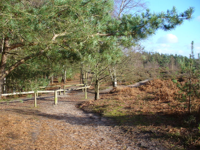
| Holmbury Hill | 2.8 miles (4.5 km) | Climb to the 856 feet (261 m) summit of Holmbury Hill on this circular walk in the Surrey Hills. The hill is the fourth highest point in the county and commands wonderful views over the surrounding area. The walk starts in the village of Holmbury St Mary, next to the church. You then pick up the Greensand Way and follow it through Hurt Wood to the hill summit where you will find an Iron Age hillfort and great views over the Weald of Sussex. You descend on more good woodland trails, returning you to the village. The area is also good for mountain bikers with a number of bridleways through Hurt Wood to try. If you'd like to continue your walking in the area then you could head east and climb the nearby Leith Hill, the highest point on the Greensand Ridge. Around here you'll also find the expansive Abinger Common and Holmwood Common with miles of good trails to try. If you head west you can climb Pitch Hill and explore the expansive Hurt Wood and Winterfold Forest. View Full Details>> | |
| Holmwood Common | 2.2 miles (3.5 km) | This National Trust managed common has miles of walking trails to try. The area covers 650 acres and consists of ancient woodland, grassland and several ponds. It's great for wildlife with butterflies, dragonflies, deer and a variety of birdlife including chiffchaffs, blackcaps and willow warblers. The common is also good for cycling with a number of flat trails to follow. If you would like to extend your walking in the area then you could climb the nearby Leith Hill. View Full Details>> | |
| Hydon's Ball and Hydon Heath | 1.2 miles (2 km) | This National Trust owned hill is one of the high points of Surrey and a great place to stretch your legs. The area is covered with attractive heathland and woodland with fantastic views from the hill top. The woodland includes oak, rowan, birch and pine with birds such as Nightingales, siskin and brambling to look out for on the way. This walk starts at the National Trust car park and follows the Octavia Hill trail up to the 179 m (587 ft) summit. Here you will find a stone seat memorial to Octavia Hill, one of the founders of the National Trust. You can stop and enjoy the wonderful views towards the South Downs and the nearby Black Down. After taking in the views you descend on different paths to the car park. You can easily extend your walk by continuing south from Hydon's Ball to the Greensand Way which runs through nearby Hambledon. You could also visit the splendid Winkworth Arboretum from the same car park. View Full Details>> | |
| Leatherhead | 11.2 miles (18 km) | The town of Leatherhead is in a good position for walking, situated on the edge of the North Downs and Surrey Hills AONB. There's nice riverside trails along the River Mole and miles of woodland footpaths in the nearby Box Hill and Norbury Parks to the south. View Full Details>> | |
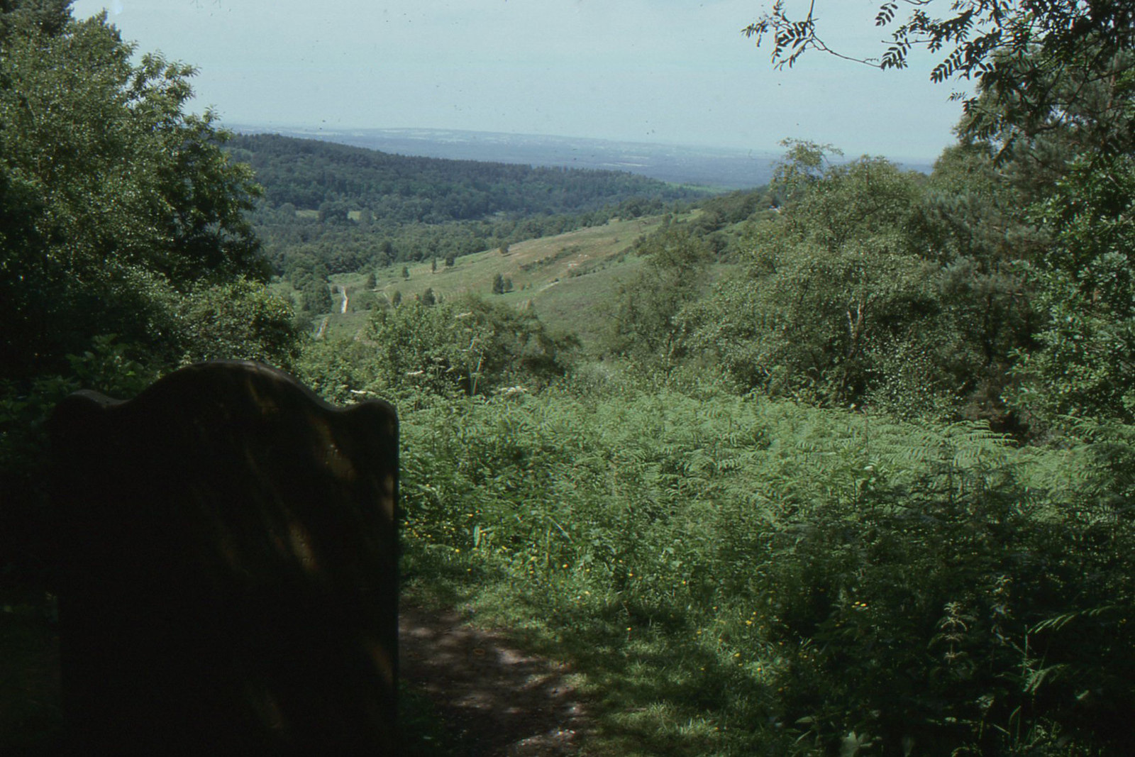
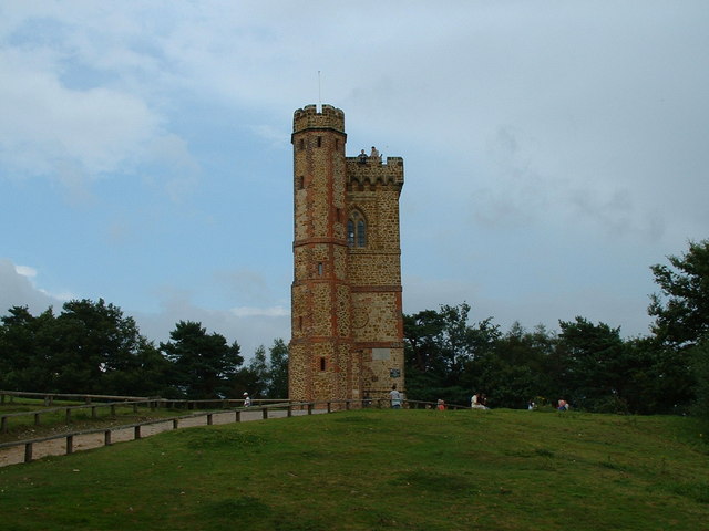
| Leith Hill | 3.7 miles (6 km) | Climb to the highest point in the South East on this challenging circular walk in the Surrey Hills AONB. View Full Details>> | |
| Limpsfield Common | 1.9 miles (3 km) | Limpsfield Common and Limpsfield Chart in the Surrey Hills have some nice woodland trails to try. There's hundreds of attractive beech trees and carpets of bluebells in the spring. At the eastern end of the common you will find a lovely community orchard which is a haven for wildlife and wildflowers. It's a nice spot for a picnic with lots of butterflies fluttering around the blossoms in the spring months. View Full Details>> | |
| Mercers Country Park | 3.1 miles (5 km) | Enjoy a nice lakeside trail around Mercers Lake on this short walk in Redhill. There's a nice surfaced trail running round the water for just over a mile. Just to the west of the lake there's also two smaller lakes at Holmethorpe Lagoons, part of the Nutfield Marsh Nature Reserve. The reserve is a great place for wildlife watching with tufted duck, gadwall, little grebes, coot, moorhens and greylag geese to look out for on the water. There's also lots of pretty wildflowers such as meadows cowslip and trefoil, oxeye daisy and yarrow. You should see several varieties of butterfly fluttering around the flowers in the summer months. The walk starts from the Mercers Country Park car park off Nutfield Marsh Road. You then head west along the lake to Holmethorpe Lagoons, passing the Watercolour Estate. The route continues along the northern side of Mercers Lake to Spynes Mere Nature Reserve. There's three more lakes here with nice footpaths to follow around the wetland habitat. The route then returns to the car park and finish point of the walk. The site also includes a watersports centre and a cafe for refreshments after your exercise. View Full Details>> | |
| Mole Gap Trail | 6.2 miles (10 km) | Follow the Mole Gap Trail from Leatherhead to Dorking on this pleasant short walk through the Surrey countryside. It's a lovely area with great views of the Surrey Hills AONB, woodland sections, pretty weirs and lots of wildlife to look out for. Keep your eyes peeled for water loving wildlife such as swans, kingfishers, herons, various duck species, and little egrets. The trail runs for a distance of about 6.5 miles (10km) and includes some small climbs on the way. View Full Details>> | |
| Newark Priory | 5 miles (8 km) | This walk visits the historic Newark Priory on the River Wey near Ripley in Surrey. View Full Details>> | |
| Newlands Corner | 2.2 miles (3.5 km) | This lovely beauty spot on the North Downs is great for walking with a number of footpaths to try. There's several nice woodland trails and open chalk downland with wonderful views over the Surrey Hills. This circular walk starts from the excellent Newlands Corner Visitor centre where you will find information, a cafe, picnic tables and a car park. It's located just a few miles east of Guildford town centre so is easily accessible. The walk follows the North Downs Way and other footpaths around the visitor centre. You'll visit Albury Downs and Walnut Tree Bottom with lots of opportunities to sit on one of the many benches and soak in the splendid views. It's a great area for flora and fauna. In the summer the grassland is covered with a variety of wildflowers. In the woodland area you may see roe deer, green woodpeckers, nuthatches and tawny owls. View Full Details>> | |
| Norbury Park | 6.2 miles (10 km) | This large area of woodland, grassland and farmland has miles of tracks and trails suitable for cyclists and walkers. In the park you'll find a Georgian manor house, peaceful woodland trails and chalk grassland with lots of wildflowers and butterflies to see. Look out for wildlife which includes roe deer, badgers, foxes and woodpeckers. The route starts from Box Hill and Westhumble Train Station although you could also start from the nearby car park. Follow the trails up to Denshire Hill and Fetcham Downs where there are splendid views over the Surrey Hills. Continue north towards Hawk's Hill on the outskirts of Leatherhead before turning round. The trails then take you south through Druids Grove and Beechy Wood before returning you to Westhumble. View Full Details>> | |
| Peaslake | 10.6 miles (17 km) | This village in Surrey is in a nice location for exploring the Surrey Hills and Greensand Ridge. This circular walk takes you to some of the highlights of the area including the expansive woodland of Hurt Wood, the iconic Leith Hill and the pretty Abinger Common. The route runs for a distance of just over 10 miles with some moderate climbs on the way. The walk starts in the village and heads south through Hurt Wood where you can see lots flowering Rhodedendron in the spring months. At the Duke of Kent School you can pick up the Greensand Way. The long distance, waymarked trail will guide you east through Pasture Wood and then up on to the summit of Leith Hill. The hill is the highest point in the South East and the highest hill on the Greensand Ridge. On the summit of Leith Hill is an 18th century Gothic tower, with panoramic views northwards to London and south to the English Channel. After taking in the views the route turns north towards Broadmoor before heading west to Abinger Common. Here you'll find miles of nice woodland trails, ponds, streams and great views from the many viewpoints on the expansive common. The route continues west, passsing the village of Holmbury St Mary, before a final woodland section takes you back into Peaslake. View Full Details>> | |
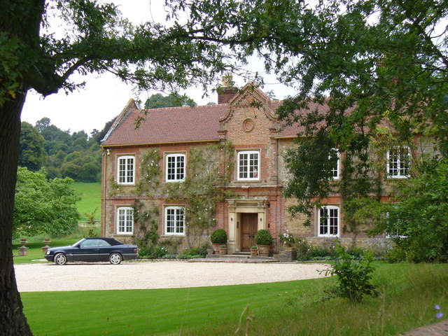
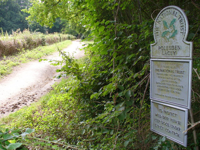
| Polesden Lacey | 3.7 miles (6 km) | A walk around the beautiful grounds of this Edwardian house at Great Bookham, near Dorking, Surrey. There are over 1400 acres of parkland and gardens to explore with magnificent views of the North Downs hills throughout. View Full Details>> | |
| Pyrford Lock | 3.7 miles (6 km) | The circular walk takes you around the village of Pyrford near Woking. You'll enjoy waterside paths along the River Wey Navigation and countryside trails around Pyrford Green. Highlights on the route include a series of delightful locks and views of the remains of Newark Priory. The walk starts from the car park at Pyrford Lock, located north east of the village and due east from Pyrford Common. The lock is a very pretty area of the canal with barges and a nice canalside pub. From here you can pick up the towpath and head south past the golf course to Walsham Lock and Newark Lock. Here you can see the ruins of Newark Priory which sits on an island surrounded by the River Wey. The Augustinian priory is a Grade I Ancient Monument having been established between 1189-1199. After passing Newark Lock you leave the river and head north towards Pyrford village. The village contains the noteworthy church of St Nicholas. The church was built in 1140 and it is thought that Queen Elizabeth I would have worshipped there. She reputedly donated a silver chalice to the church in 1570. Original frescoes, painted in red ochre, were uncovered during renovations in 1869 and 1967. After exploring the village the route heads north east across Pyrford Green to return to the river and the car park. Here you can enjoy refreshments at the popular Anchor pub which has a splendid beer garden, perfect in the summer months. View Full Details>> | |
| Ranmore Common | 3.7 miles (6 km) | This circular walk explores Ranmore Common in the North Downs, near Dorking. It is an excellent area for walking with miles of good footpaths taking you through woodland and open downland, with great views of the Surrey Hills. The walk starts from the Denbies Hillside car park and follows the North Downs Way across grassy chalk downland where you will see various types of orchids growing in the summer months. You then pick up bridleways through the common where you will find sheltered woodland trails and some climbs with great viewpoints. The bridleways are also great for cyclists. View Full Details>> | |
| Reigate Hill and Gatton Park | 5.9 miles (9.5 km) | This circular walk explores Reigate Hill and Gatton Park in the North Downs. It's a great area for walking with the North Downs Way and other good footpaths to follow. View Full Details>> | |
| Shamley Green Circular Walk | 5.7 miles (9.2 km) | This circular walk explores the countryside around the Surrey village of Shamley Green. View Full Details>> | |
| Shere | 9 miles (14.5 km) | The attractive Surrey village of Shere is in a great location for exploring the Surrey Hills and the North Downs. This circular walk makes use of the North Downs Way and other public footpaths to visit some of the highlights of the area including Newlands Corner, St Martha's Hill and Albury Park. The route runs for a distance of 9 miles with some moderate climbs along the way. From the high points there are splendid view over the surrounding countryside to enjoy. The walk starts in the village centre and heads north past Netley Park to meet with the North Downs Way. Follow the waymarked path west and it will take you past Chantry Wood and Clandon Downs to Newlands Corner. The lovely beauty spot is one of the highlights of the area and is very popular with walkers and cyclists. There's several nice woodland trails and open chalk downland with wonderful views over the Surrey Hills. You can also look out for wildlife including roe deer, green woodpeckers, nuthatches and tawny owls. The route continues west to St Martha's Hill, another fine spot for walkers. The hill summit stands at 574 feet (175 m) and commands wonderful views of the surrounding area. There are also a number of nice woodland trails, attractive grassland and a number of interesting plants. After taking in the views the route heads south past Chilworth Manor, a 17th century manor house and Grade II listed building. You then pick up public footpaths to take you south east eventually reaching the woodland of Albury Warren. Here you reach Albury Park where you will find 150 acres of parkland with lots of walking trails to try. Features include peaceful woodland, pretty lakes and views of the River Tillingbourne. There is also the Grade II listed Albury country house and the Saxon Old St Peter and St Paul's Church to see. After exploring the park you follow footpaths back into Shere where there are some quality pubs for refreshments after your walk. It's also nice to stroll around the village where you will find pretty cottages, shops including a blacksmith and trekking shop, a tea house, art gallery, and a noteworthy Norman church. View Full Details>> | |
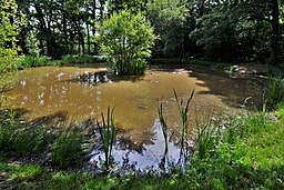
| Silent Pool | 1.2 miles (2 km) | This tranquil lake in the North Downs has a pleasant circular walkway and surrounding woodland trails. You can start your walk from the parking area just off the A25, a few miles east of Guildford. The pool is a popular destination with an eerie stillness and folklore tales. It is said King John on his horse abducted a woodcutter's daughter who was forced into the deep water and drowned. View Full Details>> | |
| Skimmington Castle Walk | 4.3 miles (7 km) | The Skimmington Castle pub is a great place to visit and start a walk from. This circular walk from the inn takes you to two of the highlights of the area at Reigate Heath and Colley Hill. The walk starts from the good sized car park at the pub which is located between Reigate Hill and Reigate Park on Bonnys Road. From here you pick up footpaths heading north through the heath where there's a windmill, pretty heather and acid grassland. You then follow Clifton Lane north before picking up a section of the North Downs Way to climb Colley Hill. Standing at a height of 722 ft (220 m) the hill commands fine views over the surrounding countryside of the North Downs. The route then descends east with the option of continuing to the nearby Reigate Hill. This route turns south, picking up a section of the Greensand Way and following the waymarked path back to Skimmington. View Full Details>> | |
| St Martha's Hill | 1.9 miles (3 km) | This circular walk visits the lovely St Martha's Hill in the North Downs, near Guildford. From the high points there are tremendous views of the Surrey Hills and Newlands Corner. The walk starts from the St Martha's Hill, Guildford Lane Car Park, just east of the hill. You then follow the North Downs Way to the high point and the 19th century church of St Martha's. The hill summit stands at 574 feet (175 m) and commands wonderful views of the surrounding area. There are also a number of nice woodland trails, attractive grassland and a number of interesting plants. View Full Details>> | |
| The Sculpture Park Churt | 1.2 miles (2 km) | This wonderful arboretum in Surrey is filled with 600 amazing sculptures. There's 2 miles of good, woodland footpaths to follow through the 10 acre site. There's also a water garden with sculptures in the lakes and a pretty stream. The pieces are all for sale so the exhibition is always changing. You can easily spend a couple of hours strolling round the site. If you'd like to extend your walk then you could head north to the nearby Frensham Ponds Country Park where you will find woodland and waterside trails around the two large ponds. View Full Details>> | |
| Thursley National Nature Reserve | 4.7 miles (7.5 km) | This lovely nature reserve has miles of boardwalks and footpaths taking you to fine heathland, ponds, lakes and deciduous woodland. It's one of the finest areas in the country for wildlife with birds including woodlark, Dartford warbler, nightjar, stonechat, whinchat and curlew. Also look out for some very rare butterflies including silver-studded blue, white-letter hairstreak and purple emperor. In the heathland area you may see reptiles such as the rare sand lizard and smooth snake. Rare dragonfly and damselfly can be spotted around the pools and lakes. In the fen and open water area you can see various water loving birds such as great crested grebe, mute swan, coot, water rail and little grebe. Finally in the woodland area you can see woodpeckers, woodcock, redstart, tawny owl, nightingale and hawfinch. This circular walk starts at the Moat car park and takes you across Thursley Common to Silkmill Pond and Warren Mere. You then head across Ockley Common and pass Pudmore Pond before returning to the car park. If you would like to continue your walk you could head to the nearby Frensham Country Park where there are miles of cycling and walking trails. The Devil's Punch Bowl and Gibbet Hill is also a great option with more cycling and walking trails through a natural nature reserve, filled with heathland, streams and woodland. The Greensand Way long distance footpath also runs through the common so you could pick this up to continue your walk. View Full Details>> | |
| Tilford | 3.7 miles (6 km) | This fine circular walk explores the area around the lovely Surrey village of Tilford. View Full Details>> | |
| Tillingbourne Waterfall | 1.4 miles (2.2 km) | This circular walk visits the Tillingbourne Waterfall on the River Tillingbourne in the Surrey Hills AONB. View Full Details>> | |
| Winkworth Arboretum | 1.6 miles (2.5 km) | Enjoy a series of woodland walking trails in this beautiful arboretum in Godalming. The area is run by the National Trust so there are very good facilities including a free car park and a tea room. In the woods you will find over 1,000 different shrubs and trees with many rare species. These include magnolias, bluebells, azaleas, rhododendron and holly. There are also large landscaped garden lakes, an attractive boathouse and lovely carved benches with animal figures. There are three colour coded, waymarked trails to try:- a blue 'Access for All' walk, a yellow 'Taste of Winkworth' walk and a red 'Challenging' walk. Look out for wildlife such as herons, green woodpecker and cormorants. It's a great place to spend a peaceful afternoon, particularly in autumn when the woods look spectacular. If you'd like to continue your walking in the area then you could head to the nearby River Wey Navigation and enjoy a waterside stroll along the towpath from Godalming. Just over a mile to the south west is another fine National Trust owned area. Hydon's Ball and Hydon Heath have a waymarked footoath taking you to the Octavia Hill memorial seat where there are splendid views over the Surrey Hills. You can follow footpaths from the arboretum through Busbridge Woods and the Juniper Valley to reach the site. View Full Details>> | |
| Winterfold Forest | 3.7 miles (6 km) | This lovely area of the Surrey Hills is a popular place for walkers and cyclists. Winterfold Wood and the adjacent Hurt Wood have many miles of footpaths and bridleways which are suitable for mountain bikers. View Full Details>> | |
| Woking | 8.1 miles (13 km) | This Surrey town has a number of fine walking trails to try, particularly just to the east of the town centre. Here you can enjoy canalside walks along the River Wey Navigation, visit the lovely Pyrford Lock or enjoy 800 acres of heathland and woodland at Wisley and Ockham Common. Near here you will also find the renowned RHS Wisley Gardens and the delightful Painshill Park. To the north of the town there's miles of trails on the expansive Horsell Common, while to the west there's a nice footpath around Goldsworth Park Lake. The Basingstoke Canal also runs right through the town. This pleasant walk picks up the towpath in the town centre and heads west towards Farnborough and Frimley Green. It's an easy 8 mile walk finishing at Frimley Lodge Park which includes a miniature railway. View Full Details>> | |
| Woldingham | 5 miles (8 km) | A circular walk from Woldingham train station taking you into the Surrey Hills AONB. The route runs for about 5 miles, exploring the countryside and woods to the south of the village. View Full Details>> |