Snowdonia Walks
With some of the most stunning scenery in the UK the Snowdonia National Park is a superb place for walkers.
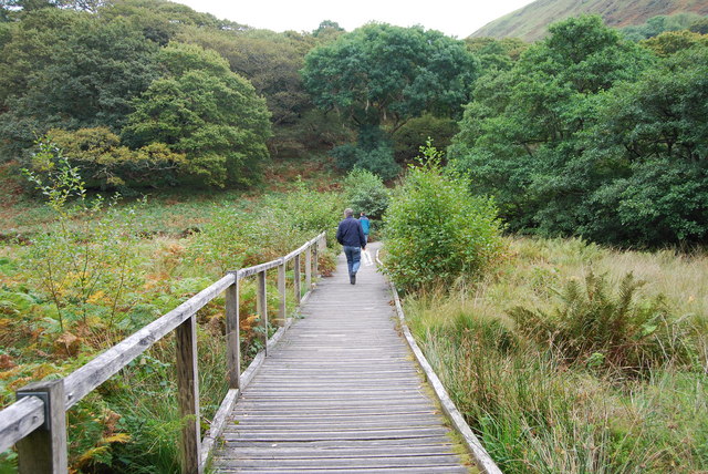
There's challenging mountain climbs, waterfalls, reservoirs, forests and lots of pretty villages to see.
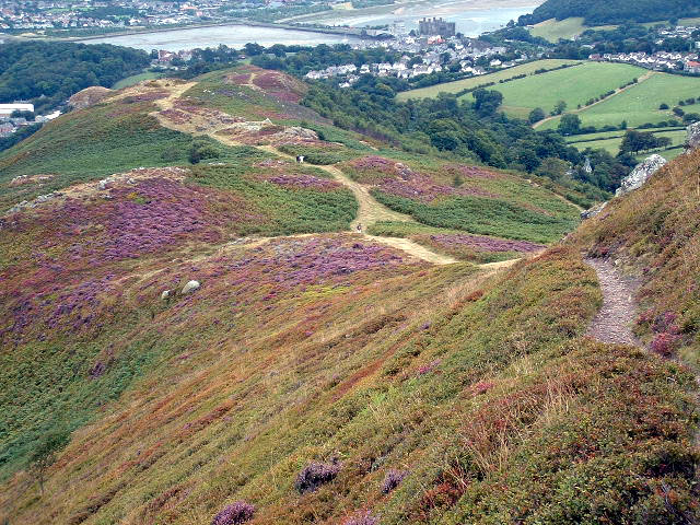
Highlights include the climb to Snowdon along the popular Llanberis Path and the beautiful Aberglaslyn Pass in Beddgelert.
Also not to be missed are the series of little waterfalls at Fairy Glen in Betws-y-Coed and the breathtaking climb to Cadair Idris.
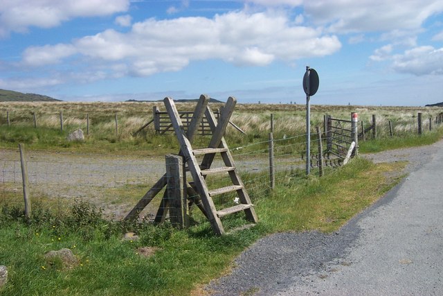
Use the filter to show walks of a certain type such as woods, reservoirs, hills, long distance, country parks, canals and rivers.
In the spring walkers flock to the beautiful bluebell woods in the Snowdonia area. Click the 'Woodland' button below to see these.
Use the links to view full route information including elevation profiles, interactive maps and GPS downloads.
You can also view an overview map of all the routes in the using the Snowdonia Walk Map>>
*New* - Walks and Cycle Routes Near Me Map - Waymarked Routes and Mountain Bike Trails>>
| Filter: |
| Route Name | Photo | Distance | Description |
| Aber Falls | 4 miles (6.5 km) | Follow a splendid walking trail up to the beautiful Aber Falls on this circular walk in the Snowdonia National Park. Aber Falls (Rhaeadr Fawr in Welsh) is located near the village of Abergwyngregynin Gwynedd. The walk starts at the car park at Bont Newydd and follows the North Wales Path along the Afon Rhaeadr Fawr to the 120 ft high falls. You'll pass through the stunning scenery of the Coedydd National Nature Reserve with its wonderful woodland and mountain scenery. There's also a variety of wildlife to look out for including treecreepers, sparrowhawks, woodpeckers, tree pipits, skylarks and buzzards. If you're lucky you may spot polecats, stoat and lizards too. The walk involves a moderate climb but you're rewarded with magnificent views of the surrounding countryside and mountains from the high points. View Full Details>> | |
| Aberdovey | 4 miles (6.5 km) | The town of Aberdovey (Aberdyfi) is located in a lovely position on the west coast of Wales. There's lovely walks along the estuary of the River Dyfi and the coastal path. View Full Details>> | |
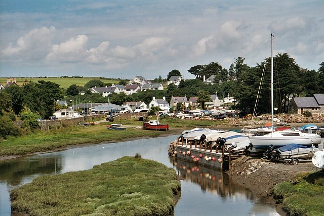
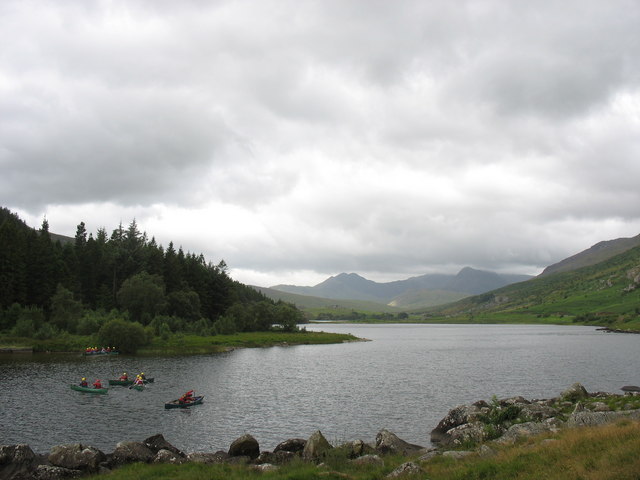
| Aberglaslyn Pass Beddgelert | 1.2 miles (2 km) | This walk takes you through a stunning narrow gorge in the Snowdonia National Park. The path runs along the running waters of the River Glaslyn with waterfalls, interesting vegetation and wonderful views of the surrounding mountainous scenery. The Welsh Highland Railway runs through the pass so look out for their splendid steam trains as you go. The walk starts from the National Trust car park in Nantmor village south of Beddgelert. From here it is a short stroll to the the fisherman's path which will take you along the side of the Aberglaslyn gorge and the River Glaslyn. The path runs for just over a mile to Beddgelert with mature oak woodland and old bridges over the river to observe. The village of Beddgelert is very picturesque with a fine bridge crossing the River Colwyn and a number of good pubs for refreshment. You can of course start the walk from here if you wish. View Full Details>> | |
| Abergynolwyn | 3.1 miles (5 km) | This South Gwynedd village is located in the southern section of the Snowdonia National Park. View Full Details>> | |
| Aberllefenni Quarry | 5.3 miles (8.5 km) | This walk takes you around the Aberllefenni Slate Quarry in the village of Aberllefenni in Gwynedd, North Wales. View Full Details>> | |
| Abersoch | 11.2 miles (18 km) | This circular walk around Abersoch uses the Llyn Coastal Path to explore the beautiful beaches and bays to the south and west of the village. View Full Details>> | |
| Aran Fawddwy | 9.9 miles (16 km) | Climb to the 905 m (2,969 ft) summit of this mountain in southern Snowdonia and enjoy breathtaking panoramic views. The mountain is only (31 ft) short of being a member of the Welsh 3000s. The walk starts from the village of Llanuwchllyn near the southern end of Bala Lake. You can park in the village or catch the Bala Lake Railway to Llanuwchllyn and start the walk from there. From the village you head south and pick up the Aran Ridge footpath. You first climb to Aran Benllyn, passing Llyn Lliwbran on the way. You continue to Aran Fawddwy with lovely views down to the lake of Creiglyn Dyfi. It's a challenging climb but with some wonderful views towards the Rhinog mountains, the Berwyns and the rest of the Arans. The walk can also be attempted from Cwm Cywarch. To continue your walking in the area you can try the Bala Lake Walk. Footpaths climb into the hills and forests above the lake with wonderful views over the water and surrounding mountains. View Full Details>> | |
| Arenig Fawr | 5.9 miles (9.5 km) | This walk visits the pretty Llyn Arenig Fawr before climbing to Arenig Fawr in the Snowdonia National Park. It's a beautiful area with lovely views of the nearby Llyn Celyn and great views of the surrounding countryside and mountains. Start the walk at the south eastern end of Llyn Celyn about half a mile east of Arenig. From here you can follow a footpath south to Llyn Arenig Fawr. The lake supplies water to the nearby town of Bala and the surrounding villages. It's a beautiful spot and generally very peaceful. Follow the path around the lake and continue west to climb Arenig Fawr. At the 854 m (2,802 ft) summit you will find a trig point and a memorial to eight American aircrew who died when their Flying Fortress bomber crashed on 4 August 1943. Some of the crash wreckage is still scattered across the hillside 300 m (330 yds) from the memorial location. There are splendid views to enjoy from the summit. On a clear day you can see Snowdon, Crib Goch, the Glyders, Tryfan and the Carneddau range. View Full Details>> | |
| Arthog Waterfalls | 1.9 miles (3 km) | This walk visits the North Wales village of Arthog where you can enjoy a lovely walking trail along a series of waterfalls. The village is located in the Meirionnydd area of Gwynedd, near Dolgellau. Start the walk at the car park on the estuary, which is located right on the Mawddach Trail. From here you can pick up footpaths heading south east through woodland and along the waterfalls. The village of Arthog itself is very small though it was originally intended to rival the likes of Llandudno. The row of terraced properties you see today was the start of a purpose-built holiday resort Solomon Andrews intended for the area. However the planned development went no further because the surrounding land proved unsuitable for urban planning. Just to the east of the falls you can visit Cregennan Lakes on the northern slopes of Cadair Idris. There's a nice footpath round the lovely lakes with the the Cadair Idris Visitor Centre also located near by. The centre includes a wealth of information and an exhibition detailing the wildlife and geology of this fascinating area. You can extend the walk by picking up the Mawddach Trail shared cycling and walking trail. The popular route runs along the old Ruabon to Barmouth railway line and can be picked up directly from the car park. There's fine views across the estuary to Barmouth on the opposite side. You can visit the town by picking up the Panorama Walk just to the west of the village. View Full Details>> | |
| Bala Lake | 7.5 miles (12 km) | Bala Lake (or Llyn Tegid) is the largest natural lake in Wales. The area on the south side of the lake is wonderful for walkers. Footpaths climb into the hills and forests for fabulous views of the lake below. The walk begins in Bala, at the visitor centre on the foreshore of the lake. You then follow footpaths along the lakeside before ascending to Craigy-Allor. From here the views over the lake and surrounding mountains are splendid. The route then descends through forest and countryside to Llanuwchllyn station. From here you can catch the Bala Lake railway back to Bala. The narrow gauge steam train runs along the southern end of the lake. It's a lovely journey with fine views of the lake and Arenig Fawr, Aran Benllyn and Aran Fawddw mountains. To continue your walking in the area you could climb Aran Fawddwy. The walk starts from the village of Llanuwchllyn near the southern end of the lake. You could also head to the nearby Llyn Celyn where there's more lovely scenery and walks to try. View Full Details>> | |
| Bangor | 4.3 miles (7 km) | This walk around Bangor takes you to some of the highlights of the coastal town. You'll visit the interesting Roman Camp, walk along the coastal path, climb to Bangor Mountain and enjoy a stroll along Garth Pier. There's also a woodland and riverside section along an old railway path. The walk starts at Garth with a walk along the pier. The popular pier provides wonderful views over the Menai Strait, which separates the island of Anglesey from the mainland of Wales. Atfer exploring the pier head west along the coast path to visit the Bangor Roman Camp. The area is now a nature reserve but in the 12th century the hill top was occupied by a fort. There's woodland trails, interesting flora and fauna and more nice views over the Menai Strait from the elevated position of the hill fort. After viewing the site the walk returns to the coast path before heading inland to climb Bangor Mountain. There are several rocky outcrops at high points on the mountain providing panoramic views of the city centre, the Menai Strait and over to the east of Anglesey, including the town of Beaumaris. This is probably the best location from which to see the city highlights including Bangor University and the cathedral. After taking in the views the route then descends to the east where you can pick up a section of the North Wales Path. The waymarked trail will lead you north along the River Cegin to the coast. The route then finishes with another coastal section leading you back to Garth Point. View Full Details>> | |
| Beddgelert Fishermans Walk | 5 miles (8 km) | This circular walk explores the riverside Fishermans Walk in Beddgelert, Snowdonia. View Full Details>> | |
| Beddgelert Forest | 3.1 miles (5 km) | This large forest is located near the village of Beddgelert in the Snowdonia National Park. In it you will find miles of walking paths and great mountain bike trails. There are great views towards Snowdon and a nice path around the lovely Llyn Llewellyn. The Welsh Highland Railway also runs through the forest so look out for the fine steam trains as you go. View Full Details>> | |
| Bethesda | 4 miles (6.4 km) | This former slate quarrying village sits in a dramatic location on the edge of the Snowdonia National Park in the valley of the River Ogwen. View Full Details>> | |
| Betws Y Coed River Walk | 1.2 miles (2 km) | A circular walk along the River Llugy and the River Conwy in the Snowdonia village of Betws Y Coed. The short walk takes you along footpaths where the two rivers converge, close to the train station and the village centre. You can start the walk from the Snowdonia National Park Visitor Centre or from the train station. Paths will then take you around the golf course and along the rushing waters of the rivers. There's nice views across the water to the surrounding woodland and mountains of the area. View Full Details>> | |
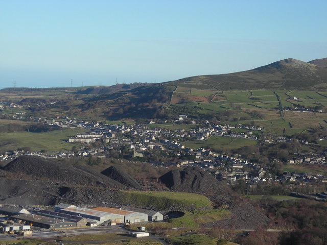
| Blaenau Ffestiniog | 5.3 miles (8.5 km) | This old slate mining town is located in Gwynedd in the Snowdonia National Park. View Full Details>> | |
| Bryn Cader Faner | 8.7 miles (14 km) | This walk climbs to a Bronze Age round cairn in the Ardudwy area of the Rhinogydd mountains. It's a fascinating monument and one of the finest of its type in Britain. From the elevated position of the stone circle there are magnificent views over Snowdonia. The site sits at a height over 1250ft (380m) so it is quite a challenging climb. The walk starts from Llandecwyn and follows a section of the Taith Ardudwy Way to the cairn circle. You can pick up the trail just to the east of the train station. Follow it east towards the tranquil Llyn Tecwyn Uchaf where you turn south towards the village of Llandecwyn, with its ancient church. You continue south past another beautiful body of water at Llyn Tecwyn Isaf where you turn east to Caerwych. The route then climbs to Y Gyrn before the final ascent to Bryn Cader Faner. The diameter of the circle is 8.5 metres (28 ft) with 18 thin jagged pillars which jut upwards from the low cairn. It is thought to date back to the late third millennium BC. After admiring the structure and taking in the views you return on the same path. If you would like to extend the walk you can continue south and visit Llyn Eiddew Mawr. If you head east you can visit Llyn Trawsfynydd. The huge lake has some nice cycling and walking trails running around the perimeter. View Full Details>> | |
| Cadair Idris | 5 miles (8 km) | The epic circular walk to the 893 m (2,930 ft) summit of Cadair Idris is one of the most popular climbs in the Snowdonia National Park. This route follows the Minffordd Path and begins near the car park at Minffordd and the glacial Tal-y-llyn Lake. The area is part of a National Nature Reserve which includes woodland, streams, waterfalls and some wonderful geological formations such as the cliffs of Cwm Cau. The walk starts from the Dol Idris Car Park at the junction of the A487 & B4405 (postcode: LL36 9AJ). There's plenty of parking here with toilets facilities also. From here you can easily pick up the Minffordd Path which will guide you up to the summit. You begin the walk with a lovely woodland section with streams and waterfalls before ascending towards the stunning Llyn Cau. This beautiful lake is surrounded by huge cliffs and is a breathtaking sight, particularly when viewed from above. You continue around the lake towards Penygadair - the highest point on the mountain. From here there are magnificent views of the Barmouth estuary, the Cambrian Mountains, the Brecon Beacons, the Rhinogs and the rest of Snowdonia National Park. You continue east to Mynydd Moel and descend towards Moelfryn, crossing the Nant Cadair before returning to the car park through the woodland. After your hike you can enjoy refreshments at the splendid Ty Te Cadair Tea Room where there's outdoor seating with great views. View Full Details>> | |
| Caernarfon | 7.8 miles (12.5 km) | This popular Welsh seaside town marks the start of the epic Llyn Coastal Path which takes you along the beautiful Llyn Peninsula. This walk uses part of the long distance trail and a section of a dismantled railway line to create a lovely circular walk around the town. The walk starts at the historic Caernarfon Castle in the town centre. The castle dates back to the 11th century and has a fascinating history. The route then crosses the Aber Swing Bridge which crosses the Afon Seiont. You then follow the coast path south to Llanfaglan where you will pass the noteworthy St Baglan's Church. The Grade I listed building dates from the 13th century with a lintel consisting of a 6th-century inscribed stone positioned over the doorway. The route then runs along the lovely Foryd Bay which is also a nature reserve with lots of birdlife to look out for. It is located at the south-western end of the Menai Strait and includes large areas of mudflats and salt marsh. Keep your eyes peeled for waders and wildfowl including brent goose, jack snipe, spotted redshank and greenshank. The walk then leaves the coast to head east through the countryside to Dinas. There is a train station here on the Welsh Highland Railway which you could catch back into Caernarfon if your legs are weary. This route picks up the Lon Eifion shared walking and cycling trail which follows a disused railway path north. You'll cross the Afon Gwyrfai before returning to Caernarfon. View Full Details>> | |
| Cambrian Way | 297.6 miles (479 km) | This epic long distance trail runs from Cardiff on the south coast of Wales to Conwy on the north coast. View Full Details>> | |
| Capel Curig | 3.1 miles (5 km) | The village of Capel Curig lies in the heart of the Snowdonia National Park, making it an excellent centre for walkers. There's a number of challenging mountain climbs which can be started from the village. There's also lakeside paths and some nice woodland trails to the south of the village. Capel Curig is also the home to the Plas Y Brenin, National Mountain Sports Centre. There's a range of activities to try here and decent accommodation. This circular walk takes you around the village's immediate area, visiting Llynnau Mymbyr and the woodland of Coed Bryn-engan. The lake is very beautiful with fine views across the water to the surrounding mountains. There's also a visit to the Afon Llugwy with some riverside footpaths in the forest to enjoy. The route runs for about 3 miles on fairly flat paths with some small climbs on the northern side of the walk. View Full Details>> | |
| Carneddau | 5.6 miles (9 km) | This walk explores the Carneddau mountain range in the Snowdonia National Park. You'll visit the peaks of Carnedd Llewellyn and Yr Elen with wonderful views of Tryfan, The Glyders and Llyn Ogwen as you go. The walk starts from Llyn Ogwen where there is roadside parking. You then follow a track north along the River Lloer to Bryn Mawr and Cwm Loer where you pass around the pretty lake of Ffynnon Lloer. The route then involves a scramble to Pen Yr Ole Wen before continuing to the peaks of Carnedd Fach and Carnedd Dafydd. You continue to the 1,064 m (3,491 ft) summit of Carnedd Llewelyn, the second highest peak in Wales after Snowdon. Just to the east of the peak you will find the highest lake in Wales, Llyn Llyffant. From Carnedd Llewelyn you can continue a short distance north west to the 962 m (3,156 ft) peak of Yr Elen. It's a very challenging walk with some scrambling but you will be rewarded with spectacular views of Snowdonia, Bangor, Anglesey and the Irish Sea. If you would like to continue your walking in the area then you could climb Tryfan or enjoy an easier walk around Llyn Ogwen. Also in the range is Foel Fras near the coast at LLanfairfechan. View Full Details>> | |
| Castell Y Bere | 1.1 miles (1.8 km) | This circular walk visits Castell Y Bere, near Abergynolwyn in the Snowdonia National Park. View Full Details>> | |
| Cnicht | 3.4 miles (5.5 km) | Climb to the 'Matterhorn of Wales' on this challenging walk from the village of Croesor in Gwynedd. Although several thousand metres lower, Cnicht has a similar appearance to the famous mountain of the Alps. View Full Details>> | |
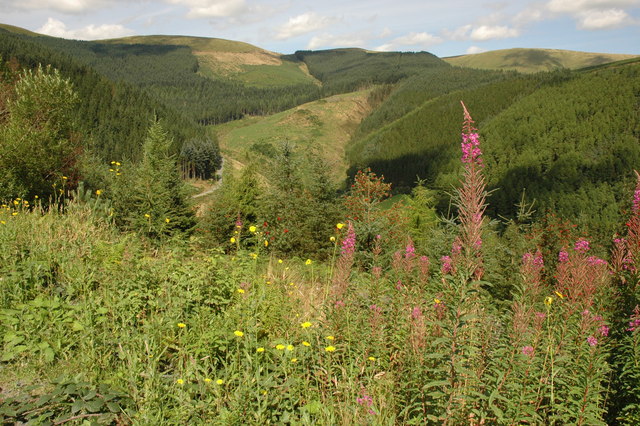
| Coed Y Brenin Forest Park | 5 miles (8 km) | This large forest in Snowdonia is fantastic for both cycling and walking. For walkers there are 4 well devised, all ability trails taking place on wide well maintained paths. The trails take you along the Afon Eden on a sculpture lined riverside path and along a disused tramway to the old Copper processing mill. If you're looking for more strenuous walking then you can pick up one of the 3 difficult routes. The waterfall trail takes you to the confluence of the Afon Gain and Mawddach with their twin waterfalls. The mountain trail climbs to the Mynydd Penrhos ridge with spectacular views of the surrounding area. Cyclists can follow a National Cycle Network trail which runs through the park. There are also a number of graded mountain bike trails. Depending on your ability and experience you can follow the blue moderate trail for a good introduction to singletrack mountain biking. The red trails are more difficult while the black (severe) trails are for the experienced mountain biker. There are 7 trails in all plus an easy forest road trail that follows the Mawddach river valley. This one is good for families looking for a more relaxing ride! The circular route below starts near the visitor centre and takes you along the National Cycle Network trail and a riverside track. It's suitable for both walkers and cyclists. View Full Details>> | |
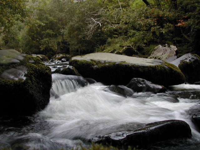
| Conwy Falls | 0.6 miles (1 km) | Follow the circular Conwy Falls Walk through this beautiful wooded gorge near Betws-y-Coed. The walk starts from the car park and cafe located just off the A5 where it meets the B4406. You then pick up the trail through the woodland to the River Conwy where you will find the lovely falls. Here the river drops 50 feet (15 m) into a deep pool. It's a short, easy walk with a number of good viewpoints. You can refresh yourself in the good sized cafe after your walk. To extend your walk you can pick up a footpath along the river to Fairy Glen. Here you will find little waterfalls, rapids and cascades chanelled into a narrow ravine on the River Conwy. It's a delightful place and is only about a mile up river from Conwy Falls. Also nearby are the wonderful Swallow Falls and the picturesque Miners Bridge. View Full Details>> | |
| Conwy Mountain | 3.2 miles (5.2 km) | Enjoy fabulous views over Conwy Bay and the Welsh mountains on this climb to Conwy Mountain (Mynydd y Dref). You can follow a section of the North Wales Path from the town up into the hills. Starting at Conwy Suspension Bridge head north along the Conwy Estuary to Bodlondeb Woods. Follow the trail round the edge of the woods before turning south towards Cadnant Park. Trails then climb west to the mountain summit which stands at a height of 244 m (801 ft). Here you will find Neolithic Hut Circles and the Iron Age hillfort of Castell Caer Seion. There's also lots of pretty heather and magnificent views over the town to Great Orme and the mountains of the Snowdonia National Park. There are a number of footpaths you can follow around the hill top. At the western end you will find the Sychnant Pass where the car park offers an alternative start point for exploring the area. View Full Details>> | |
| Cregennan Lakes | 3.5 miles (5.7 km) | This circular walk takes you around these two beautiful lakes in Snowdonia. There's some stunning scenery in this National Trust owned area which lies at the northern slopes of Cadair Idris. You can start the walk at the car park at the western end of the northern lake. It's located about a mile to the south east of the little village of Arthog, on the Mawddach Estuary. From the car park you can pick up trails heading round the lakes before returning on some quiet country lanes. The scenery is stunning with the two lakes backed by Pared Y Cefn Hir hill and other mountains. After your walk you can head to the Cadair Idris Visitor Centre to enjoy refreshments at the tea room. Located near the car park the centre includes a wealth of information and an exhibition detailing the wildlife and geology of this fascinating area. View Full Details>> | |
| Criccieth | 5 miles (8 km) | This circular walk explores the coast and countryside surrounding the town of Criccieth in the Eifionydd area of Gwynedd. On the way you'll visit the historic Criccieth Castle and the grave of former Prime Minister David Lloyd George. View Full Details>> | |
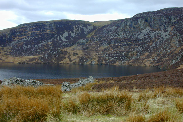
| Cwm Idwal | 2.5 miles (4 km) | Explore this wonderful hanging valley and enjoy some of the most spectacular mountainous scenery in the country on this fine circuit in Snowdonia. In a Radio Times poll in 2005, Cwm Idwal was ranked the 7th greatest natural wonder in Britain. This circular walk begins at the car park next to the western end of Lllyn Ogwen. You then pick up a footpath which ascends to the beautiful Llyn Idwal. It's a simply wonderful spot with the crystal clear lake and surrounding mountains forming a spectacular natural amphitheatre. The footpath runs along the edge of the lake to the Darwin Idwal Boulders and then to the Idwal Slabs. The slabs were used as a training ground for Mount Everest conqueror Edmund Hillary. As you pass the lake you close in on the impressive headwall of Cwm Idwal know as 'The Devil's Kitchen'. From here the route descends on the western side of Llyn Idwal to Llyn Ogwen and the finish point. If you would like to continue your walking in the area then you could climb the challenging Tryfan mountain. The route starts from the eastern end of Llyn Ogwen which is a great place to extend your walk. View Full Details>> | |
| Cwm Pennant | 3.7 miles (6 km) | This circular walk explores the beautiful Cwm Pennant in the Snowdonia National Park. View Full Details>> | |
| Cwmorthin | 1.9 miles (3 km) | This walk visit visits the Cwmorthin Quarry and the adjacent lake in Tanygrisiau, north Wales. It's a beautiful place with a stream, mountains, gardens, waterfalls and some interesting mining history as well. View Full Details>> | |
| Dinas Dinlle Coastal Walk | 2.5 miles (4 km) | This walk visits the ancient hillfort and beautiful beach at Dinas Dinlle in Gwynedd, north-west Wales. There is a car park in the village just north of the site. From here you can follow footpaths south up to the fort before heading north along the coast to the nearby Caernarfon Airport. View Full Details>> | |
| Dinas Emrys | 1.9 miles (3 km) | This walk takes you to a historic site on the Glaslyn river in the Snowdonia National Park. View Full Details>> | |
| Dinorwic Quarry | 4 miles (6.5 km) | This walk explores the fascinating old Dinorwic Slate Quarry in Llanberis. At one time the quarry was the second largest slate quarry in the world, after the nearby Penrhyn quarry at Bethesda. View Full Details>> | |
| Dolgoch Falls | 1.2 miles (2 km) | Travel on the marvellous Talyllyn Railway to Dolgoch and visit the beautiful Dolgoch Falls on this circular walk in the Snowdonia National Park. View Full Details>> | |
| Dolwyddelan Castle | 3.7 miles (6 km) | This circular walk visits a historic castle located in the Conwy County area of North Wales. It's a beautiful area with the stunning scenery of the Snowdonia National Park and the Afon Lledr valley to enjoy. View Full Details>> | |
| Dorothea Quarry | 3.1 miles (5 km) | This walk in the Nantlle valley visits the 19th century Dorothea Quarry. The slate quarry is now flooded and is a popular place for scuba divers. View Full Details>> | |
| Dyfi Forest | 6.8 miles (11 km) | This expansive forest is located in the Dyfi Valley area of the Snowdonia National Park. View Full Details>> | |
| Elidir Fawr | 3.7 miles (6 km) | Climb to Elidir Fawr, the northernmost peak in the Glyderau range on this challenging walk in Snowdonia. The walk takes you to the 924 metre (3,031 ft) summit from the village of Nant Peris at the bottom of the Llanberis Pass. It's only about a 2 mile climb, but quite steep. The walk starts from the parking areas off the A4086 in Nant Peris. Cross the A4086 and then pick up a country lane heading north. A footpath then takes you the rest of the way to the summit, passing the Afon Dudodyn on the way. There are fabulous views over the peaks and reservoirs of the national park. You can extend the walk by continuing a short way on to the pretty Marchlyn Mawr reservoir. Following the path further will take you to Foel-Goch and then on to Y Garn. From the 947 m (3,107 ft) summit there are great views of Llyn Clyd and the Ogwen Valley. Also nearby are the climbs to Glyder Fawr and Glyder Fach and Tryfan. View Full Details>> | |
| Fairy Falls Trefriw | 1.2 miles (2 km) | Visit these pretty falls in Trefriw and enjoy a stroll along the rushing water of the River Crafnant. From the parking area follow the trails along the river behind the mills to the falls. There's little bridges which make nice viewpoints down to the falls. After exploring the falls you can enjoy a riverside walk along the Crafnant to the point where it joins the River Conwy, just north of the village. The Fairy Falls hotel is a great place for refreshments after your walk. To extend your walking in the area head south west and visit the beautiful Llyn Geirionydd and Llyn Crafnant. There's two lovely circular trails to try here with wonderful views of the Carneddau mountains. View Full Details>> | |
| Fairy Glen Betws y Coed | 0.6 miles (1 km) | Visit this delightful glen in Betws y Coed and enjoy little waterfalls, rapids and cascades in a wooded gorge on the River Conwy. You can pick up the Fairy Glen footpath from the A470 north of the falls, next to the Fairy Glen Hotel. It is located just where the road crosses the river and runs for about half a mile through the glen. There are some steep steps to climb down so please take car when wet as they can be a bit slippery. The glen is a delightfully peaceful area with the rushing water surrounded by interesting vegetation and attractive woodland. If you enjoy this walk then you could head to the nearby Swallow Falls. These can be reached from Betws-y-Coed by following the Afon Llugwy to the falls. It's a lovely riverside walk, with woodland trails, the picturesque wooden Miners Bridge and a series of waterfalls to enjoy. Just south of Fairy Glen you will find Conwy Falls. It's about a mile down the river and consists of a short circular trail through the Conwy Forest Park. This takes you to the River Conwy where you will find the lovely 50 ft waterfall. View Full Details>> | |
| Fishermans Walk Betws Y Coed | 3.6 miles (5.8 km) | This walk takes you through the stunning scenery of the River Lledr Gorge in Dolwyddelan, Conwy. View Full Details>> | |
| Foel Fras | 9.3 miles (15 km) | Climb to the summit of Foel Fras on this challenging climb in the Carneddau mountain range in the Snowdonia National Park. The walk starts from the pretty seaside town of Llanfairfechan and climbs towards Garreg Fawr along the North Wales Coast Path. You continue to Pen Bryn Du before reaching the 770 m (2,526 ft) of Drum. From Drum you climb to Foel Fras with wonderful views down towards the pretty Llyn Anafon below. The summit of Foel Fras stands at 942 m (3,091 ft) making it one of the Welsh 3000s (mountains over 3000ft high). From the high pint there are wonderful views over Carneddau and the rest of Snowdonia. This route descends straight back to LLanfairfechan but you have other options if you'd like to extend your walk. You could continue south and climb to Carneddau Llewellyn, the second highest peak in Wales after Snowdon. This would take you past Garnedd Uchaf and Foel Grach. You could also descend back to Drum and head east to visit Pen Y Castell. As an alternative you can start the walk from the beautiful Aber Falls by heading left from the car park along the North Wales Coast Path towards Garreg Fawr. Then follow this route from there. View Full Details>> | |
| Four Valleys Path | 18.6 miles (30 km) | Explore the four former slate mining valleys of Nantlle, Gwyrfai, Padarn and Ogwen on this beautiful walk through Gwynedd. The walk runs from Penygroes to Bethesda passing along the edge of the Snowdonia National Park along the way. Highlights on the walk include the 13th century, Dolbadarn Castle which features one of the finest surviving examples of a Welsh round tower. You will also pass between Llyn Peris and Llyn Padarn in Snowdonia. View Full Details>> | |
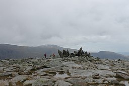
| Glyder Fawr and Glyder Fach | 5 miles (8 km) | Explore the Glyderau mountain range on this spectacular walk in Snowdonia. The challenging walk visits the peaks of Glyder Fawr and Glyder Fach with incredible views towards Tryfan and over Llyn Ogwen and Llyn Idwal. You will also pass incredible rock formations in the form of the Cantilever Stone and Castell y Gwynt. The walk starts at Llyn Ogwen by Idwal Cottage where parking is available. You then climb towards the pretty Llyn Bochlywd and then on to Bwlch Tryfan. You continue to the peak of Glyder Fach, the second highest of the Glyderau range and the sixth highest in Wales. There is a challenging section over the spectacular Bristly Ridge where some scrambling is required. It's a stunning ridge with truly awe inspiring views over Nant Ffrancon and Cwm Idwal. At the summit of Glyder Fach you will find the precariously positioned Cantilever Stone. The climb then continues to the high point of the Glyderau range at the 1000m high Glyder Fawr. You will pass the magnificent Castell y Gwynt with its series of tall spiky rocks and enjoy views towards Snowdon on this section. The descent back to Llyn Ogwen passes the two pretty lakes of Llyn y Cwn and Llyn Idwal with wonderful views over the Ogwen Valley. If you'd like to continue your walking in this area then the Cwm Idwal and Tryfan walks are both nearby. The climb to Elidir Fawr can also be tackled from the nearby Nant Peris at the bottom of the Llanberis Pass. View Full Details>> | |
| Gwydyr Forest | 7 miles (11.2 km) | This large area of woodland encircles the popular village of Betws-y-Coed in the Snowdonia National Park. There's miles of footpaths and mountain bike trails with lots of pretty streams, rivers, waterfalls, hills and lakes to see. This long circular route takes you around the area immediately surrounding Betws-y-Coed, following a series of trails to Llyn Elsi, Rhiwddolion, Pentre Du, the Miners Bridge over the River Llugwy and the Clogwyn Cyrau Nature Reserve to the north of the village. The forest stretches for miles so there's huge scope for extending your exercise. Just off this route there is the option of visiting Swallow Falls and Fairy Glen. There's lovely waterside walking here with lots of pretty waterfalls to see. If you head to the northern end of the forest there's several beautiful reservoirs to visit including Llyn Cowlyd, Llyn Crafnant and Llyn Geirionydd. These reservoirs have some lovely circular walking trails with wonderful views of the Carneddau mountains. Near Llyn Geirionydd there's also the delightful Fairy Falls in the village of Trefriw. View Full Details>> | |
| Hafod Y Llan | 3.7 miles (5.9 km) | This waymarked walk runs through the National Trust's Craflwyn in Beddgelert, Snowdonia. View Full Details>> | |
| Harlech | 11.2 miles (18 km) | This town on the edge of the Snowdonia National Park has some lovely coastal footpaths to try. This walk takes you along a section of the Wales Coast Path to nearby Llanenddwyn. On the way you'll visit Llandanwg Beach, Pensarn Harbour and the Morfa Dyffryn Nature Reserve. At the end of the route you can catch the train back to Harlech from Llanenddwyn. The walk starts from Harlech Train Station, next to Harlech Castle. The impressive castle was built by Edward I during his invasion of Wales between 1282 and 1289. UNESCO considers Harlech to be one of "the finest examples of late 13th century and early 14th century military architecture in Europe", and it is classed as a World Heritage site. From the castle you can pick up the Wales Coast Path and follow it west past Royal St David's golf course. This will take you to Harlech Beach where you can head south along the dunes to Llanfair and then on to Llandanwg where you can visit the noteworthy St Tanwg's Church. Also known as "the church in the sand, St Tanwg's is an early medieval church, with the western end possibly dating back to the 13th century. However, the presence of 6th century inscribed stones, and the dedication to St Tanwg, suggest much earlier use of the site as a church, possibly dating to around 453 AD as part of St Patrick's work to establish links between Ireland and Britain. From here you head east to small village of Pensarn where there is a picturesque harbour. Follow the path past Llanbedr and then west toward Shell Island. The attractive peninsula is known for the wide variety of seashells that wash up on the beach, and for its wild flowers. Public vehicular access to the island is only possible via a causeway across the estuary of the River Artro when the tide is out. Access on foot is always possible from the adjacent Mochras/Morfa Dyffryn beach, which extends for several kilometres south of Shell Island. The route continues south along Morfa Dyffryn National Nature Reserve. The beautiful reserve includes huge sand dunes, seashore, saltmarsh and grassland with a wide variety of wildlife to look out for. Keep your eyes peeled for birds such as stonechats, skylarks and wheatears. There's also lots of pretty wildflowers in the warmer months with highlights including marsh-orchid, speedwells, thyme and maiden pink. After passing along the reserve the route heads inland to Llanenddwyn train station where the route finishes. View Full Details>> | |
| Llanberis Waterfall | 0.9 miles (1.5 km) | Visit this spectacular waterfall on this short walk in Llanberis in the Snowdonia National Park. Also known as Ceunant Mawr Waterfall these lovely falls drop over a hundred feet into the Afon Arddu. It's a short walk to the falls from the centre of Llanberis. A footpath off Church Road leads to the falls where there is an observation point. You can continue your walk by following the riverside path along the Afon Arddu or visiting the woodland of Coed Victoria. To continue your walking in Llanberis you can visit the beautiful Padarn Country Park. View Full Details>> | |
| Llanrwst | 5.6 miles (9 km) | This attractive market town is located in an ideal spot in the Snowdonia National Park. There's nice trails along the River Conwy, a nearby forest and several beautiful lakes to visit in the area. It's also the home of the wonderful Gwydir Estate which includes a historic castle, an ancient chapel and an expansive forest. View Full Details>> | |
| Llyn Cau | 3.7 miles (6 km) | This walk climbs to the beautiful Llyn Cau on the slopes of Cadir Idris in the Snowdonia National Park. While still quite a challenging walk it's not as strenuous as the longer climb to mountain summit. As such it's a great way of exploring the stunning Cadir Idris National Nature Reserve with less stress on the body. Start your walk from the Dol Idris Car Park at the junction of the A487 & B4405 (postcode: LL36 9AJ ). From here you can pick up the the Minffordd path and follow it up to the lake. You'll enjoy a delightful woodland section before passing the stunning cliffs of Craig Cau. The park then forks with one branch going straight on to the lake and one heading left up to the mountain peak. Go straight on and you will soon come to the glacial lake where there is a lovely circular trail running around the perimiter of the water. The striking lake is shaped like a crater formed by a cirque glacier during the last ice age when snow and ice accumulated in the corries due to avalanches on higher slopes. It's a wonderful sight so be sure to bring your camera. After circling the lake descend the same way. At the end of the walk you can enjoy refreshments at the splendid Ty Te Cadair Tea Room where there's outdoor seating with great views. To extend your walking in area continue up to the summit of Cadair Idris for wonderful views over the Snowdonia National Park to the coast. Tal-y-llyn Lake is also located very close by. View Full Details>> | |
| Llyn Celyn | 0.6 miles (1 km) | Enjoy a little stroll along this reservoir in the valley of the River Tryweryn. You can park at the car park on the western side of the lake. There's a footpath here through some lakeside woodland and along the water. It's a great viewpoint with views right across the lake to the surrounding countryside and hills. Just to the west of the car park there's some other public footpaths which climb above the lake for more nice views. At the eastern end of the site you will find the dam and some nice trails along the River Tryweryn to try. These can be picked up from Canolfan Tryweryn, the National White Water Centre for Wales. View Full Details>> | |
| Llyn Cowlyd | 8.7 miles (14 km) | Visit the deepest lake in north Wales on this walk in the Carneddau range. The walk starts from the car park at Capel Curig and follows a footpath north to the reservoir. This section passes along the Afon Llugwy before climbing to the lake which is positioned 1,164 feet (355 m) above sea level. There are great views over the Ogwen Valley. The trail then runs along the lake with splendid views over the water towards the surrounding mountains of Tryfan, Y Garn, Foel Goch and Pen-Yr-Ole-Wen. It's a good footpath which runs for about 2 miles along the north-western shore of the lake. Other walk highlights include views of the pretty Afon Ddu stream which flows from the lake, and views of the 45ft (14m) high dam at the north-eastern end of the water. View Full Details>> | |
| Llyn Crafnant | 3.1 miles (5 km) | Llyn Crafnant is another beautiful reservoir in the Gwydyr Forest area of the Snowdonia National Park. There's a splendid 3 mile circular trail running around the lake with great views to the surrounding forests and Carneddau mountains. It's a fairly easy waymarked walk so perfect for an afternoon stroll in peaceful surroundings. You can start the walk from the car park on Crafnant Road, just to the north of the reservoir. Head south from here and you can pick up the footpaths on the western side of the water. Follow the path through the woodland and past the lake until you come to the River Hendre. You turn left here and cross the river to return to the Crafnant Road. You can follow this quiet little country lane all the way back to the car park. On this section you'll pass the lakeside cafe where you can hire boats and stop for a bite to eat. There is also the option of picking up more woodland trails to the east of the lane if you prefer. View Full Details>> | |
| Llyn Cwm Bychan | 1.2 miles (2 km) | Enjoy a short walk or cycle along this pretty lake in the Rhinogs. The lake is one of the sources of the River Artro which flows south westwards through Llanbedr and onwards to the sea. There is a car park at the eastern end of the lake where you can pick up the lakeside trail. It's a good surfaced track, ideal for an easy walk or cycle. The lake is surrounded by hills, rocky outscrops and interesting flora and fauna. If you would like to continue your walking in the area then you could climb Rhinog Fawr for great views over Snowdonia. View Full Details>> | |
| Llyn Dinas | 2.5 miles (4 km) | Enjoy a nice circular walk around this beautiful lake in the Snowdonia National Park. You can start the walk from the Llyn Dinas car park at the western end of the lake, off the A498. It's about 1.5 miles east of Beddgelert. From the car park pick up the public footpaths heading above the south eastern side of the water. There's some moderate climbing as you head through the woodland above the reservoir. The path eventually takes you to the end of the reservoir where you can cross the Afon Glaslyn and return along the road to the car park. Alternatively you can return the same way through the woods and avoid the road. To continue your walking in the area you could visit the beautiful Aberglaslyn Pass on the circular Fishermans Walk which passes the lake. Also nearby are miles of cycling and walking trails in Beddgelert Forest. Along the Afon Glaslyn you will find Llyn Gwynant which has some nice footpaths along the water and through the surrounding woodland. The Snowdon Watkin Path also starts from the nearby Nant Gwynant car park. View Full Details>> | |
| Llyn Eigiau | 3.7 miles (6 km) | This walk visits the beautiful Llyn Eigiau in the Carneddau Mountains of the Snowdonia National Park. View Full Details>> | |
| Llyn Elsi | 3.1 miles (5 km) | This circular walk visits the lovely Llyn Elsi from the village of Betws-y-Coed in the Snowdonia National Park. It's about a 1 mile walk from the village to the lake where you can pick up a circular trail around the water. Start the walk from just behind St. Mary's church then steadily climb through the woodland to the peaceful lake. Llyn Elsi is surrounded by attractive woodland where you can extend your walk on a number of trails. It sits in an elevated position of about 800ft so there are lovely views towards the Carneddau range, the Glyderau range and Moel Siabod. To continue your walking in the area you can visit the splendid Fairy Glen where you'll find little waterfalls, rapids and cascades in a wooded gorge on the River Conwy. Near here there's also other lovely walks to Conwy Falls and Swallow Falls. The reservoir is located in the Gwydyr Forest area of the national park. You can find a series of other beautiful reservoirs here with more lovely walking trails. View Full Details>> | |
| Llyn Geirionydd | 1.9 miles (3 km) | An easy circular walk around the delightful Llyn Geirionydd in the Gwydyr Forest area of the Snowdonia National Park. It's a very peaceful area with great views of the Carneddau mountains and the woodland surrounding the lake. You can start the walk from the car park at the south eastern end of the lake. There's a picnic area and toilets here too. Follow the little country lane along the eastern side of the water before crossing the River Geirionydd at the northern end. A public footpath then runs along the western side of the lake, just below Mynydd Deulyn. If you head west you can enjoy two more lovely reservoir walks at Llyn Cowlyd and Llyn Crafnant. Llyn Cowlyd is the deepest lake in North Wales and has more nice waterside trails. Llyn Crafnant has a fine circular trail with a lakeside cafe which also hires rowing boats. You could also follow the trails along the River Geirionydd at the northern end of the water or pick up the woodland trails in the surrounding forests. The lake is located near to the village of Trefriw where you can enjoy a little walk along the delightful Fairy Falls. View Full Details>> | |
| Llyn Gwynant | 2.5 miles (4 km) | Enjoy a circular walk around this beautiful lake in Snowdonia. The lake has nice paths along the water and through the surrounding woodland, with great views towards the mountains of Snowdonia. The lake links with Llyn Dinas where there are more nice trails to try. The Snowdon Watkin Path also starts from the nearby Nant Gwynant car park so you could try this challenging climb to extend your walk. If you don't feel like climbing all the way to the summit then you could try the start of the path which is very pretty. It takes you through woodland to the Afon Cwm Llan where there are some lovely waterfalls. If you head north along the Afon Glaslyn you could also visit Llyn Llydaw, one of the most visited lakes in the country. View Full Details>> | |
| Llyn Llydaw | 4 miles (6.5 km) | This walk visits Llyn Llydaw on the flanks of Snowdon, about one-third of the way up the mountain. It's one of the most visited lakes in the United Kingdom with thousands of people passing it each year on their way up to the Snowdon summit. It's a nice one to do if you want to explore the mountain without doing the full, more strenuous climb. The walk starts from the Pen y Pass car park and follows the Snowdon Miners Track up to LLyn Teyrn. Soon after you come to the much larger Llyn Llydaw where you can cross the causeway to the other side. There's a nice path along the northern side of the lake which you can follow up to Lake Glaslyn to extend the walk. The walk descends the same way back to the car park where you can enjoy refreshments in the cafe. To continue your walking in the area you can head along the Afon Trawsnant and the Afon Glaslyn to Llyn Gwynant where there is a nice circular trail to try. View Full Details>> | |
| Llyn Ogwen | 3.1 miles (5 km) | This circular walk takes you around Llyn Ogwen in the Snowdonia. You'll also visit the beautiful Ogwen waterfall at the western end of the lake. There's great views over the lake to the surrounding hills and mountains. The views of Tryfan are particularly good as it is located just to the south of the lake. You can start the walk from the Tryfan car park on the southern side of the lake. You then follow the lakeside pavement to the waterfall before picking up footpaths above the lake on the northern side. It's easy to extend your walking in this beautiful area. You can head up to the hanging valley at Cwm Idwal and visit Llyn Idwal on the way. View Full Details>> | |
| Llyn Parc | 4 miles (6.5 km) | This walk takes you from Betws Y Coed to the lovely Llyn Parc in the Gwydyr Forest. It's a about a 2 mile walk from the village to the lake. The forest is in an elevated position so you will be climbing up hill on the way there before descending on the return leg. View Full Details>> | |
| Llyn Trawsfynydd | 7.8 miles (12.5 km) | Enjoy a long circular walk or cycle around this large lake in in Gwynedd, North Wales. With a total surface area of 4.8 km˛ (1,180 acres) the reservoir is slightly bigger than Wales's largest natural lake, Llyn Tegid (Bala Lake). It's a beautiful spot with lots of wildlife to look out for including Otters, Osprey and rare birds in the woodland sections. Most of the route is suitable for both cyclists and walkers. If you are on a bike please go around the footbridge on the roads though. This trail uses a mixture of footpaths, country lanes and road-side pavements to take you on a tour of the lake and its surrounding countryside. The route starts in the village of Trawsfynydd and heads west to the water where you cross the lake on the footbridge. There's great views in all directions as you cross the narrow bridge. The path then climbs through the woodland and countryside on the western side of the water. This section is quite challenging with the path reaching a height of almost 1000ft (300m). From the high points there are great views over the water to the surrounding hills and mountains of Snowdonia. You then pass along the northern section of the lake, passing the pumping station and the visitor centre. Here you can enjoy refreshments at the cafe which overlooks the water. The final section takes you along the eastern side of the lake on footpaths and pavement during the roadside section along the A470. If you would like to do a shorter route which avoids the roadside section then start from the visitor centre and head west to the dam and then south along the paths on the western side of the water. This is a shared walking and cycle path with bike hire available at the visitor centre. If you would like to continue your walking in the area you could head west and climb to the fascinating stone circle at Bryn Cader Faner or the nearby Foel Penolau in the Rhinogydd range. The Taith Ardudwy Way long distance trail can be picked up near here too. View Full Details>> | |
| Llynnau Mymbyr | 1.9 miles (3 km) | Enjoy a short walk along this picturesque lake in the Dyffryn Mymbyr valley area of the Snowdonia National Park. The walk starts from the car park at Capel Curig and follows a track to the lake. There are footpaths on either side of the lake with the ones on the southern side passing the woodland of Coed Bryn-Engan. There are lovely views across the water to the surrounding mountains. It is a particularly good spot to get a photo of the Snowdon Horseshoe across the water. View Full Details>> | |
| Lon Eifion | 11.2 miles (18 km) | This splendid cycling and walking trail runs along a disused railway path from Caernarfon to Bryncir on the edge of the Snowdonia. It's a good surfaced traffic free path making it ideal for a safe family cycle or a leisurely walk. There are lovely views of the surrounding Welsh Countryside and mountains such as Yr Eifl (or the Rivals) and Snowdon. The route runs alongside the Welsh Highland Railway so you should also see some wonderful steam trains as you go. The route starts at Caernarfon at the impressive Caernarfon Castle, and heads south through the town, crossing the River Seiont on the way. You continue to Llanwnda and Groeslon where you pass the lovely Glynllifon Country Park. It's well worth taking a short detour from the path and visiting the park with its woodland, gardens, parkland and river. There is also a cafe, a maze and exhibits such as steam power pistons restored by Fred Dibnah. The route continues through Penygroes before the final stretch takes you to the finish point at the little village of Bryncir. View Full Details>> | |
| Lon Gwyrfai | 4.3 miles (7 km) | This shared cycling and walking route runs for just over 4 miles between Rhyd Ddu and Beddgelert in the Snowdonia National Park. View Full Details>> | |
| Machynlleth | 5 miles (8 km) | This market town in Powys has some lovely trails to try through the Dovey and Lllyfnant Valleys. This walk takes you through the latter valley with riverside paths, woodland trails and a visit to the Cors Dyfi Nature Reserve near Derwenlas. Machynlleth is significant as the ancient capital and parliamentary seat of wales, home to Laura Ashley and lying within the UNESCO Dyfi Biosphere reserve. The walk starts just to the west of the town at the visitor centre. From here you can pick up country lanes heading south to Wylfa. Woodland trails then continue south taking you into the Lllyfnant Valley where you can enjoy riverside footpaths. The trails then bend round to the Cors Dyfi Nature Reserve in Derwenlas. The site includes habitats such as open water, swamp, bog, wet woodland, scrub and gorse. Boardwalks will take you to viewing platforms where you can look out for wildlife including Ospreys, otters, red kites, peregrines and hen harriers. View Full Details>> | |
| Maentwrog | 1.2 miles (2 km) | This delightful village is located in a fine position in the Vale of Ffestiniog in Snowdonia. There's views of the River Dwyryd, beautiful local gardens, several nearby reservoirs and expansive woodland to the north of the settlement. View Full Details>> | |
| Mawddach Trail | 8.7 miles (14 km) | This splendid cycling and walking trail takes you along the old Ruabon to Barmouth railway line on excellent paths. The route runs for about 9 miles from the coastal town of Barmouth to Dolgellau, through the Snowdonia National Park. You start by crossing the Barmouth Bridge over the lovely River Mawddach estuary on the coast of Cardigan Bay. The route then runs right alongside the estuary to Penmaenpool Bridge where you can stop for some riverside refreshments. The final stretch continues along the river to the historic town of Dolgellau. It's a beautiful trail with lots of bird watching opportunities around the estuary. The nearby Cadair Idris makes for a wonderful backdrop for the whole of the route. It's also a very flat trail so it's perfect for people of all abilities. Highlights on the route include the little village of Arthog where you could take a small detour to visit the Arthog Waterfalls. The series of pretty falls run along a stream to the south east of the trail, just before you cross the estuary into Barmouth. To extend your walking in the Barmouth area try the Panorama Walk. View Full Details>> | |
| Moel Eilio | 8.1 miles (13 km) | This circular walk climbs to Moel Eilio from Llanberis in the Snowdonia National Park. It's a challenging climb with the option of continuing up to the peak of Snowdon Llanberis Path after reaching the Moel Eilio peak. Start your walk in Llanberis and head past the quarries to Bwlch y Groes. Here you can ascend to the summit on the north ridge of Moel Eilio, passing Bryn Mawr on the way. From the 726 m (2,382 ft) summit there are splendid views towards Snowdon and the surrounding mountains. After taking in the views you descend to the subsidiary summits of Foel Gron and Foel Goch. The path then descends past Cefn Drum and the Llanberis Waterfall before returning to the town. An alternative route is to start from the Snowdon Ranger Path car park and head to the summit via Foel Gron and Foel Groch. See the video below for details of this route and to give you an idea of the scenery you can expect to see on this walk. To extend your walking in the area you can climb to the Snowdon Peak on the Snowdon Llanberis Path or visit the beautiful Padarn Country Park. View Full Details>> | |
| Moel Hebog | 1.9 miles (3 km) | This challenging walk climbs Moel Hebog from Beddgelert in the Snowdonia National Park. There's great views of the Welsh coastline and several peaks including Snowdon, Moel Siabod and the Nantlle Ridge. Please note that while this is a great walk the path is not always well defined and there is a degree of scrambling involved. The walk starts from the picturesque village of Beddgelert with its fine bridge crossing the River Colwyn and a number of good pubs for refreshment. You then follow footpaths out of the village and through a woodland section before ascending the mountain path. At the 783 m (2,569 ft) summit you will find a trig point where you can enjoy some stunning views of the surrounding peaks. The walk can be extended by continuing to the peaks of Moel yr Ogof and Moel Lefn . The area is great for wildlife spotting. Look out for Buzzards, Red Kites and Perigrine Falcons as you make your way up the mountain. If you'd like to continue your walking in the area then you could follow the Fishermans Walk along the stunning Aberglaslyn Pass. You could also visit the nearby Beddgelert Forest where you'll find miles of walking paths and mountain bike trails. View Full Details>> | |
| Moel Siabod | 5 miles (8 km) | Climb to the summit of Moel Siabod on this challenging walk in Snowdonia. The mountain reaches a peak of 872m making it the highest peak in the Moelwynion mountain range. The views from the summit are particularly special. On a clear day the you can see Snowdonia, Glyderrau and the Carneddau ranges. The start point at the village of Pont Cyfyng is delightful, with views of the Afon (river) Llugwy and the Llugwy waterfalls. You then ascend to the summit passing a small lake, a quarry and the lovely Llyn-y-Foel on the way. There's also the spectacular Deaer Ddu south east ridge which requires some scrambling before you reach the summit. This is a challenging walk with some scrambling required. You are rewarded with wonderful views throughout. View Full Details>> | |
| Moel y Gest | 5 miles (8 km) | This hill near Porthmadog offers fine views over North Wales including the Llyn Peninsula, the Rhinogydd, Moelwynion, Moel Hebog, and Snowdon. This walk starts at the lovely harbour in Porthmadog and follows the coastal path south to Borth-Y-Gest. Here you can leave the coast and follow a footpath north west to the hill summit which stands at a height of 263 m (863 ft). It's a lovely spot with fine views back down to Porthmadog and the adjacent river estuary. As well as the great views you will also find a hillfort which shows some resemblance to the "nuclear forts" of the Early Middle Ages found in Scotland. After taking in the views the route descends back to Porthmadog on the same paths. View Full Details>> | |
| Mynydd Mawr | 5 miles (8 km) | Climb to the 698 m (2,290 ft) summit Mynydd Mawr on this challenging climb in the Snowdonia National Park. On the walk you will enjoy stunning views of Llyn Cwellyn and the surrounding mountains. The walk starts from the village of Rhyd Ddu and follows woodland trails through Beddgelert Forest before climbing above Llyn Cwellyn to Foel Rudd and then on to the Mynydd Mawr summit. There are interesting geological formations, rocky outcrops and breathtakingly beautiful views to enjoy. It's also a fairly quiet walk with most people heading to Snowdon from Rhyd Ddu. If you'd like to continue your climbing in the area then the Snowdon Rhyd Ddu Path starts from the village too. You could also head along the wonderful Nantlle Ridge. View Full Details>> | |
| Nant Ffrancon | 5 miles (8 km) | A walk through the stunning Nant Ffrancon Valley from Bethesda to Llyn Ogwen. View Full Details>> | |
| Nantcol Waterfalls Walk | 1.9 miles (3 km) | This circular walk explores the beautiful Rhaeadr Nantcol Waterfalls in Snowdonia in North Wales. View Full Details>> | |
| Nantlle Ridge | 8.7 miles (14 km) | This popular circular walk explores the Nantlle Ridge range of mountains in the Snowdonia National Park. View Full Details>> | |
| New Precipice Walk | 3.1 miles (5 km) | This lovely trail follows the New Precipice Walk along the hills to the west of Llanelltyd, near Dolgellau in Gwynedd. View Full Details>> | |
| Padarn Country Park | 2.5 miles (4 km) | This country park in Snowdonia has a number of splendid way-marked walking trails to follow. There are 800 acres to explore through oak woodland and along lakeside paths. The beautiful Llyn Padarn is the centrepiece of the park. You can stroll along the lakeside or catch the Llanberis Lake Railway which runs along the easten edge of the lake. It's a splendid 1 hour ride with views of the 13th century Dolbadarn Castle and the twin lakes of Llyn Padarn and Llyn Peris. Mount Snowdon, the highest peak in England and Wales makes a wonderful backdrop. To continue your walking in the area you could visit the spectacular Llanberis Waterfall. It is located just to the south of the country park and has a nice footpath running to the 100ft high falls. For splendid views of the area you could try the climb to Moel Eilio from Llanberis. View Full Details>> | |
| Panorama Walk Barmouth | 5.9 miles (9.5 km) | A classic circular walk around Barmouth climbing above the town for magnificent views over the Mawddach estuary and the Snowdonia National Park. Start your walk from the car park on Panorama Road, just to the north east of the town. From here you can pick up footpaths to take you up to the Panorama gardens, where there is a great viewpoint. The route then heads north to Cutiau where you turn west towards Llwynon. There follows a challenging climb up to Bwlch Llan which reaches a height of around 1100ft. Your efforts are rewarded with wide ranging views over the Cader Idris range and Cardigan Bay from the high points. The walk then heads to Ffridd Y Graig, Craig Y Gigfran and Dinas Oleu before descending to the sea front in Barmouth. The final section then passes along the pretty Barmouth Beach before climbing back to the finish point at the car park. To extend your walking in the area try the Barmouth to Fairbourne Walk which takes you across Barmouth Bridge to the village of Fairbourne. This uses part of the Mawddach Trail which takes you along the old Ruabon to Barmouth railway line on a brilliant cycling and walking trail. It will take you to Dolgellau where you can try the excellent Precipice Walk and the New Precipice Walk. On the opposite side of the estuary you can also visit the little village of Arthog and try the Arthog Waterfalls Walk. You could also try the long distance Taith Ardudwy Way which starts in the town and takes you through the Snowdonia National Park. View Full Details>> | |
| Pen Yr Ole Wen | 2.2 miles (3.5 km) | Climb to the 7th highest mountain in Snowdonia on this challenging walk in the Carneddau mountain range. Start the walk from the National Trust Ogwen Cottage car park at the western end of Llyn Ogwen. Head up to the A5 and turn left until you cross the bridge. On your right you should see a stile and a National Trust information board. This path will lead you all the way up to the Pen Yr Ole Wen summit. The mountain stands at a height of 978 m (3,209 ft), the same height as England's highest peak, Scafell Pike. There's splendid views over the Ogwen Valley, Cwm Idwal and the Glyderau group including Tryfan. After taking in the views the route then descends back to the car park on the same track. View Full Details>> | |
| Porthmadog | 8.1 miles (13 km) | This attractive coastal town in Gwynedd has some lovely coastal walking paths and beautiful beaches to explore. View Full Details>> | |
| Precipice Walk Dolgellau | 3.1 miles (5 km) | A lovely circular walk through the hills surrounding Llyn Cynwch in the Snowdonia National Park. From the elevated position of the trail there are fabulous views over the Mawddach River and the surrounding mountains. The walk takes place on good, signed paths with an easier path along the reservoir for those looking for a more sedate stroll. You can start your walk from the car park a few miles north of Dolgellau, near to Nannau Farm and the Foel Offrwm Hill Fort. From here you can pick up the trails heading west towards the lake. Follow the paths above the water, taking you round to Foel Cynwch and the Foel Faner Iron Age Hillfort. The route then descends to the lake where you enjoy an easy waterside stretch before returning to the car park. View Full Details>> | |
| Pwllheli | 3.4 miles (5.5 km) | This circular walk takes you around the town of Pwllheli on the Llyn Peninsula. On the walk you'll visit the harbour, beach, the River Rhydir and the Lon Cob Bach Nature Reserve. Pwllheli is considered the the main town of the peninsula, with a train station and a range of shops and other services. The walk starts from the train station and heads south to the front where there are two blue flag beaches. You then head west along the beach before following a footpath north to the River Rhydir and the Lon Cob Bach Nature Reserve. There's some nice walkways here with interesting flora and fauna to look out for. You continue east through the town to the Inner Harbour where there's a nice path to follow to South Beach. You then retrace your steps to return to the train station and the finish point of the walk. View Full Details>> | |
| Rhinog Fawr | 4.3 miles (7 km) | Visit the Rhinogs range of mountains in the Snowdonia National Park and climb Rhinog Fawr on this challenging walk. You'll pass heathery slopes, little streams, rocky outcrops and two small lakes on your way to the top. The walk begins from the Llyn Cwm Bychan car park a couple of miles north of Rhinog Fawr. You then follow the footpaths through a woodland area before climbing the Roman Steps. You'll pass the two pretty lakes of Llyn Morwynion and Llyn Du before coming to the 720 m (2,360 ft) summit of Rhinog Fawr. From here there are fabulous views over the surrounding peaks and lakes. The area is also a National Nature Reserve so look out for interesting flora and fauna including purple heather and wild goats. View Full Details>> | |
| Rowen | 2.5 miles (4 km) | This little village sits in a fine location in the beautiful River Conwy valley. View Full Details>> | |
| Snowdon Horseshoe | 7.5 miles (12 km) | This classic circular walk to the Snowdon summit is a favourite for many. The 7 mile challenge is considered one of the finest ridge walks in the country. It is a very challenging circuit with knife edge sections along Crib Goch, where great care should be taken, particularly on windy days. The walk starts from the Pen-y-pass car park at the top of the Llanberis Pass off the A4086 road. From here you pick up the Snowdon Pyg Track and head west towards Bwlch Y Moch. You continue west to the exhilarating section along Crib Goch. The high point stands at 923 metres (3,028 ft) above sea level. It involves a fair degree of scrambling and a challenging knife edge ridge so take your time! After tackling three rock-pinnacles you will arrive at the grassy col at Bwlch Coch. From here there are great views to Llyn Glas, Y Lliwedd's twin peaks and the Snowdon peak. The next section climbs to Garnedd Ugain mountain, the second highest peak in Wales, lying just under one kilometre north of the summit of Snowdon itself. The route continues to the Finger Stone on Bwlch Glas, marking the top of the Pyg Track and Miners Track. Soon after you reach the summit of Snowdon where you can enjoy views as far as the Isle of Man, the Peak District, the Lake District and Ireland. A brass plaque shows all the surrounding mountains of Snowdonia you can see. The route then steeply descends to Bwlch Cileau and Y Lliwedd using part of the Watkin Path. You continue the descent to Lliwedd Bach and then on to Llyn Llydaw. There are nice views here back to Crib Goch where you can see walkers tackling the same challenging ridge you have already completed! Then next section passes along the shores of the pretty lake before following part of the Snowdon Miners Track to the much smaller Llyn Teyrn. From here it is a short stroll back to the car park and the end of the route. There are lots of other routes up to the mountain summit to try. These include the Snowdon Llanberis Path, Miners Track, Pyg Track, Ranger Path and the Rhyd Ddu Path. View Full Details>> | |
| Snowdon Llanberis Path | 9 miles (14.5 km) | Climb to the summit of the highest mountain in Wales on this challenging walk. The Llanberis Path is the longest of the six routes to the top of Snowdon but because of it's gradual elevation it is generally considered the easiest route to the summit. It's very popular with leisure walkers as it runs parallel with the Snowdon Mountain railway which starts at Llanberis. As such you can use the railway to take you up (or down) part of the route. The path starts in Llanberis near to the Royal Victoria Hotel and climbs towards Hebron Station with great views back towards Dinorwig Slate Quarry and Elidir Fawr. You continue to Halfway House, with wonderful views of Moel Cynghorion, Foel Goch, Foel Gron, Moel Eilio and the Cwm Brwynog valley. At Halfway House you can purchase refreshments in the summer months. The next stage ascends towards Cwm Glas Bach with views of the Llyn Du'r Arddu lake. The final section takes you from Bwlch Glas to the summit where there are magnificent views over Snowdonia, Ireland, the Isle of Man, the Peak District and the Lake District. If you're looking for more challenging climbs to the summit you could try the Snowdon Miners Track or the Snowdon Pyg Track. The peak can also be reached by following a longer trail to Moel Eilio Foel Gron and Foel Goch. For an exhilarating circular ridge walk, taking in the Crib Goch ridge, try the Snowdon Horseshoe. View Full Details>> | |
| Snowdon Miners Track | 8.1 miles (13 km) | This route follows the Miners Track to the summit of the highest mountain in Wales. It is a slightly longer route than the alternative Pyg Track but has the advantage of waterside sections alongside the mountain's three beautiful lakes of Llyn Teyrn, Llyn Llydaw and Glaslyn. The walk begins in the Pen y Pass car park and ascends to the pretty Llyn Teyrn before coming to the much larger Llyn Llydaw. The path crosses the lake and then runs right along it's northern edge, making for a lovely waterside section. At the lake you'll also pass the ruins of the old Britannia Copper Mine crushing mill. You continue along a steep section to Llyn Glaslyn and then Bwlch Glas where you can see the tracks of the Snowdon Mountain Railway. The final section takes you from Bwlch Glas to the Snowdon summit where there are magnificent views over Snowdonia, Ireland, the Isle of Man, the Peak District and the Lake District. The Pyg Track starts from the same car park. It is a shorter route but has more challenging rocky sections. For an exhilarating circular ridge walk, taking in the Crib Goch ridge, try the Snowdon Horseshoe. View Full Details>> | |
| Snowdon Pyg Track | 6.8 miles (11 km) | Climb to the summit of Snowdon on this challenging walk in the Snowdonia National Park. Snowdon is the highest mountain in Wales, standing at a height of 1,085 metres (3,560 ft). The Pyg Track is one of six paths to the Snowdon summit. It is generally regarded as the most challenging as it crosses some rough and rocky terrain. The walk begins in the Pen y Pass car park and ascends to Bwlch y Moch. You continue past the beautiful glacial lakes of Llyn Llydaw and Glaslyn on your way to Bwlch Glas where you can see the tracks of the Snowdon Mountain Railway. The final section takes you from Bwlch Glas to the summit where there are magnificent views over Snowdonia, Ireland, the Isle of Man, the Peak District and the Lake District. The Snowdon Miners Track also starts from the same car park and has the advantage of waterside sections along the mountain's three beautiful lakes of Llyn Teyrn, Llyn Llydaw and Glaslyn. There's also the Snowdon Ranger Path,Snowdon Llanberis Path and the Snowdon Rhyd Ddu Path to try. For an exhilarating circular ridge walk, taking in the Crib Goch ridge, try the Snowdon Horseshoe. View Full Details>> | |
| Snowdon Ranger Path | 8.1 miles (13 km) | Climb to the summit of Snowdon on the ranger path on this challenging walk in the Snowdonia National Park. You can start your walk from the National Park car park next to Llyn Cwellyn and the Snowdon Ranger railway station. From here you can pick up the path, heading east away from the lake. It's generally a good track with rockier sections as you approach the summit. It runs for nearly 4 miles with wonderful views over the surrounding mountains and the numerous beautiful lakes. The route actually passes very close to Llyn Ffynnon-y-gwas and Llyn Du r Arddu as you approach the summit. You will also pass Clogwyn Du'r Arddu, considered to be one of the best climbing cliffs in Britain. Here there are magnificent views of the Llechog ridge and Cwm Clogwyn with the lakes of Llyn Glas, Llyn Coch and Llyn Nadroedd. (Blue Lake, Red Lake and Snakes' Lake). From the Snowdon summit the views are also impressive with 18 lakes and 14 peaks visible. On a clear day you can see as far as Ireland, the Isle of Man and the Lake District.
The ranger path is one of several routes to the summit. You can also try the Llanberis Path, Miners Track, Pyg Track and the Rhyd Ddu Path. For an exhilarating circular ridge walk, taking in the Crib Goch ridge, try the Snowdon Horseshoe. View Full Details>> | |
| Snowdon Rhyd Ddu Path | 7.5 miles (12 km) | The Rhyd Ddu Path is one of the six main routes to the summit of the highest mountain in Wales. It is considered to be one of the quietest and most beautiful, though there are some challenging sections where care should be taken. The path begins in the car park in the village of Rhyd Ddu and ascends to Pen ar Lon, Rhos Boeth and Llechog, before reaching the 1,085 metres (3,560 ft) summit. On the asent you will enjoy magnificent views of Llyn y Gadair and Llyn Cwellyn lakes, and the summits of Moel Hebog, Moel yr Ogof, Moel Lefn, Mynydd Drws y Coed and Mynydd Mawr. From the Snowdon summit there are views over Snowdonia, Ireland, the Isle of Man, the Peak District and the Lake District. For an exhilarating circular ridge walk, taking in the Crib Goch ridge, try the Snowdon Horseshoe. View Full Details>> | |
| Snowdon Watkin Path | 7.5 miles (12 km) | The Watkin Path to the Snowdon summit is considered to be the most challenging of the available routes as it starts from the lowest elevation. It is, however, very pretty with attractive woodland and waterfalls near the start. You can start your walk from the good sized Nant Gwynant car park off the A498. Then if you head south over the Afon Glaslyn you will soon come to the start of the Watkin path on your right. You head north along the path, passing through woodland before a waterside stretch along the Afon Cwm Llan. You'll pass some lovely waterfalls before coming to the Gladstone Rock. The rock is dedicated to the Prime Minister William Gladstone, who opened the path in 1892. The path continues north from the rock with great views over the Glaslyn estuary and Llyn Glaslyn lake below. The next section from Bwlch y Saethau is quite challenging with a very steep incline and loose stones. Shortly after you reach the summit where you are rewarded with magnificent views towards Ireland, the Isle of Man and the Lake District. There's several other routes across Snowdon to try. If you would like to do a circular walk then the Snowdon Horseshoe is a good option. For a longer but less demanding climb try the Llanberis Path. The beautiful Llyn Gwynant and Llyn Dinas are also very close to the start of this route. You could visit these two lovely lakes from the same car park. You can virtually climb to the summit using the google street view link below! View Full Details>> | |
| Snowdonia Slate Trail | 83.3 miles (134 km) | This long circular walk explores Snowdonia's rich mining history. The area is designated as a World Heritage Site and includes a number of fascinating old quarries and historic mining villages. View Full Details>> | |
| Swallow Falls | 2.5 miles (4 km) | This walk follows the Afon Llugwy from Betws-y-Coed to the beautiful Swallow Falls in the Snowdonia National Park. This is a popular riverside walk, passing along woodland trails with a series of waterfalls to enjoy. The walk starts in the delightful village of Betws-y-Coed in the Conwy valley. The area is popular with walkers as it is surrounded by some wonderful woodland trails, the Clogwyn Cyrrau Nature Reserve, the Llyn Elsi, and the rivers Conwy, Llugwy and Lledr. This walk takes you along the Llugwy passing the wooden Miners Bridge and several smaller waterfalls before coming to Swallow Falls. The falls are charming and are best enjoyed after wet weather. You can enjoy refreshments at the nearby Swallow Falls Hotel. View Full Details>> | |
| Sychnant Pass | 5 miles (8 km) | This circular walk explores the wonderful Sychnant Pass near Conwy in North Wales. The pass runs through the stunning scenery of the Snowdonia National Park from Conwy to Penmaenmawr via Dwygyfylchi. There's lots of great walking trails with stunning views towards the Welsh Coast and the Isle of Anglesey. View Full Details>> | |
| Taith Ardudwy Way | 24.2 miles (39 km) | This walk takes you through the Snowdonia National Park from Barmouth, on the Mawddach Estuary, to Llandecwyn. The route is divided into three sections:
Southern: Barmouth to Tal y Bont (8 miles) Central: Tal y Bont to Harlech(13 miles) Northern: Harlech to Llandecwyn (12 miles). Highlights on the walk include the lovely views of the Mawddach Estuary at Barmouth (video below), fabulous views of the Rhinogydd range of mountains in Snowdonia and the Bryn Cader Faner Bronze Age round cairn towards the end of the route. Also look out for buzzards and red kites as these are regularly seen on the trail. There are challenging climbs on the walk but you will be rewarded with some of the best coastal/mountain views in Wales. The walk is waymarked with a Buzzard logo. In Barmouth the route links with the Mawddach Trail. A splendid cycling and walking trail which takes you along the Mawddach Estuary. View Full Details>> | |
| Tal-y-llyn Lake | 2.5 miles (4 km) | Enjoy a waterside walk around this stunning glacial lake in the Snowdonia National Park. Also known as Llyn Mwyngil, the lake is situated at the foot of the imposing Cadair Idris the second highest mountain in Wales. There is a lovely walking trail along the northern end of the lake which will take you from Tal-y-llyn to Dol-ffanog. At the south western end of the lake you will find a lakeside hotel where you can get a Welsh cream tea and other refreshments. To extend your lakeside walking try the climb to the stunning Llyn Cau. View Full Details>> | |
| Tal Y Fan | 5 miles (8 km) | This walk climbs to Tal Y Fan in the Carneddau mountains of North Wales. View Full Details>> | |
| Torrent Walk | 1.7 miles (2.7 km) | This circular walk explores the Afon Clywedog gorge near Dolgellau in Gwynedd. View Full Details>> | |
| Tryfan | 2.2 miles (3.6 km) | This is a very popular and very challenging climb to the top of Tryfan in Snowdonia. Tryfan has a distinctive pointed shape with rugged crags making it stand it out amongst the other peaks in the area. This route takes you to the 917.5 m (3,010 ft) summit via the north ridge. The path is difficult in many places so scrambling with both hands is required. The walk starts from the car parking area next to Llyn Ogwen and ascends to Milestone Buttress and then onto the eye catching Canon Stone. This splinter of rock protrudes from the mountain at a 45 degree angle. The route continues to the north ridge where you will scramble over several boulders before reaching the summit. At the summit you will see the striking boulders of Adam and Eve. It is said that if you jump between the rocks on the 'Leap of Faith' you will be rewarded the Freedom of Tryfan. The descent takes you to Bwlch Tryfan and then onto the pretty Llyn Bochlwyd. You continue with lovely views of the lake to Bochlwyd Buttress and then back to the shores of Lyn Ogwen. If you would like to continue your walking in the area then you could head to the nearby Cwm Idwal for more stunning mountainous scenery. The route starts from the eastern end of Llyn Ogwen. You could also tackle the nearby Glyder Fawr and Glyder Fach or the slightly quieter Carneddau Range. The climb to Elidir Fawr can be tackled from the nearby Nant Peris at the bottom of the Llanberis Pass. View Full Details>> | |
| Y Garn | 4.3 miles (7 km) | Enjoy breathtaking views over the Snowdonia National Park on this challenging circular walk to the 947 m (3,107 ft) summit of Y Garn. The walk starts at the car park at the western end of Llyn Ogwen and climbs to the wonderful natural amphitheatre of Cwm Idwal. In a Radio Times poll in 2005, Cwm Idwal was ranked the 7th greatest natural wonder in Britain. You pass along the beautiful clear waters of Llyn Idwal before climbing towards Pinnacle Crag. You continue to the summit with views Llyn Clyd and the Ogwen Valley. The route then descends towards the Devil's Kitchen and Cwm Idwal before returning to the car park. If you'd like to continue your walking in the area then you could try the challenging Tryfan mountain. If you continue north from the peak you can visit Foel-Goch, the Marchlyn Mawr reservoir and the summit of Elidir Fawr. View Full Details>> |