South Downs Cycle Routes
Use the links to view full route information including elevation profiles, interactive maps and GPS downloads.
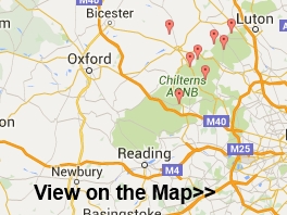
You can also view an overview map of all the routes in the using the South Downs Cycle Map>>
*New* - Walks and Cycle Routes Near Me Map - Waymarked Routes and Mountain Bike Trails>>
| Route Name | Photo | Distance | Description |
| Bignor Hill | 7 miles (11.2 km) | This walk or cycle climbs to Bignor Hill from the village of Amberley in West Sussex. It's a moderate climb of about 3.5 miles, following the South Downs Way for the duration of the route. It's a good path which is also suitable for cycling. If you prefer a shorter walk then you could park at the car park just half a mile west of the hill, and start your climb from there. This route starts off from Amberley train station, following a section of the River Arun out of the village. The waymarked path then heads west, past Coombe Wood before skirting the northern edge of Houghton Forest. You then climb past Bury Hill and Westburton Hill before arriving at the Bignor Hill summit. At over 700ft the hill commands wonderful views over the South Downs to the coast. To extend the walk you could follow the Monarch's Way south west along the Stane Street Roman Road to visit Eartham Woods. To turn it into a circular route you could head south east into Houghton Forest and return on the woodland trails to the village. You could also explore the countryside around the village on our Amberley Circular Walk. View Full Details>> | |
| Black Down | 3.7 miles (6 km) | Climb to the highest point in the South Downs on this challenging route in Sussex. The area is run by the National Trust and includes a series of well defined paths taking you to flower-rich meadows, ancient woodland and copses. There are fabulous views over the Weald from the Temple of the Winds, at the southern end of Black down. The English Channel can also be seen through the River Arun gap on a clear day. The circular route below starts at the car park near the Temple of the Winds and takes you north across Black Down to Boarden Door Bottom. Cyclists can also enjoy a number of easy bridleways or more challenging mountain bike trails which run across the area. The Sussex Border Path walking trail runs through Black Down so you could pick up this trail and head west to the nearby Marley Common to continue your walk. Black Down is located just a few miles south of Haslemere town centre. You can reach it from the train station on our Haslemere Circular Walk which also visits Marley Common. View Full Details>> | |
| Crawley to Brighton | 24.9 miles (40 km) | Follow National Cycle Route 20 from Crawley to the seaside resort of Brighton. You start at the train station in Crawley and head through Tilgate Forest passing through the golf course. The route continues to Handcross where you can see the pretty Nymans Gardens before passing the villages of Staplefield, Bolney and Hickstead. A long traffic free section then follows taking you to the outskirts of Brighton with views of the South Downs as you go. The final stretch takes you through Brighton passing the attractive pavillion gardens before finishing near the prom. View Full Details>> | |
| Ditchling Beacon | 5 miles (8 km) | Climb to the highest point in East Sussex and enjoy wonderful views of the Weald and the Downs on this circular walk. The lovely chalk grassland of the area is covered with a variety of flowers and plants during the summer months. Look out for marjoram, thyme and different types of orchid with butterflies such as the Chalkhill Blue flying around them. The walk begins in the village of Ditchling just to the north of Ditchling Beacon and follows the Sussex Border Path to Burnhouse Bostall. You then pick up the South Downs Way and head to the beacon passing the Ditchling Beacon Nature Reserve on the way. You then descend to Ditchling following bridleways past Wick Farm and Stoneywish Country Park. If you'd like to continue your walking in the area then you could head west along the The South Downs Way to the beautiful Devils Dyke. The video below shows the area well from about 7:00 minutes on. View Full Details>> | |
| Downs Link | 36 miles (58 km) | This is a terrific walking or cycling path running from St Martha's Hill in Guildford to Shoreham by Sea. View Full Details>> | |
| Friston Forest | 5 miles (8 km) | Enjoy miles of cycling and walking trails in this large forest on the South Downs near Eastbourne. There are trails for mountain bikers ranging from gentle off road trails to an exhilarating single track ride. There are two fairly easy waymarked trails for walkers. Look out for wildlife including rare butterflies and deer. This circular route starts at the car park and takes you along some of the bridleways in the forest. It also visits the pretty village of West Dean. It's easy to extend your outing by visiting the nearby Cuckmere River and Cuckmere Haven and Seven Sisters Country Park. You could also pick up the The South Downs Way which runs past the forest. Our South Downs Circular Walk also passes through the forest. It will take you on a tour of the surrounding area, visiting Seven Sisters Country Park and Birling Gap. View Full Details>> | |
| Harting Down | 3.4 miles (5.5 km) | This large area of chalk downland on the South Downs is managed by the National Trust. View Full Details>> | |
| Houghton Forest | 3.7 miles (6 km) | These woods near Arundel have good mountain bike trails and some nice footpaths to try. You can park at the Whiteways Countryside car park, just off the A29 at the south eastern end of the forest. From here you can pick up the trails heading north west through the woods. You could also follow either the Monarch's Way or South Downs Way from the village of Houghton. You can also extend your walking in the area by continuing along either of these long distance trails or the Midhurst Way which also passes through the forest. View Full Details>> | |
| Meon Valley Trail | 9.3 miles (15 km) | This peaceful cycling and walking trail runs along a disused railway track from West Meon to Wickham via Droxford. There are splendid views of the beautiful Meon Valley and the River Meon to enjoy as well as a variety of wildlife including butterflies, redwing and egrets. The route is reasonably flat, running along a surfaced path for just under 10 miles. View Full Details>> | |
| Petersfield to Brighton | 43.5 miles (70 km) | Starting in the market town of Petersfield follow the South Downs Way to Brighton on the south coast. View Full Details>> | |
| Queen Elizabeth Country Park | 5.3 miles (8.5 km) | Explore 2000 acres of open access woodland and downland in the South Downs on this circular walk or cycle in Hampshire. Queen Elizabeth Country Park is Hampshire's biggest country park with 20 miles of trails for walkers, cyclists & horse riders. Highlights in the park include Butser Hill - the highest point on the South Downs with views to the Isle of Wight. There is also a Visitors Centre where you can sign up for a guided walk. The park is very popular with mountain bikers with several off road trails running through the park. See the video below for example of what you can expect. View Full Details>> | |
| Seven Sisters Country Park | 3.4 miles (5.5 km) | Explore nearly 700 acres of parkland and coast on this delightful circular walk through the South Downs. The Country Park is named after the famous Seven Sisters chalk cliffs on the Sussex Heritage Coast. On the route you will enjoy fabulous views of the Cuckmere river before heading towards the beautiful coastline. The walk starts from the country park visitor centre next to Exceat Bridge at a postcode of BN25 4AB for your sat navs. From here you can pick up the South Downs Way National Trail and follow the waymarked path south along the Cuckmere River to the Seven Sisters cliffs. The path then heads east along the wonderful coast path to a significant landmark at Birling Gap. This special area is run by the National Trust and includes the famous Belle Tout lighthouse. There's also fabulous views along to the nearby Beachy Head and 500 acres of open chalk grassland with a wide variety of butterflies and wildflowers to look out for. The route then leaves the coast and heads north towards Friston Forest where you can enjoy some nice woodland trails and look out for rare butterflies and deer. These trails will lead you west back to the visitor centre where the route finishes. There are a number of other footpaths and trails in the Park - further information and trail maps can be found in the Visitor Centre. Cycling is permitted on the valley floor and there is a concrete track which offers access to the beach. Mountain biking is also popular in Friston Forest so much of this area is great for cyclists as well as walkers. View Full Details>> | |
| Winchester to Petersfield | 26.1 miles (42 km) | Travel through Hampshire along the beautiful South Downs Way from Winchester to the pretty market town of Petersfield. View Full Details>> |


Your Submitted Routes
| Route Name | Distance | Difficulty |
| Albourne to Brighton | 15 miles (24 km) | *** |