Chilterns Walks
Use the links to view full route information including elevation profiles, interactive maps and GPS downloads.
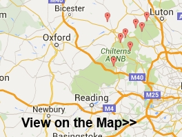
You can also view an overview map of all the routes in the using the Chilterns Walk Map>>
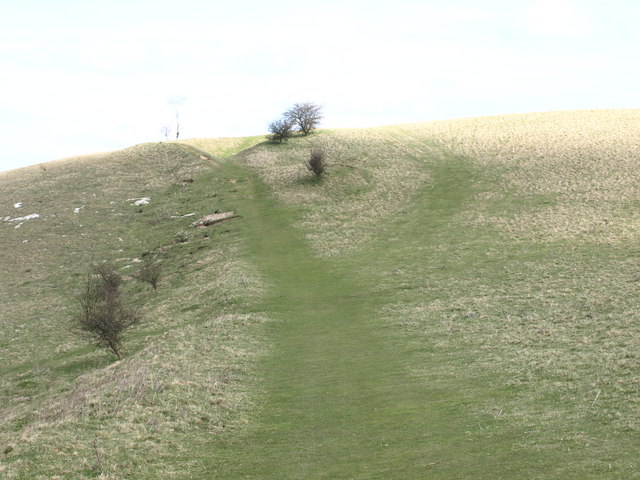
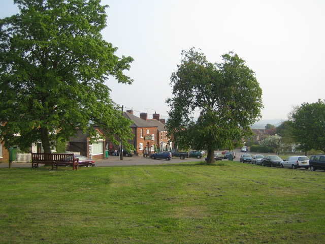
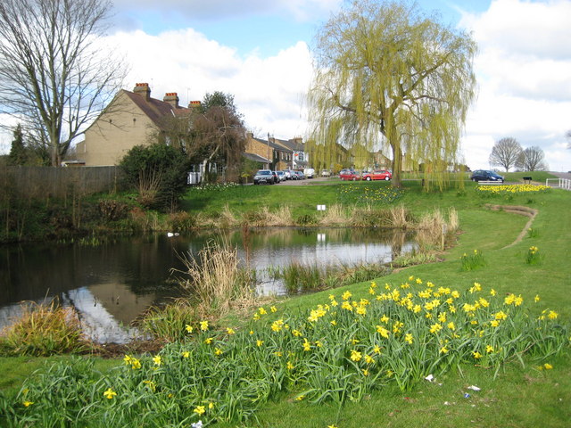
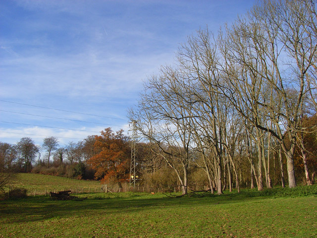
| Route Name | Photo | Distance | Description |
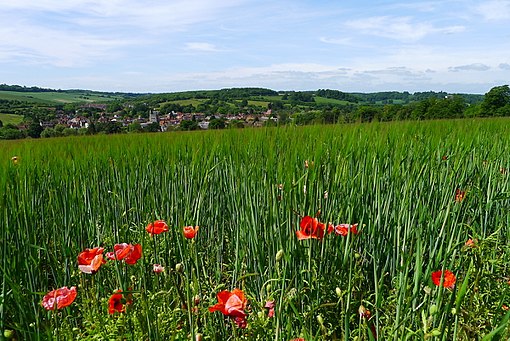
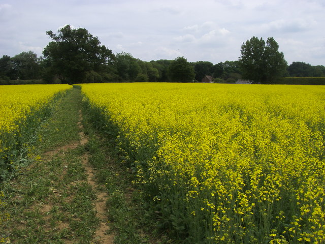
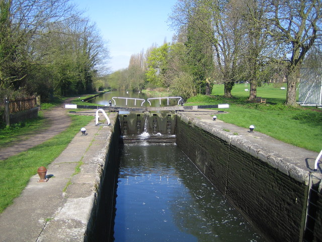
| Amersham Circular Walk | 9 miles (14 km) | This circular walk around the market town of Amersham visits the nearby village of Chalfont St Giles while exploring the attractive countryside of the Misbourne valley. There's riverside paths, woodland trails and a series of moderate hill climbs with splendid views of the Chilterns countryside. The walk starts near the train station and passes through Parsonage Wood before heading east towards Little Chalfont. You then skirt the edge of Pollards Wood and continue into Chalfont St Giles. It's a pretty village with a duck pond fed by the River Misbourne. Other highlights include the church of Saint Giles which is of Norman architecture and dates from the 12th century. You can also visit the former home of John Milton, author of the epic poem 'Paradise Lost'. The house is now a open to the public as a museum and includes an extensive collection of 17th-century first editions of John Milton's works, both poetry and prose. The village is roughly the half way point on the walk so a great place to stop for refreshments on one of the nice pubs or cafes. After exploring the village the route then follows footpaths through the attractive farmland to the south of the river. You'll pass close to the pretty Hodgemoor Woods which is worth a short detour if you have time. The 250 acre bluebell wood has miles of good footpaths and mountain bike trails. The woods also have a healthy population of muntjac deer to look out for. The South Bucks Way long distance trail runs through the area. You can use the waymarked path to go directly to Chalfont St Giles if you prefer a shorter walk. The path continues south through Chalfont St Peter before coming to the splendid Colne Valley. Just to the north of the town you can pick up the Chess Valley Walk and enjoy a riverside stroll along the River Chess. View Full Details>> | |
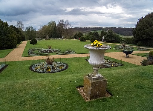
| Ashridge Boundary Trail | 16 miles (26 km) | This walk takes you on a tour of the National Trust owned Ashridge Estate in the Chiltern Hills. The estate consists of 5,000 acres of woodlands, commons and chalk downland which supports a rich variety of wildlife. The walk starts at the Ashridge Estate Visitor Centre next to the Bridgewater Monument, erected in 1832 to the Duke of Bridgewater. You can climb the monument for fabulous panoramic views of the estate before starting the circular tour of the beautiful grounds. Highlights on the walk include the Golden Valley to the north-east of Little Gaddesden and Ashridge House which was created by famous landscape gardener Capability Brown in the 18th century. You will also visit Ivinghoe Beacon, with its splendid views of the Vale of Aylesbury, Berkhamsted Common and Dunstable Downs. Another highlight of the walk is the popular Dockey Wood. View Full Details>> | |
| Ashridge to Ivinghoe Beacon Circular Walk | 6 miles (10 km) | This circular walk climbs to the splendid viepoint at Ivinghoe Beacon from the Ashridge Estate. The route runs for just under 7 miles with some moderate climbs along the way. The route starts from the National Trust's visitor centre and car park in the estate. From here you can pick up the Monarch's Way and follow it north past Moneybury Hill, Hanging Islay, Duncombe Terrace and Crawley Wood. View Full Details>> | |
| Aston Rowant Nature Reserve | 5 miles (8.5 km) | Enjoy a circular walk around this wonderful nature reserve in the Chilterns and climb Beacon Hill on the way. The reserve is a splendid place for walking with miles of good paths taking you through woodland, chalk grassland and some lovely Chilterns countryside. It's a wonderful place for flora and fauna with flowers such as orchids, the Chiltern gentian and various wildflowers. The attractive mixed woodland includes beech, yew, and juniper. As for wildlife look out for Red Kites soaring above and butterflies such as the silver-spotted skipper and the Adonis blue. You may also see Dartmoor Ponies, Roe deer, feral goats and buzzards. This walk starts in the good sized Cowleaze Wood car park and takes you through pretty bluebell woods before reaching Beacon Hill where you can enjoy wonderful views of the reserve and Chiltern Hills. The route then descends on the Ridgeway, before passing Bald Hill and returning to the car park. If you'd like to continue your walking in this lovely area then you could head to the nearby Christmas Common and Watlington Hill where there is more beautiful flora and fauna. View Full Details>> | |
| Aylesbury Ring | 31 miles (50 km) | This long circular walk takes you on a tour of the beautiful Aylesbury Vale in Buckinghamshire. It runs for just over 30 miles and includes several pretty villages, canal side walking and a visit to the National Trust's Waddesdon Manor. The path starts and ends in Wendover first heading towards Great Kimble and then onto Dinton where you will find the impressive Dinton Hall. The route continues to Eythrope, crossing the River Thame and passing Eythrope Park and Eythrope Manor House. You continue through the countryside past Waddesdon, Hardwick, Long Marston and the Aylesbury Canal before joining the Wendover Canal Arm near Aston Clinton for the final waterside stretch back to Wendover. View Full Details>> | |
| Barton Hills | 2 miles (3 km) | Visit the Barton Hills National Nature Reserve and enjoy peaceful walking trails in the Chilterns. A series of footpaths take you to the attractive downland, chalk grassland, natural springs and beech woodland. It's delightful in the summer months with a variety of wildflowers attracting butterflies such as marbled white and dark green fritillary. Look out for vegetation including wild thyme, horseshoe vetch, marjoram and orchids as you make your way along the paths. It's a great area for wildlife too with lots of different birds and mammals such as ponies, stoats, weasels and hares. You can start your walk from the little town of Barton-le-Clay which lies just to the north of the reserve. Follow the John Bunyan Trail through the town and south to the reserve. To extend your walking in the area you can follow the John Bunyan Trail and the Icknield Way Path through the surrounding Bedfordshire countryside. The trails can take you east towards Hexton, Pegsdon and Pirton or south towards Luton. The video below shows an exploration of the Barton and Pegsdon Hills from Hexton. From there you can enjoy a climb with wonderful views over the surrounding area. Also nearby is the village of Streatley and Sundon Hills Country Park near Toddington. This includes the climb to Sharpenhoe Clappers where there is an Iron Age Hillfort and more great views to enjoy. View Full Details>> | |
| Beaconsfield | 11 miles (18 km) | This circular walk from Beaconsfield explores some lovely Chilterns countryside. You'll also visit the lovely Hodgemoor Woods and the interesting village of Chalfont St Giles. The 11 mile route uses a mixture of public footpaths, country lanes and a section of the South Bucks Way. The walk starts from the train station and heads north through the town to Brown's Wood near Knotty Green You then turn east to Owlsears Wood before coming to Hodgemoor. The 250 acre woods include lots of pretty bluebells in the spring and a healthy population of Muntjac Deer to look out for. Also keep your eyes peeled for tawny owls, buzzards, kites and numerous other woodland birds. After leaving the woods you come to Chalfont St Giles. The attractive village includes nice cottages with a duck pond fed by the River Misbourne. Other highlights include the church of Saint Giles which is of Norman architecture and dates from the 12th century. You can also visit the former home of John Milton, author of the epic poem 'Paradise Lost'. The house is now a open to the public as a museum and includes an extensive collection of 17th-century first editions of John Milton's works, both poetry and prose. There's a good selection of pubs and cafes so it makes an ideal stopping point for refreshments, at what is about the half way point of the walk. From the village you pick up the waymarked South Bucks Way long distance footpath. Follow it south and it takes you past Dibden Hill toward Chalfont St Peter. View Full Details>> | |
| Beeches Way | 16 miles (25 km) | Follow the Beeches Way through the Chilterns from the River Thames at Cookham to the Grand Union Canal at West Drayton. You start off at Cookham and head east to the wooded Burnham Beeches Nature Reserve. The reserve covers over 500 acres with a network of great woodland trails. There's also ponds, grassland, heathland with wildlife which includes Exmoor Ponies. The walk then passes through Fulmer before a lovely stretch through Black Park Country Park and Langley Park Country Park. The final stretch takes you around the lakes in Colne Valley Regional Park before finishing on the Grand Union Canal at West Drayton. View Full Details>> | |
| Benson | 6 miles (9 km) | This pretty South Oxfordshire village is in a great spot for riverside walks and exploring the Chilterns Hills AONB. There's also a noteworthy Norman church and an 18th century pub for refreshments after your exercise. View Full Details>> | |
| Binfield Heath and Crowsley Park | 4 miles (6 km) | This circular walk from Binfield Heath visits Crowsley Park, owned by the BBC in South Oxfordshire. Since the Second World War, the park has been the site of a signals-receiving station used by BBC Monitoring. In 2018, the BBC began a further modernisation of the facility, including the installation of 18 new satellite dishes. View Full Details>> | |
| Bledlow Ridge | 6 miles (9 km) | This Buckinghamshire based village has some fine country walks into the surrounding Chiltern Hills. There's also a worthy local nature reserve and a fine village pub to investigate. View Full Details>> | |
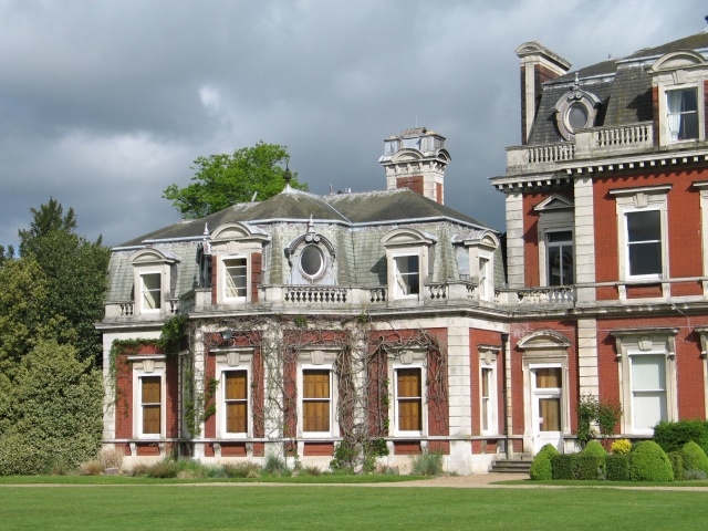
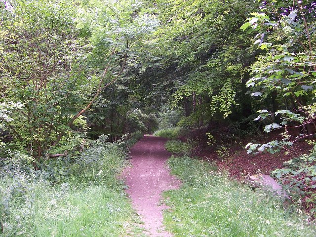
| Bradenham Woods | 2 miles (3.5 km) | This circular walk explores the woodland and countryside surrounding the pretty village of Bradenham in the Chilterns. The area is run by the National Trust so there are good, waymarked footpaths and facilties. The walk starts in the car park in Bradenham. It's a typically lovely English village with pretty cottages, a village green, village pond and a cricket pitch. You will pass Bradenham Manor House and the fascinating St Botolph church which has sections dating from the 14th century. The footpath then gently climbs away from the village with wonderful views over the Chilterns. You then pick up woodland trails through the deciduous woodland of Park Wood. The wood is in an elevated position above the village so there are nice views back towards Bradenham, including the Manor House and the Church. After leaving the wood you descend back towards the village and the finish point at the car park. If you are coming by train then Saunderton train station is only about a mile from the village. If you would like to extend your walking in the area then both Hughenden Park and West Wycombe Park are great options. You could also explore Naphill Common which has many woodland footpaths. Our longer circular walk from High Wycombe visits the common, Hughenden Park and Downley Common. View Full Details>> | |
| Caversham | 14 miles (22 km) | This riverside village in Reading is considered one of the finest places to live in the country. There's lovely river walks and a particularly fine public park to explore on foot. View Full Details>> | |
| Chalfont St Giles | 9 miles (14.5 km) | This pretty Buckinghamshire village sits in a nice rural spot on the edge of the Chilterns AONB. View Full Details>> | |
| Charlbury Circular Walk | 4 miles (6.5 km) | This circular walk uses part of the Oxfordshire Way long distance trail to explore the area around the Oxfordshire town of Charlbury. View Full Details>> | |
| Chesham | 5 miles (8 km) | The town of Chesham is in a great location for exploring the Chiltern Hills AONB and the lovely Chess Valley. Two long distance trails run through the town including the Chess Valley Walk and the Chiltern Link. The latter provides a link to The Ridgeway National Trail where you can further explore the hills surrounding the town. View Full Details>> | |
| Chiltern Link | 8 miles (13 km) | Travel through the beautiful Chiltern Hills on this path which links the Chess Valley Walk and the Ridgeway National Trail. The route runs for 8 miles between Wendover and Chesham passing through some really splendid countryside and the lovely Wendover Woods. View Full Details>> | |
| Chiltern Way | 124 miles (200 km) | This is the original 125 mile circuit of the Chilterns AONB taking you through Hemel Hempstead, Chalfont St Giles, Marlow, Hambleden, Turville, Fingest, Bix Bottom, Ewelme, the Ridgeway, Stokenchurch, Great Hampden, Aldbury, the Dunstable Downs Country Park, Sharpenhoe Clappers and Harpenden. The main attractions on the route are the series of delightful villages with their ancient churches, pretty village greens and fascinating museums. The Chilterns countryside is also beautiful with rivers, canals and the rolling hills to enjoy. View Full Details>> | |
| Chilterns Pub Walk - Aldbury | 7 miles (11 km) | This walk climbs to the wonderful Ivinghoe Beacon from the splendid Greyhound Inn in the Chilterns village of Aldbury. You'll enjoy some of the finest views in the Chilterns with a great reward of a fine meal at the inn at the end of your walk. You start off at the Greyhound Inn in Aldbury. It's a very pretty village with its nice cottages and duck pond. From here you can pick up footpaths heading north through Aldbury Common which sits on the western side of the popular Ashridge Estate. The walk follows a section of the Ashridge Boundary Trail through the common where there are nice peaceful woodland trails and lots of interesting flora and fauna to look out for. At Incombe Hole the route picks up the Icknield Way Path to take you up to Ivinghoe Beacon. The iconic hill stands at 233 m (757 ft) and commands fine views over the Chiltern Hills and the Vale of Aylesbury. The route then heads east to visit Gallows Hill before descending back to the Ashridge Estate. View Full Details>> | |
| Chinnor | 5 miles (8.6 km) | This village in South Oxfordshire is in a fine location for walkers with hill climbs and large areas of woodland right next to the settlement. The local Chinnor Quarries are also a popular place for walkers with significant geological interest to be found here. The site is private but there is a public footpath running past the quarries. View Full Details>> | |
| Chitty Chitty Bang Bang Windmill | 2 miles (2.8 km) | This short circular walk visits Cobstone Windmill in Turville, Buckinghamshire. View Full Details>> | |
| Chorleywood | 5 miles (8.7 km) | This village in the Three Rivers District of Hertfordshire has some nice walks to try. This circular walk takes you to some of the highlights of the area including Chorleywood Common, the River Chess and Chenies Manor House. The village is easily accessible from London on the Metropolitan line of the London Underground. The walk starts from the Chorleywood underground station which is a short stroll from the common. You can pick up the Chess Valley Walk just north of the station and follow it east to the open space which consists of 200 acres of common land and woodland. After heading through the common you pass Chorleywood House. The 200-year-old manor house is surrounded by an estate with nice countryside and woodland. On certain open days you can enjoy walks in the grounds of the house. Soon after passing the old house you will come to the River Chess. Follow the trail north to Sarratt Bottom where the river bends to the east to take you through the Frogmore Meadows Nature Reserve. This lowland meadow is rich in wildflowers with different types of butterfly to look out for. At Chenies Bottom you cross the river and head south towards Chenies Manor House. The Tudor House is a Grade I listed building and is surrounded by award-winning gardens. Original 13th Century features including a Medieval well, a dungeon and a reputed priest hole. You can tour the house and garden for a fee, from April to October. After exploring the house the route then heads south on a bridleway through Carpenter's Wood before returning to the centre of Chorleywood. View Full Details>> | |
| Christmas Common and Watlington Hill | 4 miles (6 km) | This circular walk takes you around the lovely area of Christmas Common in the Chilterns. The walk starts from the decent sized car park on Hill Road and takes you to Watlington Hill. Here you will find nice woodland paths and an abundance of wildlife. Red Kites are often seen gliding above while the hill is one of the last sanctuaries of the extremely rare silver spotted skipper butterfly. Also look out for rabbits on the attractive chalk grassland and redwings and fieldfares above. The hill commands great views of the Chilterns and the Oxfordshire Plain. This walk makes use of the Swan's Way and the Oxfordshire Way to take you through some of the countryside and woodland surrounding Watlington Hill and the little village of Christmas Common. There is a nice pub in the village where you can enjoy refreshments at the end of the walk. View Full Details>> | |
| Coombe Hill | 5 miles (8 km) | Climb to the 260 m (850 ft) summit of this lovely hill in the Chilterns. Coombe Hill is the highest viewpoint in the Chiltern Hills and commands wonderful views over Aylesbury Vale and the Cotswolds. This circular walk starts in Wendover, near the train station, and follows the Ridgeway long distance trail to the summit. It's a nice, grassy footpath taking you over the delightful Bacombe Hill. There's a series of nice woodland paths and the area is also a nature reserve so look out for pretty wildflowers and over 20 species of butterfly. The summit is a special place with the iconic Coombe Hill Monument. It was erected in 1904 in memory of 148 men from Buckinghamshire who died during the Second Boer War. As well as the great views over the Chilterns AONB you can also see Chequers, the country home of the Prime Minister from the summit. From the summit you descend on more nice woodland paths to Dunsmore and then back into Wendover. You could also visit the hill from the south by climbing from nearby Princes Risborough along the Ridgeway. Our walk starts from the town's train station and visits the attractive nature reserves at Pulpit Hill and Whiteleaf Hill on the way. To extend your walking in the area you can pick up the Wendover Canal Arm of the Grand Union Canal. It starts in the town and heads to the nearby Weston Turville Reservoir, Tring Reservoirs and Bulbourne. Also of interest is Wendover Woods where there's miles of good walking and cycling trails to be found. In the woods you can also enjoy a climb to the summit of Haddington Hill, the highest point in the Chilterns. View Full Details>> | |
| Dockey Wood | 2 miles (3 km) | This delightful little bluebell wood is part of the wider Ashridge Estate in the Chilterns. The wood is very popular in the spring months as it is covered in carpets of bluebells. Please stick to the paths marked by the National Trust when you visit the site. You can park at the car park on Beacon Road which gives access to the wood. Then extend your walk by following the public footpaths running to Ward's Hurst Farm, the Ringshall Coppice and Ivinghoe Common. You can further extend your walk by picking up the long distance Ashridge Boundary Trail and exploring 5,000 acres of woodlands, commons and chalk downland. View Full Details>> | |
| Dunstable Downs Country Park | 4 miles (6.5 km) | Climb Dunstable Downs and enjoy breathtaking views over the Chilterns Area of Outstanding Natural Beauty on this circular walk in Whipsnade. There are miles of footpaths crossing the chalk grasslands of the Downs visiting a number of interesting sites including: The Five Knolls - a Bronze Age cemetery constructed over 4000 years ago. Whipsnade Heath - a mosaic of grassland, scrub and woodland, with a fantastic variety of wildlife. A peak of 797 ft (243 m) - this is the highest point in Bedfordshire and provides fine views over the county Whipsnade Tree Cathedral - an extraordinary 10 acre park in planted in the form of a cathedral. The area also includes the Chilterns Gateway Visitor Centre which has a wealth of information about the area, a cafe and fabulous views in a sheltered environment. Look out for gliders, kite fliers, hang gliders and paragliders on the downs too. You will often see them gliding past the hills on a summer day. If you'd like to continue your walk you could follow the Icknield Way Path which runs through the park. This will take you north east into Dunstable or south west to another major highlight of the area at Ivinghoe Beacon. The iconic hill is located just a few miles to the west of the park and is a great way to extend your walking in the area. It commands fine views over the Chiltern Hills and the Vale of Aylesbury. View Full Details>> | |
| Ewelme | 9 miles (15 km) | This delightful Oxfordshire village sits in a lovely spot in the Chiltern Hills, close to the River Thames. View Full Details>> | |
| Fingest | 9 miles (14.5 km) | This pretty little Buckinghamshire village is located in the Chilterns near Henley on Thames. It's a picture postcard place with a number of medieval and Georgian cottages scattered around a very fine old church. The village's name comes from the Anglo Saxon 'Tinghurst', meaning 'wooded hill where assemblies are made'. View Full Details>> | |
| Gerrards Cross | 1 miles (1.5 km) | This Buckinghamshire based town is in a nice location for exploring the Chiltern Hill AONB. There's also a pleasant local common and riverside trails along the River Misbourne which runs past the eastern side of the settlement. View Full Details>> | |
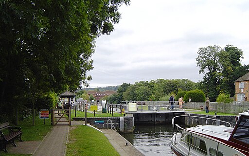
| Goring | 11 miles (18 km) | This riverside village in South Oxfordshire is ideally located for walking with two National Trails passing through the area. Both The Ridgeway and the Thames Path head through the village and are a great way to explore the river and the surrounding countryside. The noteworthy village was named Oxfordshire's Village of the Year in 2009 and also has an interesting church with parts dating from the 13th century. This circular walk uses both waymarked trails to take you along both sides of the River Thames. You'll pass through two counties as in this area the river bisects Oxfordshire and Berkshire. Starting on the eastern side of the river at Goring Bridge, the route first heads north along the Ridgeway to South Stoke and North Stoke. At Mongewell you cross to the other side, although you could continue to nearby Wallingford if you prefer. On the western side of the river you pick up the Thames Path and follow it south. You'll pass the Berkshire settlements of Moulsford and Streatley, before crossing Goring Bridge to return to Goring. At Streatley you will pass the lovely riverside Swan Inn, which is a great place to sit outside and enjoy refreshments in the summer months. To continue your walking in the village you can pick up the The Swan's Way long distance trail. The shared cycling and walking trail starts in Goring and runs all the way to Salcey Forest. View Full Details>> | |
| Great Missenden | 5 miles (8 km) | Enjoy a circular walk around the village of Great Missenden in the Chilterns. The walk visits the pretty abbey gardens before climbing the surrounding hills for great views back down to the village and into the surrounding Chilterns countryside. The walk starts in the village near to the train station and parking area. You then head south along a section of the South Bucks Way long distance trail. This will take you to Missenden Abbey where you can explore the pretty Abbey Park with its lake and views of the River Misbourne. The walk then heads east into the hills surrounding the village. You'll pass Chalkdell Wood Nature Reserve before climbing towards Hyde End where there is some woodland and attractive farmland. The route then turns north through South Heath and Ballinger Common. You descend to Frith Hill before returning to the village. The walk links with the Chiltern Link near Ballinger Common so you could pick up this long distance trail to extend your walk. Heading east will take you through the countryside to Chesham where you can enjoy nice riverside walk along the River Chess. Another good option is to follow the South Bucks Way north and link with the Icknield Way Path. You can then enjoy a climb to Coombe Hill for more great views over the area. Also near Coombe Hill are miles of woodland trails in Wendover Woods and waterside walks along the Grand Union Canal. The Chiltern Heritage Trail also passes through the village. View Full Details>> | |
| Greys Court | 2 miles (4 km) | This walk explores the area around the National Trust's Greys Court in Henley-on-Thames, Oxfordshire. View Full Details>> | |
| Haddington Hill | 3 miles (4.5 km) | Enjoy a climb to the highest point in the county of Buckinghamshire on this circular walk in Wendover Woods. There's a car park located very close to the hill summit from which you can start the walk. Follow the path east and you will soon reach the 267 m (876 ft) summit where you will find a rock marking the high point of the Chilterns. The rest of the route explores some of the footpaths to the south of the hill before returning to the car park. The Icknield Way Path and The Ridgeway long distance trails both pass the hill. To continue your hill climbing in the Chilterns, follow the trails west to Coombe Hill. Here you can enjoy fabulous views over the Aylesbury Vale and the Cotswolds. View Full Details>> | |
| Hambleden | 5 miles (8.2 km) | This pretty Buckinghamshire village is nicely positioned for exploring the Chiltern Hills on foot. It's also a short walk from the River Thames where you can enjoy some nice easy waterside walking. This circular route takes you down to the river before visiting the village of Medmenham. On the way there's nice countryside views, riverside paths and some peaceful woodland sections too. The walk runs for just over 5 miles on fairly flat paths, with a moderate climb toward the end. You start off at the public car park in the village. The village includes pretty cottages and a noteworthy church which dates from the 14th century. It includes a memorial to Cope D'Oyley (who died in 1633) and his family. The post office in the village serves also as the local shop and cafe, which is a good place for refreshments before or after your walk. From the village you can pick up a footpath heading south to Mill End. Here you will find the picturesque Hambleden Mill and Hambleden Lock. The historic watermill was built in the late 18th century, possibly incorporating part of an earlier 17th century mill. It has now been converted into flats. The lock was built by the Thames Navigation Commission in 1773 and includes a very long weir. The great weir is impressive and there are walkways over it from the lock to the small village of Mill End on the Buckinghamshire bank. The route continues past Hambleden Place before picking up a riverside trail to take you east to Medmenham. The pretty village includes some old timber framed brick and flint cottages and some estate workers cottages built at the beginning of the 20th century from local chalk rock. The Dog and Badger Inn dates from late in the 16th century, and is a great place to stop for refreshments. After passing through the village you return to Hambleden on footpaths heading north west through Killdown Bank and Binfield Woods. This final section includes a moderate climb to just over 300ft with some nice views from the high points. View Full Details>> | |
| Hemel Hempstead | 14 miles (23 km) | This circular walk from Hemel Hempstead explores the countryside to the east of the town, skirting the edge of the Chilterns Hills. On the way you'll enjoy waterside paths along the Grand Union Canal to Berkhamsted before exploring the woodland on Berkhamsted Common. The walk makes use of two of the waymarked footpaths which run through the area - the Grand Union Canal Walk and the Chiltern Way. The walk starts on the canal just to the south of the town centre at Two Waters. From here you can follow the towpath west through Boxmoor where there is a lock, weir and views over the River Bulbourne. The route continues to Berkhamsted where you will pass the ruins of the noteworthy Berkhamsted Castle. The Norman motte-and-bailey castle was built to obtain control of a key route between London and the Midlands during the Norman conquest of England in the 11th century. At Dudswell the route leaves the canal to pick up the Icknield Way Path, following it north east to Norcott Hill. Here you follow bridleways onto the expansive Berkhamsted Common. The area is made up of attractive Silver birch woodland and gorsey heath with miles of ancient tracks to follow. After passing through the common the route continues through Potten End before turning south east through the outskirts of Hemel Hempstead to return to the canal. It is then a short walk back to the town centre. View Full Details>> | |
| Henley-on-Thames | 14 miles (22.5 km) | The popular market town of Henley-on-Thames has a number of excellent waymarked trails to try. The riverside town is a very pretty place and home to the famous Henley Regatta. The rowing event takes place every year over the first weekend in July. Look out for the Grade I listed Henley Bridge as you make your way through the town. The five arched bridge across the river thames was built in 1786. The parish church of St Mary the Virgin dates from the 16th-century while the The Old Bell dates from 1325. The town can be accessed by train from Twyford and there are direct trains from London Paddington in peak hours. This long circular walk makes use of the Thames Path, the Chiltern Way and the Oxfordshire Way to take you on a tour of the countryside surrounding the town. These three long distance footpaths all pass close to the town. They are a good way of exploring the area as they are waymarked and of a good quality. The walk starts in the town centre near the river and follows the Thames Path south to Bolney Court. This section passes Park Place, Marsh Lock weir and Ferry Eyot island. Here you turn west along the Chiltern Way and head towards the village of Binfield Heath via Harpsden Wood. You then turn north and head past the woodland of the BBC owned Crowsley Park estate. From the public footpaths there are views of Crowsley Park House, a Grade II listed 18th century mansion house. After leaving Crowsley Park you continue north to the splendidly named Rotherfield Peppard village. Here you will find the lovely Peppard Common which has nice walking trails through woodland, lowland heath and grassland. The walk continues through the fringe of Nettlebed Woods before turning south along a section of the Oxfordshire Way. This takes you past the villages of Bix and Middle Assendon before coming to Henley Park. Shortly after you return to the town and the finish point. View Full Details>> | |
| Henley via Stonor Circular Walk | 12 miles (18.8 km) | A circular walk from Henley visiting Stonor, Middle Assendon and the National Trust's Greys Court. The route runs for just over 12 miles with some fine woodland and country trails. View Full Details>> | |
| High Wycombe | 8 miles (12.5 km) | This large Buckinghamishire town is a great place to go for a country walk with some several attractive woodland areas, views of the Chiltern Hills and the wonderful Hughenden Park to enjoy. With a train station on the Chiltern Main Line, the town is easily accessible from London with services operated by Chiltern Railways from London Marylebone. As such it's a great place to come for a country weekend walk if you coming from the capital. This circular walk visits some of the highlights of the area including Hughenden Park, Naphill Common, Downley Common and Little Tinker's Wood. View Full Details>> | |
| Hitchin | 12 miles (20 km) | The Hertfordshire town of Hitchin makes a great base for exploring the lovely north eastern corner of the Chiltern Hills. This walk visits the nearby Pegsdon Hills using a number of the waymarked long distance trails which pass through the area surrounding the town. The walk starts in the town centre and picks up the Hitchin Outer Orbital Path to take you to Oughtonhead Common. It's a very pretty area with the views of the River Oughton and the Oughtonhead Nature Reserve. You can look out for wildlife including kingfishers, water rails and woodcock in this area. View Full Details>> | |
| Hodgemoor Woods | 2 miles (3 km) | These woods near the town of Amersham have some good footpaths and mountain bike trails to try. You can start off at the car park on Bottrells Lane at the northern edge of the site. From here you can pick up miles of footpaths and bridleways across the 250-acre woods. It's a delightful area with lots of pretty bluebells in the spring and a healthy population of Muntjac Deer to look out for. Also keep your eyes peeled for tawny owls, buzzards, kites and numerous other woodland birds. This basic circular route is designed for walkers but cyclists can also enjoy a series of permissive trails and a bike park with bumps and jumps. See the video below for an idea of what you can expect from the ride. Click here for a map showing the trails and visit the website below to get a permit for cycling in the woods. Our Amersham Circular Walk skirts the northern edge of the woods. You can pick it up to extend your walk and explore the countryside surrounding Amersham and the nearby village of Chalfont St Giles. The long distance South Bucks Way also passes just to the north of the woods. It's a great way to explore the Misbourne valley area of the Chilterns and extend your exercise. View Full Details>> | |
| Hughenden Manor Park | 2 miles (4 km) | The 1,500 acres of parkland surrounding the red brick Victorian mansion of Hughenden Manor is great for a short walk in lovely surroundings. There's woodland trails, pretty formal gardens and riverside paths to enjoy. The area is also surrounded by some beauitful Chilterns countryside. The house and parkland is run by the National Trust so there are four good waymarked paths to try. There also beautiful formal gardens with an Italian influence, a walled garden, a willow maze and orchards. Hughenden Manor was home to Prime Minister, Benjamin Disraeli during the 19th century. You can explore the house with its wonderful collection of personal memorabilia and Victorian playroom. If you enjoy this walk then you could head to the nearby West Wycombe Park to extend your exercise. View Full Details>> | |
| Ivinghoe Beacon | 5 miles (8 km) | Climb to the top of this iconic hill in the Chilterns on this walk in Buckinghamshire. Ivinghoe Beacon stands at 233 m (757 ft) and commands fine views over the Chiltern Hills and the Vale of Aylesbury. The walk starts from the car park next to Pitstone Windmill and makes use of the Icknield Way Path to take you to the summit. The Pitstone Windmill has been restored by the National trust and is well worth a visit before you begin your climb to Beacon Hill. On the way you'll pass through chalk grassland and woodland with a wide variety of wildlife to look out for. View Full Details>> | |
| John Bunyan Trail | 77 miles (124 km) | Follow in the footsteps of John Bunyan, the Puritan Evangelist and author of the book 'Pilgrim's Progress'. The walk visits many historic villages associated with Bunyan. It starts at Streatley and visits Sharpenhoe, Harlington, Westoning, Steppingley, Flitwick, Ampthill, Millbrook, Ridgmont, Cranfield, Bromham, Stevington, Pavenham, Oakley, Clapham, Bedford, Elstow, Shefford, Meppershall, Shillington, Hexton and Barton le Clay before returning to Streatley. There's some beautiful Bedfordshire countryside to enjoy including Sharpenhoe Clappers, the Barton Hills, the Pegsdon Hills and views of the Chiltern Hills for much of the walk. View Full Details>> | |
| Letchworth | 10 miles (16 km) | Letchworth Garden City is located in Hertfordshire near to Hitchin and Stevenage. Walking highlights include the epic Icknield Way Path, the nearby Chiltern Hills, Norton Common and river paths along the River Oughton near the town. View Full Details>> | |
| Little Missenden | 6 miles (9 km) | This delightul Buckinghamshire village has some nice country and river walking trails to try. There's also a picturesque village green and a couple of fine old pubs for refreshments afterwards. The church is also noteworthy, dating back to the 13th century it includes some amazing wall paintings. View Full Details>> | |
| Mapledurham House | 4 miles (7 km) | The Mapledurham estate is a wonderful place for a relaxing afternoon walk. The house is located on the River Thames with the picturesque Old Watermill right beside it. The mill is still operational and dates from the 15th century. The route below is circular, starting at the house and taking you on a tour of the woodland and countryside in the estate. The park is located near Caversham in Oxfordshire. The estate is located on the Thames Path so you could continue your walk along the river. For example if you head east you will soon come to the delightful Caversham Court Gardens. Heading west will take you to the pretty village of Pangbourne where you can visit the delightful water meadows and enjoy a stroll along the River Pang. View Full Details>> | |
| Marlow | 4 miles (7 km) | The riverside town of Marlow is a lovely spot for walking. With the Thames path and some lovely countryside and woodland there's lots of good options for walkers. View Full Details>> | |
| Marlow to Henley | 8 miles (13 km) | A popular riverside walk between these Marlow and Henley-on-Thames. The walk follows a lovely section of the Thames Path National Trail for about 8 miles. There's locks, weirs, interesting villages and great views of the Chilterns countryside to enjoy. At the end of the walk you can return the same way or catch a bus back to Marlow to rest your legs. The walk starts on the Grade I listed Marlow Bridge which was opened in 1832. Follow the towing path west along the northern side of the river, passing the weir at Temple Lock and Temple Mill Island. The island was named after it's three watermills which have now been replaced with a modern housing development and a marina. You continue by crossing the river on the Temple Footbridge which connects the Buckinghamshire and Berkshire banks of the Thames. Shortly after you come to the village of Hurley where you will find the pretty Hurley Lock and Hurley Priory. The former Benedictine priory was founded in 1086 with the surviving priory church now used as the Hurley parish church. Also look out for kayakers around the rushing waters of Hurley. The route continues west, past Medmenham, Black Boy Island and Frog Mill Ait before coming to the hamlet of Aston. Follow the bend of the river round toward Hambleden Mill and Hambleden Lock. The historic watermill sits next to a large weir in a lovely spot on the river. The Grade II listed mill has now been converted into flats overlooking the Thames. You can take a small detour here and cross the walkways over the weir from the lock to the small village of Mill End on the Buckinghamshire bank. After enjoying Hambleden you continue south towards Temple Island. The island is a well known local landmark as it is used as the start of the course for Henley Royal Regatta. It includes an elegant ornamental temple (folly) designed by the 18th century English architect James Wyatt and constructed in 1771. The next section takes you past the village of Remenham where there are fine views across the river to Fawley Court. The Grade I listed country house dates from the late 17th century and is noted for its fine architecture. The final section takes you into Henley-on-Thames finishing on Henley Bridge. The Grade I listed bridge was built in 1786 and includes five elliptical stone arches. View Full Details>> | |
| Marlow to Hurley River Walk | 2 miles (3.6 km) | This easy riverside walk takes you from Marlow to Hurley along the Thames Path. The route runs for a distance of just over 2 miles on a flat waymarked path. As such it's perfect for a pleasant afternoon stroll. The walk starts on Marlow Bridge and heads east past the delightful Higginson Park which is worth a small detour. The riverside park is a popular local attraction with its pretty gardens and maze. The path continues to Temple Lock and Temple Lock Island. It's a noteworthy and scenic spot on the river, having first built by the Thames Navigation Commissioners in 1773. Shortly after passing the lock you come to Hurley Lock, another significant and picturesque lock on the Thames. Here the river splits into a number of channels with several weirs between wooded islands. Just to the south of the lock you can stroll into the small village of Hurley. You'll pass the historic remains of Hurley Priory, a former Benedictine priory which sits on the banks of the river. The long narrow nave of the priory church survives and is used as the Hurley parish church. It has mainly Norman windows and doorways. Also of note here is the Olde Bell Inn which dates from 1135. It is claimed to be the oldest hotel in the UK, and one of the oldest hotels in the world. The hotel is said to contain a secret tunnel leading to the village priory, which was used by John Lovelace, who was involved in the Glorious Revolution to overthrow King James II in the 17th century. The hotel was also used as a meeting point for Winston Churchill and Dwight D. Eisenhower during World War II. It's well worth exploring the whole site as other features include a kitchen garden, wildflower garden and a 16th century Tithe Barn. The inn is located close to Pinewood Studios and over the years, has seen a number of movie-star guests, including Mae West, Greta Garbo, Cary Grant, Errol Flynn, Elizabeth Taylor and Richard Burton. After exploring Hurley you can return to Marlow the same way or turn it into a circular walk by heading north from Temple lock into the countryside. You could then pick up Lower Pound Lane and follow it back to Marlow, via Higginson Park. View Full Details>> | |
| Nettlebed | 10 miles (16 km) | This Oxfordshire village is surrounded by several large areas of woodland and some lovely Chilterns countryside. There's also a nearby nature reserve and a fine National Trust property within walking distance. View Full Details>> | |
| Pegsdon Hills | 2 miles (4 km) | Enjoy a climb to Deacon Hill and enjoy wonderful views over the Chilterns on this walk in the Pegsdon Hills. The hills are also a designated nature reserve so there's lots of intersting flora and fauna to see as well. There's a series of footpaths to follow across the site where you will find chalk hills and wildflower meadows with orchids and moschatels. In the summer months the flowers attract butterflies such as dingy and grizzled skippers. There are fine views of the surrounding Chiltern Hills from the high points which reach nearly 172 metres at Deacon Hill. Start the walk from the car park on the Pirton Road just to the east of the site. From here you can pick up the Icknield Way Path and follow it towards Deacon Hill where there's a trig point and wonderful views to enjoy. The route then follows other footpaths across the hills before picking up the Icknield Way to return you to the car park. On your walk you may see a deer and various birds including skylark, buzzard and fieldfare. View Full Details>> | |
| Pirton | 11 miles (18.2 km) | This Hertfordshire based village is surrounded by some lovely Chilterns countryside which you can explore on two significant long distance trails. View Full Details>> | |
| Pitstone Windmill | 1 miles (1 km) | This walk visits the Grade II listed Pitstone Windmill, near Ivinghoe in Buckinghamshire. View Full Details>> | |
| Princes Risborough | 11 miles (17 km) | This Buckinghamshire based town is in a great location for exploring the beautiful Chiltern Hills AONB. This walk from the town's train station takes you to some of the highlights of the area. You'll climb to Coombe Hill, Pulpit Hill and Whiteleaf Hill with some fabulous views over the surrounding countryside to enjoy on the way. You'll also pass Chequers, the country house retreat of the Prime Minister. The walk starts from the train station where you can pick up The Ridgeway National Trail. The waymarked path will take you up to Whiteleaf Hill, a local nature reserve. The hill has five scheduled ancient monuments, including some dating to the Neolithic and Bronze Ages and the Whiteleaf Cross, a chalk carving thought to date to the eighteenth century. There's also attractive woodland and lots of butterflies to look out for in the summer months. From here it's a short walk to Pulpit Hill which is another notable area in this part of the Chilterns. The area is run by the National Trust and includes more beech woodland, a Bronze age hill fort and lots of interesting flora and fauna. After exploring the site the route continues east passing Chequers. There's been house on the site since the 12th century and once housed a royal prisoner, Lady Mary Grey, the younger sister of Lady Jane Grey and granddaughter of King Henry VII. It also contains one of the country’s largest collections of art and memorabilia about Oliver Cromwell. After passing the house the route bends round to the north to climb Coombe Hill. The popular hill is the highest viewpoint in the Chiltern Hills and commands wonderful views over Aylesbury Vale and the Cotswolds. The summit also includes the iconic Coombe Hill Monument. It was erected in 1904 in memory of 148 men from Buckinghamshire who died during the Second Boer War. There's also more nice views down to Chequers from here. The walk then returns to the train station using the same paths. View Full Details>> | |
| Pulpit Hill and Whiteleaf Hill | 6 miles (9.4 km) | This circular walk from Princes Risborough makes use of a section of a The Ridgeway to visit Pulpit Hill and Whiteleaf Hill. The route runs for a distance of about 6 miles, with some moderate climbs and the reward of splendid views over the surrounding Chilterns countryside. Starting from the Whiteleaf Hill car park you follow the waymarked footpath a short distance to the north to visit Whiteleaf Hill. The hill is also a nature reserve with five scheduled ancient monuments, including some dating to the Neolithic and Bronze Ages and the Whiteleaf Cross, a chalk carving thought to date to the eighteenth century. The area also includes semi-natural beech woodland which dates back to at least 1600. Look out for wildlife including whitethroat birds, and butterflies such as the speckled wood and the peacock. The route continues north to Grangelands and Pulpit Hill, a biological Site of Special Scientific Interest in Cadsden. Pulpit Hill is run by the National Trust and includes grassland and scrub, which support interesting breeding birds and invertebrates, such as glow-worms and marbled whiteand chalk hill blue butterflies. There are also areas of mature beech woodland, with a sparse shrub layer of holly and elder. After exploring the site the walk continues east along the Ridgeway to Buckmoorend. This noteworthy section passes Chequers, the country house retreat of the Prime Minister. At Buckmoorend you pick up the Icknield Way Path. This takes you south through Chisley Wood to Little Hampden Common. Here you turn west to follow a footpath to Dirtywood Farm and Ninn Wood before returning to the car park. View Full Details>> | |
| Quainton Hill | 2 miles (3.4 km) | This circular walk climbs to Quainton Hill from the Buckinghamshire village of Quainton. It's a very pretty village with a well known old windmill, a picturesque village green, a 14th century church, a row of 17th century almshouses and a rather fine 1700s pub to visit after your exercise. The hill lies just to the north of the settlement and makes for a fine walk and viewpoint. View Full Details>> | |
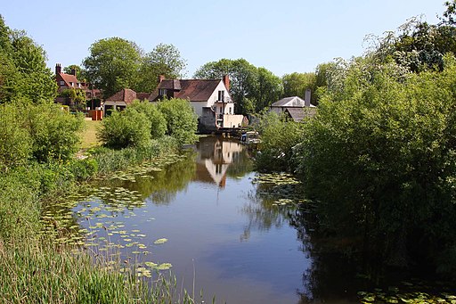
| Sarratt | 5 miles (8 km) | This picture postcard village sits in a delightful spot in the Chess Valley in Hertfordshire. It's a popular place for a walk with a pretty village green, quaint old cottages, a pond and waterside trails along the scenic river at the bottom of the settlement. View Full Details>> | |
| Saunderton | 15 miles (24.5 km) | This Buckinghamshire based village is well served by a series of footpaths running into the glorious rolling Chilterns countryside. View Full Details>> | |
| Shardeloes | 4 miles (6 km) | This circular walk visits the lovely Shardeloes Park and Lake near Amersham in Buckinghamshire. It's a peaceful and scenic place with waterside trails along the lakes and the River Misbourne which runs through the area. It's also great for wildlife with lots of water loving birds to look out for in the park. View Full Details>> | |
| Sharpenhoe Clappers | 3 miles (5 km) | Visit this classic chalk escarpment in the Chilterns and enjoy wonderful views across this beautiful area. This circular walk makes use of the John Bunyan Trail and the Icknield Way Path to take you on a tour of the Sharpenhoe Clappers and the Smithcombe Hills. There's a degree of climbing involved with the route hitting a peak of just over 500ft at the high points. You can park at the Sharpenhoe Clappers car park on Sharpenhoe Road to start your walk. Then head north towards the Iron Age Hill Fort and beech wood which sits atop the area. In the summer months the chalk grasslands are covered in pretty wildflowers which attract a variety of butterflies. Look out for orchids, primroses and an uncommon rose, Rosa stylosa, found in scrub areas. After exploring the hill fort you can head south through the Smithcombe Valley along the Icknield Way Path. You'll pass Smithcombe hill as you make your way to the village of Streatley. From Streatley you pick up the John Bunyan Trail to take you back to the car park. There's lots of good options for extending your walking in the area. Just to the east is the lovely Barton Hills National Nature Reserve where there's lots more interesting flora and fauna to see. Just to the west is Sundon Hills Country Park with lots more walking trails and great views to enjoy. View Full Details>> | |
| Sonning Common | 6 miles (9 km) | This walk takes you around the countryside, parkland and woodland surrounding the village of Sonning Common in Oxfordshire. The village is a popular place for walkers wishing to explore a quiet area of the Chilterns. It is the home of the Sonning Common Health Walks set up in 1996 by Dr William Bird. The walks aim to reduce heart disease, reduce cholesterol and blood pressure, relieve depression and anxiety, reduce stress, tackle obesity, and help with diabetes. The circular route uses a section of the Chiltern Way long distance trail and other public footpaths to explore the area. It runs for just under 6 miles on reasonably flat paths with some small climbs on the way. Walk highlights include some lovely views of the Chiltern Hills, peaceful woodland trails and the interesting BBC owned Crowsley Park. The walk starts just to the south of the village at the Millenium Green and Bird in Hand Pub where you can pick up the Chiltern Way. Follow it north east and it will take you to Crowsley Park. The country estate is owned by the BBC and though it is not open to the public there are public footpaths crossing the park with views towards the 18th century mansion. Among Crowsley Park's former owners were the Baskerville family who provided the inspiration for Conan Doyle's The Hound of the Baskervilles. Since the Second World War, Crowsley Park has been the site of a signals-receiving station used by BBC Monitoring. In 2018, the BBC began a further modernisation of the facility, including the installation of 18 new satellite dishes. The route then turns north along Kings Farm Lane, taking you around a section of Crowsley Park Woods, to the east of Rotherfield Peppard. The route then turns south to follow country lanes back to the Chiltern Way. This will then lead you back to the start point where you can enjoy refreshments at the Bird in Hand pub. View Full Details>> | |
| Stoke Row | 1 miles (1.5 km) | This walk takes you around the pretty Oxfordshire village of Stoke Row. On the walk you will visit the notable features of the settlement including the village green, the Maharajah's Well and the Cherry Orchard. You'll also pass the noteworthy 17th century pub which has a splendid history and has been used as a filming location on many occasions. View Full Details>> | |
| Stokenchurch | 12 miles (19 km) | This Buckinghamshire based village has some lovely trails to follow through the surrounding Chilterns countryside. There's lots of peaceful woodland trails, two wildlife rich nature reserves and hill climbs with fine viewpoints to visit in the immediate area. The village is known for The Stokenchurch BT Tower, which can be seen for miles around. There's also a 13th century church and a noteworthy hotel with a history stretching back hundreds of years. View Full Details>> | |
| The Ridgeway | 86 miles (139 km) | Step back in time on this wonderful 85 mile route which follows an ancient chalk ridge route used by prehistoric man. The trail starts at Overton Hill in Wiltshire on the edge of the Marlborough Downs and heads east through the Chiltern Hills to Ivinghoe Beacon in Buckinghamshire. Highlights on this fascinating route include a series of iron age forts, the famous Uffington White Horse, the beautiful Chiltern Hills and a lovely stretch along the River Thames at Goring-on-Thames. View Full Details>> | |
| The Swan's Way | 65 miles (105 km) | The Swan's Way long distance bridleroute runs from Salcey Forest in the north to Goring on Thames in the south, a distance of 65 miles (105km). From the Northants border, the route crosses the Vale of Aylesbury to meet the Ridgeway near Princes Risborough and then follows the chalk slopes of the Chilterns to the Thames at Goring. View Full Details>> | |
| Tring Circular Walk | 7 miles (11.8 km) | This circular walk explores some of the highlights surrounding the Hertfordshire town of Tring. The 7.5 mile route visits Tring Park the Tring Reservoirs and the Grand Union Canal with fine scenery throughout. The walk starts in the town centre and follows a footpath south into Tring Park. In the park you will find expansive areas of grassland and pretty bluebell woods ideal for a peaceful afternoon stroll. There's lots of wildflowers and butterflies in the summer months with great views from the park's high points. In the park you pick up The Ridgeway and follow it east past Langton Wood and Wiggington to the canal. View Full Details>> | |
| Tring Park | 3 miles (5.5 km) | This splendid park in the Chilterns AONB has lots of good walking trails to try. In the park you will find expansive areas of grassland and pretty bluebell woods ideal for a peaceful afternoon stroll. There's lots of wildflowers and butterflies in the summer months with great views from the park's high points. It's a great area for wildlife watching with orange tip, marbled white and common blue butterflies to look out for. Also keep your eyes peeled for kestrel, red kite, woodpeckers, nuthatch, chifffchaff, willow warbler and blackcap. The park is located just to the south of the Tring town centre. You can park at the Natural History Museum car park and then pick up the trails into the park. Tring park is in a great location for extending your walking in the area. The Icknield Way Path and the Ridgeway long distance trails both pass through the southern section of the park. If you head west you can enjoy woodland cycling and walking trails in the expansive Wendover Woods. It's only about 2 miles west of the park and includes waymarked walks, sculptures and more great views of the Chilterns countryside. Just to the east of the park is the Grand Union Canal which you can follow north to Marsworth and the lovely Tring Reservoirs. View Full Details>> | |
| Turville | 13 miles (21 km) | This circular walk explores the countryside surrounding the Chilterns village of Turville. The walk makes use of the Shakespeare's Way and Chiltern Way waymarked trails to create the loop. It's a 13 mile route but can be cut down to about 8 miles without the excursion to Stonor Park and the Warburg Nature Reserve. There are some moderate climbs along the way, with the route reaching a high point of just over 600ft. The walk starts in the village where you can pick up the Chiltern Way and follow it east past Turville Windmill and Turville Hill, where there are nice views back down to the village. You continue through Fingest Wood to Skirmett, Pheasant's Hill and the village of Hambledon. The village includes a noteworthy church which dates from the 14th century and includes a conspicuous memorial to Cope D'Oyley (who died in 1633) and his family. The post office in the village serves also as the local shop and cafe, so it's a good point in the walk to stop for refreshments. At Hambledon you pick up the Shakespeare's Way and follow it north west through woodland and countryside to Southend. You then head west to Stonor Park which has a public footpath running through Balham Wood and to the south of the house. The fine country house was probably begun after 1280 when Sir Richard Stoner (1250–1314) married his second wife, Margaret Harnhull. The house has a 12th-century private chapel and the remains of a prehistoric stone circle are also in the grounds. It is open to the public on certain days and includes The Chilterns Pit Stop Cafe and a Visitor Centre. After passing the park you continue west to visit Warburg Nature Reserve. The reserve is a lovely place for a stroll with lots of bluebells and wood anemones in the spring. In the summer months the site is rich with orchids including fly orchid and bird's-nest orchid. After exploring the reserve the route heads east to return to Turville, via Stonor Park and Southend. View Full Details>> | |
| Wallingford Circular Walk | 14 miles (23 km) | This circular walk explores the countryside surrounding the riverside Oxfordshire town of Wallingford. The route makes use of three of the long distance trails which pass through the area. You'll follow sections of the Thames Path the The Ridgeway and The Swan's Way as you make your way through the beautiful Chiltern's countryside which surrounds the town. The route reaches high points of nearly 700ft so there are some moderate climbs with wonderful views to enjoy. View Full Details>> | |
| Warburg Nature Reserve | 2 miles (2.5 km) | This delightful nature reserve near Henley-on-Thames has some lovely woodland trails to try. It's a splendid place for flora and fauna with lots of bluebells and wood anemones in the spring. In the summer months the site is rich with orchids including fly orchid and bird's-nest orchid. Look out for wildlife including rare butterflies and a variety of woodland birds. All in all over 2,000 species of plants, fungi and animals have been recorded here. The reserve has good facilities with a visitors centre, a picnic area and two bird hides. There's also a car park where you can start your walk. You could also start off from the nearby village of Nettlebed and follow paths past Nettlebed Common to the site. The Chiltern Way and the Oxfordshire Way both pass the reserve. You can easily pick up either of these long distance trails to extend your walk. Heading south will take you to Nettlebed Woods where there are more nice bluebell trails. If you follow the Oxfordshire way south east it will take you to Henley-on-Thames where you can enjoy a nice riverside walk. Our Turville Circular Walk also visits the reserve from the nearby village. It passes the famous Chitty Chitty Bang Bang Windmill and then takes you to the attractive 13th century Stonor Estate just to the east of the reserve. View Full Details>> | |
| Wendover Circular Walk | 7 miles (11.6 km) | This circular walk explores the area surrounding the Buckinghamshire town of Wendover. The loop runs for just over 7 miles following the Wendover Canal Arm of the Grand Union Canal before exploring Wendover Woods. The route starts on the canal and follows the towpath north to Halton. Near Aston Clinton you leave the canal and head south into Wendover Woods. The expansive woods are a popular place for walkers with several waymarked trails including a lovely easy access trail for all abilities. On the way you can see sculptures, deciduous trees, evergreen trees and many woodland flowers. There are also splendid views of the surrounding Chilterns countryside. At the southern end of the woods you pick up the Icknield Way Path. You follow the waymarked path west along Hale Lane to return to the town. View Full Details>> | |
| Wendover Woods | 4 miles (7 km) | Enjoy miles of great cycling and walking trails in this large forest in Buckinghamshire. The cycle trail is a moderate 5 mile route on waymarked surfaced tracks. It has some steep sections but is generally suitable for all abilities/families. For walkers there are several waymarked trails including a lovely easy access trail for all abilities. On the way you can see sculptures, deciduous trees, evergreen trees and many woodland flowers. There are also splendid views of the surrounding Chilterns countryside. Other attractions in the woods include a splendid cafe and a Go Ape forest adventure with Zip Wires, Tarzan Swings and a variety of Crossings. For children there is a fun Superworm trail from the creators of the Gruffalo. The woods also include the highest point in the Chilterns at Haddington Hill. If you'd like to continue your outing then several long distance trails run past the forest. You could pick up the Icknield Way Path, the Chiltern Link or The Ridgeway or head to the nearby Grand Union Canal and pick up the Wendover Canal Arm to visit Weston Turville Reservoir . The woods are located near Aylesbury and Tring. Heading north east along the Ridgeway will take you into Tring via the lovely Tring Park. View Full Details>> | |
| West Wycombe Park | 5 miles (8 km) | Explore the beautiful estate surrounding West Wycombe House on this walk in the Chilterns AONB. The Palladian house has 45 acres of landscaped gardens with a lovely large lake, views of the River Wyre, woodland paths and sweeping lawns to enjoy. Look out for attractive temples and follies such as the Temple of the Four Winds. After strolling round the grounds you can climb to West Wycombe Hill for wonderful views over the Chilterns countryside. At the top of the hill you will find the 18th century Mausoleum. It is also a great spot to look out for the Red Kite. After descending the hill you can then continue your walk through miles of surrounding woodland and head towards nearby Bradenham. The village of West Wycombe also has many interesting features such as the Grade I listed church and the popular Hellfire Caves. This extraordinary network of man-made chalk and flint caverns is well worth a visit. If you'd like to extend your walk then you can head to the nearby Hughenden Park with its gardens, parkland, woodland and and riverside paths. Our longer circular walk from nearby High Wycombe takes in Hughenden, Naphill Common and Downley Common. View Full Details>> | |
| Weston Turville Reservoir | 1 miles (1.7 km) | This walk visits the Weston Turville Reservoir just south of the Buckinghamshire village of the same name. View Full Details>> | |
| Wychwood Forest | 4 miles (6 km) | Explore this large area of forest near Charlbury on this woodland walk. View Full Details>> |