Lake District Cycle Routes
Use the links to view full route information including elevation profiles, interactive maps and GPS downloads.
You can also view an overview map of all the routes in the using the Lake District Cycle Map>>
*New* - Walks and Cycle Routes Near Me Map - Waymarked Routes and Mountain Bike Trails>>
| Route Name | Photo | Distance | Description |
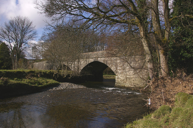
| Carlisle to Cockermouth | 34.2 miles (55 km) | This challenging route follows National Cycle Route 7 from Carlisle to Cockermouth. The route starts just outside the city of Carlisle on the River Caldew and then follows the river along the largely off road Cumbria Way before a section on quiet country lanes leads you into Cockermouth on the edge of the Lake District. Highlights on the route include the lovely Over Water, views of the River Derwent and the backdrop of the beautiful Lake District Fells. View Full Details>> | |
| Coast to Coast Whitehaven to Tynemouth | 136.7 miles (220 km) | This is the complete C2C National Cycle route crossing the country from east to west along a number of cycle tracks/paths and minor roads. You will see some spectacular scenery as you pass through the Cumbrian Lake District and Northumberland before the last leg through County Durham and the finish point at Tynemouth Pier on the east coast of England. See the Whitehaven to Sunderland page for the other C2C section. View Full Details>> | |
| Cockermouth to Workington | 12.4 miles (20 km) | Starting in Cockermouth head west to the coast along National Cycle Route 71. View Full Details>> | |
| Coniston Water | 3.7 miles (6 km) | This short, easy cycling and walking trail runs along the western shoreline of the beautiful Coniston Water in the Lake District National Park. The route starts at the car park at Lake Road and runs through Coniston Hall Park to Hoathwaite Farm. It's perfect for beginners and families looking for a safe, waterside ride. Bikes can be hired from the Coniston Boating Centre. If you'd like to continue your outing you could head to the nearby Grizedale Forest where you will find miles of way-marked cycling and walking trails. You could also follow the Cumbria Way a couple of miles to the north east where you will find the beautiful Tarn Hows and the pretty Monk Coniston estate. For a longer walk try our 16 mile Circular Walk around Coniston which visits the tarns, fells and forest on both sides of the lake. View Full Details>> | |
| Ennerdale Forest | 12.4 miles (20 km) | Enjoy miles of traffic free cycling and walking trails in this super forest in the Lake District National Park. The route starts at the Bowness Knott car park next to the beautiful Ennerdale Water. You then head east into the forest along the lakeside path. After leaving the lake behind the track follows the River Liza into the forest to Ash Crag before returning along the south side of the river. The forest tracks are quite uneven in places so a mountain bike is required for cyclists. The views of Ennerdale valley are fabulous with some of the highest and best-known fells in Cumbria forming a spectacular backdrop - Great Gable, Green Gable, Brandreth, High Crag, Steeple and Pillar are all visible on the route. Just to the south of the forest is Pillar, the eighth highest mountain in the eighth highest mountain in the Lake District. View Full Details>> | |
| Fred Whitton Challenge | 108.7 miles (175 km) | Follow the route of the Fred Whitton Challenge cycle ride through the Lake District. It is a circular route which starts and ends in Grasmere. There are many steep and challenging climbs with the route visiting the following locations:
| |
| Grizedale Forest | 4.3 miles (7 km) | This huge forest in the Lake District has several way-marked cycling and walking trails to enjoy. There are six way-marked mountain bike trails of varying lengths and difficulty. These include a moderate (blue) 2 mile trail which visits the Goosey Foot and Juniper Tarns. The Hawkshead Moor Trail is graded red and visits the western side of the valley, overlooking Coniston Water. For an exciting rollercoaster ride try The North Face Mountain Bike Trail. The singletrack trail offers an adrenelising descent through oak woodlands and conifer forest. Walkers can enjoy 8 super, way-marked trails. These include the moderate Bogle Crag Trail which runs for 2.5 miles and features numerous sculptures along the way. The Silurian Way is a longer, more challenging walk which visits the summit of Carron Crag, the highest point in the forest. The walks offer great views of the Lake District mountains and lakes such as Coniston Water, Windermere and Esthwaite Water. There's a great visitor centre at the start of this circular route where you can hire bikes and find out more information on all the cycling and walking trails in the forest. View Full Details>> | |
| Hardknott Pass | 18.6 miles (30 km) | Tackle one of Britain's toughest climbs on this spectacular cycle ride in the Lake District. Hardknott Pass shares the title of steepest road in England along with Rosedale Chimney Bank in North Yorkshire. This ride starts in the village of Grasmere and heads around the lake towards Eltwerwater before heading into Great Langdale. You pass Lingmoor Fell and Blea Tarn before beginning a steep ascent through Wrynose Pass to Hardknott Pass where you will pass the Hardknott Roman Fort. You then descend into Eskdale, passing along the River Esk before finishing at Eskdale Green. It's an extremely tough ride but with stunning views of the Lake District mountains throughout. If you would like to shorten the ride you could park at Blea Tarn car park and cycle to Hardknott Pass from there. View Full Details>> | |
| Kendal to Settle | 43.5 miles (70 km) | Follow National Cycle route 68 on this challenging but rewarding route which takes you from the Cumbrian Lake District National Park, through the Yorkshire Dales National Park to Settle. View Full Details>> | |
| Kendal to Windermere | 9.9 miles (16 km) | This short but attractive route takes you through the Lake District National Park and along National Cycle Route 6 from Kendal to Windermere. The scenery on the way is fabulous with a lovely stretch along the River Kent at the start and some beautiful countryside scenery near Stavely (below). The route finishes on the banks of Lake Windermere with its stunning views and variety of tourist attractions. View Full Details>> | |
| Keswick Railway Path | 6.2 miles (10 km) | Enjoy an easy cycle or walk along the Keswick Railway Path in the Lake District National Park. The tree lined path runs along the trackbed of the old Cockermouth, Keswick and Penrith railway, following the River Greta from Keswick to Threlkeld. It's great for families as it's a nice easy cycle ride with a flat and well defined path. Walkers can enjoy the path too as it makes for a super riverside stroll. The latter part of the video below gives a good commentary on the railway path and shows the lovely scenery you can expect to see on the route. This includes the beautiful tree-clad Greta Gorge and views of the magnificent Blencathra mountain. Near to the route is the fascinating Castlerigg Stone Circle. Often thought of as the Stonehenge of the Lake District the ancient stone circle is located just to the south of the path and is well worth a visit. To extend your walk you climb to the nearby Latrigg Fell and enjoy great views over the area. View Full Details>> | |
| Lakes And Dales Loop | 195.7 miles (315 km) | A challenging circular ride exploring the Lake District, the Yorkshire Dales and the River Eden Valley. View Full Details>> | |
| National Cycle Route 71 | 150.4 miles (242 km) | This signed Sustrans Cycle Route runs from Whitehaven to Kirby Knowle in Yorkshire. View Full Details>> | |
| Penrith to Consett | 52.8 miles (85 km) | Travel from Penrith in the Cumbrian Lake District along the C2C National Cycle route to Consett in Durham. This can be completed as the 2nd leg of the C2C ride following from Whitehaven to Penrith. View Full Details>> | |
| Silurian Way | 10.6 miles (17 km) | This waymarked circular walk explores Grizedale Forest in the Lake District. View Full Details>> | |
| Thirlmere Reservoir | 9.3 miles (15 km) | Enjoy a circular walk or cycle around the lovely Thirlmere Reservoir in the Lake District National Park. The route starts at Wythburn at the Steel End car park at the southern end of the lake and then follows the National Cycle Network route on the western side of the lake. On the return on the eastern side of the lake walkers can follow the woodland trail at the lower part of Helvellyn. Cyclists can follow the A591 which runs right alongside the lake for a couple of miles. You can get a bite to eat at the inn at Thirlspot with more details below. View Full Details>> | |
| Wast Water | 6.8 miles (11 km) | Enjoy a circular walk around one of the most stunning lakes in the Lake District National Park. View Full Details>> | |
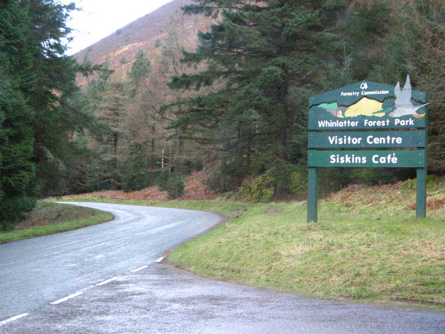
| Whinlatter Forest Park | 6.8 miles (11 km) | Enjoy some fantastic walking and cycling trails in this huge park in the Lake District. There are fantastic views of Bassenthwaite Lake, Derwent Water and Keswick as you make your way through the mixed species forest and peaceful glades. The park also has two fantastic purpose built mountain bike trails with cycle hire available within the park. The red graded Altura Trail is a challenging 19 km mountain singletrack, the Quercus Trail is an easier 7.5 km trail. The C2C cycle route also runs through the park so you could continue your ride on the Whitehaven to Keswick or Whitehaven to Penrith cycle route. Walkers can head south of the park and enjoy a climb to Grisedale Pike. View Full Details>> | |
| Whitehaven to Keswick | 31.1 miles (50 km) | Starting on the West coast of Cumbria follow the C2C National Cycle route from Whitehaven to Keswick in the Lake District. This route can be completed as the first leg of the C2C crossing from Whitehaven to Sunderland/Newcastle. Highlights on this journey are Whinlatter Forest and the stunning scenery of the Lake District. This includes the beautiful Lowes water and Crummock Water (below). View Full Details>> | |
| Whitehaven to Penrith | 52.8 miles (85 km) | Starting on the West coast of Cumbria follow the C2C National Cycle route from Whitehaven to Penrith in the Lake District. This route can be completed as the first leg of the C2C crossing from Whitehaven to Sunderland/Newcastle. Highlights on this journey are Whinlatter Forest, the stunning scenery of the Lake District and the spectacular Cumbrian mountains - including Blencathra below. Particularly eye catching are the beautiful Lowes and Crummock Water as well the popular and stunning Derwent Water (below). View Full Details>> | |
| Whitehaven to Sunderland | 133.6 miles (215 km) | This is the complete C2C National Cycle route crossing the country from east to west along a number of cycle tracks/paths and minor roads. You will see some spectacular scenery as you pass through the Cumbrian Lake District and Northumberland before the last leg through County Durham and the finish point at Roker Pier on the east coast of England at Sunderland. See the Whitehaven to Tynemouth page for the other section. View Full Details>> | |
| Windermere-Circular | 28 miles (45 km) | This circular route takes you through some lovely Lake District scenery as you travel around the beautiful Lake Windermere. The route passes through the villages of Ambleside, Grasmere and Elterwater and exposes you to some stunning views. Highlights are the spectacular lakeland scenery around Windermere including Rydal Water, Grasmere Lake, Esthwaite Water and the lovely wooded section through Hawkshead Hall Park. View Full Details>> |