Amwell Nature Reserve
![]()
![]() This nature reserve is located in village of Great Amwell just to the south of Ware in Hertfordshire.
This nature reserve is located in village of Great Amwell just to the south of Ware in Hertfordshire.
At the site there's riverside trails along the Lea Valley Walk, lakes, reedbeds, grassland and woodland to explore.
There's an abundance of wildlife with bittern, widgeon, gadwall, shoveler, goldeneye and dragonflies to look out for.
You can start the walk from the public car park at Stanstead Lock and then follow the River Lea into the reserve.
The New River Path also runs through the reserve so you can continue your walk along this pleasant waterway.
Postcode
SG12 9SS - Please note: Postcode may be approximate for some rural locationsAmwell Nature Reserve Ordnance Survey Map  - view and print off detailed OS map
Amwell Nature Reserve Open Street Map  - view and print off detailed map
Amwell Nature Reserve OS Map  - Mobile GPS OS Map with Location tracking
Amwell Nature Reserve Open Street Map  - Mobile GPS Map with Location tracking
Walks near Great Amwell
- Ware - This Hertfordshire based town has two rivers to explore and a fine local nature reserve to visit.
- New River Path - Follow the man made New River from Hertford to Islington on this easy waterside walk
- Lea Valley Walk - A super walk with a series of delightful waterside sections along the River Lea
- Stort Valley Way - A lovely riverside circular walk around Harlow, Nazeing and Roydon.
- Harcamlow Way - This long distance walk takes you to some of the most beautiful countryside, interesting historical sites and delightful country parks in the counties of Cambridgeshire, Essex and Hertfordshire.
The route is a figure-of-eight, starting in Harlow and first heading to Saffron Walden where you will pass the splendid Jacobean mansion and gardens at Audley End - Forty Hall - This manor house in Enfield is surrounded by lovely parkland and gardens
- Enfield - This North London based market town has some nice local parks, several waymarked trails, a historic local hall and waterside trails along the New River which runs past the town.
Pubs/Cafes
Built in 1538 the historic Red Lion pub is one of the oldest buildings in the area and the second oldest in Stanstead Abbotts. It started life as a monastery, then a coaching inn and was renovated in 2005 to help reinstate the character of the pub. They serve good quality food and gave a garden area. You can find them on the High Street at postcode SG12 8AA. The pub is dog friendly.
Photos
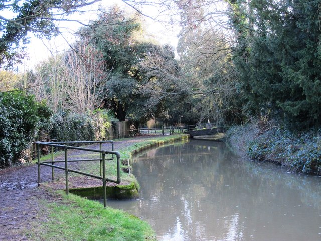
Stanstead Mill Stream at Amwell Magna near the Amwell Nature Reserve — in Hertfordshire, eastern England. Away from the Lee Navigation the River Lea is more natural. This shows the Stanstead Mill Stream soon after it splits from the River Lea at a weir within the Amwell Magna Fishery near the Amwell Quarry. It rejoins the Lea Navigation in the navigable waters below Stanstead Abbots.


