Blacktoft Sands RSPB Nature Reserve - Goole
![]()
![]() Enjoy a circular walk around this pretty RSPB nature reserve. The reserve is located at the confluence of the River Ouse and River Trent, a few miles east of Goole. It is known for its wetland breeding birds, including marsh harrier, bittern, kestrels, avocets and bearded tit.
Enjoy a circular walk around this pretty RSPB nature reserve. The reserve is located at the confluence of the River Ouse and River Trent, a few miles east of Goole. It is known for its wetland breeding birds, including marsh harrier, bittern, kestrels, avocets and bearded tit.
The site has some nice grassy public footpaths to follow to a number of bird hides. There's lots of pretty lakes and a visitor centre with lots of information and facilities.
In Goole you can pick up the Trans Pennine Trail and enjoy riverside trails along the northern side of the River Ouse. The Howden 20 can also be picked up here and followed to the impressive Howden Minster in the nearby market town.
Postcode
DN14 8HR - Please note: Postcode may be approximate for some rural locationsBlacktoft Sands Ordnance Survey Map  - view and print off detailed OS map
Blacktoft Sands Open Street Map  - view and print off detailed map
Blacktoft Sands OS Map  - Mobile GPS OS Map with Location tracking
Blacktoft Sands Open Street Map  - Mobile GPS Map with Location tracking
Cycle Routes and Walking Routes Nearby
Photos
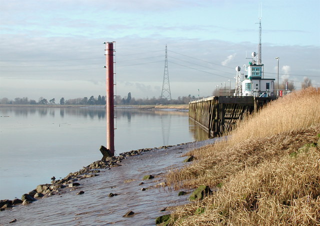
Looking west along the north bank of the River Ouse near Pier House, Blacktoft. The original 470ft long jetty was built between 1873 and 1881 by the Aire & Calder Navigation Company to provide a stopover for those vessels which required two high tides to travel from Hull to Goole. It was used by the paddle steamers of the Humber Steam Packet Service until about 1920, and later the local Hope & Anchor pub became well known to foreign sailors from as far away as Copenhagen and St Petersburg.


