Blashford Lakes
![]()
![]() This walk takes you around Blashford Lakes Nature Reserve and Ibsley Water on the edge of the New Forest. There are good surfaced footpaths to follow around several lakes with the Avon Valley Path also running through the site. You can stop and use won of the many bird hides to look out for woodpecker, nuthatch, grey heron, great crested grebe, coot and sand martin. Adder, grass snake and kingfisher can be seen in the summer months. There are good facilities with a visitor centre and car park.
This walk takes you around Blashford Lakes Nature Reserve and Ibsley Water on the edge of the New Forest. There are good surfaced footpaths to follow around several lakes with the Avon Valley Path also running through the site. You can stop and use won of the many bird hides to look out for woodpecker, nuthatch, grey heron, great crested grebe, coot and sand martin. Adder, grass snake and kingfisher can be seen in the summer months. There are good facilities with a visitor centre and car park.
If you would like to extend your walk you could continue along the Avon Valley Path towards the pretty village of Ibsley or head east, on any number of footpaths, into the New Forest. Just to the east of the reserve you will find the expansive Rockford and Ibsley Commons where there are miles of heathland and woodland trails.
Postcode
BH24 3LY - Please note: Postcode may be approximate for some rural locationsBlashford Lakes Ordnance Survey Map  - view and print off detailed OS map
Blashford Lakes Open Street Map  - view and print off detailed map
Blashford Lakes OS Map  - Mobile GPS OS Map with Location tracking
Blashford Lakes Open Street Map  - Mobile GPS Map with Location tracking
Further Information and Other Local Ideas
Just north east of the lakes there's some fine areas of the New Forest to explore. These include the Ashley Walk, Godshill and the Latchmore Brook and Hasley Hill Inclosure which is only a couple of miles away. There's lots of peaceful woodland, heathland, streams and New Forest Ponies to enjoy in these nearby locations.
Just to the north west is the nearby town of Verwood. Here you can enjoy a walk around Verwood Forest, the Cranborne Common Nature Reserve and the Stephen's Castle Nature Reserve where there's a lovely viewpoint.
Cycle Routes and Walking Routes Nearby
Photos
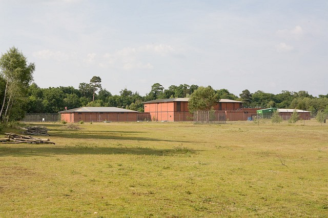
Entering Blashford Lakes wildlife reserve Run by Hampshire and Isle of Wight Wildlife Trust. As a consequence of this reserve, many more of the paths around the lakes are open to the public than might appear from looking for RoW on maps.


