Bridgwater Bay National Nature Reserve
![]()
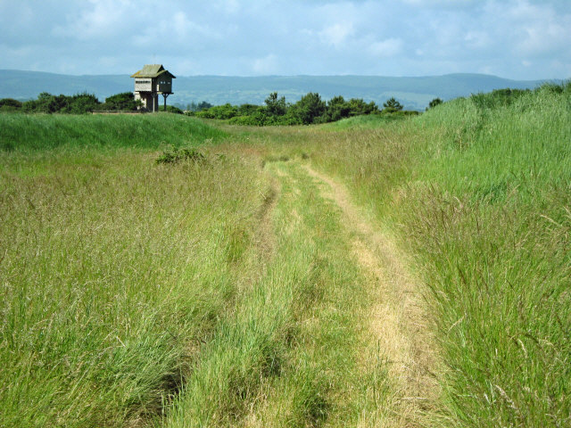
![]() Explore this beautiful nature reserve on this short walk in the Somerset Levels. The reserve is situated on the mouth of the River Parrett with lovely views over the estuary to Stert Island and Burnham-on-Sea. It consists of extensive areas of mudflats, sand banks, reed beds and saltmarshes attracting a large number of birds. Look out for shelduck, curlew, redshank and oystercatcher from the excellent elevated bird hide. There is also an abundance of interesting flora with wildflowers and plants including Somerset hair grass,wild thyme, horseshoe vetch and birds-foot-trefoil.
Explore this beautiful nature reserve on this short walk in the Somerset Levels. The reserve is situated on the mouth of the River Parrett with lovely views over the estuary to Stert Island and Burnham-on-Sea. It consists of extensive areas of mudflats, sand banks, reed beds and saltmarshes attracting a large number of birds. Look out for shelduck, curlew, redshank and oystercatcher from the excellent elevated bird hide. There is also an abundance of interesting flora with wildflowers and plants including Somerset hair grass,wild thyme, horseshoe vetch and birds-foot-trefoil.
Steart Marshes nature reserve is also located on the south side of the peninsula with otters, egrets, owls waders and wildfowl to look out for.
The River Parret Trail starts from Bridgwater Bay so you can pick this up to extend your walking in the area. The lovely waterside trail heads south to the nearby village of Combwich and then on to Bridgwater.
This walk start from the Steart car park but you could also start from Combwich or Bridgwater and follow the River Parret Trail to the reserve.
You could also head west along the estuary towards Hinckley Point Nuclear Power Station. It's a lovely walk with great views of the Sterte Flats and Catsford Common.
Postcode
TA5 2PX - Please note: Postcode may be approximate for some rural locationsBridgwater Bay National Nature Reserve Ordnance Survey Map  - view and print off detailed OS map
Bridgwater Bay National Nature Reserve Open Street Map  - view and print off detailed map
Bridgwater Bay National Nature Reserve OS Map  - Mobile GPS OS Map with Location tracking
Bridgwater Bay National Nature Reserve Open Street Map  - Mobile GPS Map with Location tracking
Further Information and Other Local Ideas
The circular Steart Marshes Walk starts from the same car park. The longer walk will take you south through the marshes on alternative trails.
Cycle Routes and Walking Routes Nearby
Photos
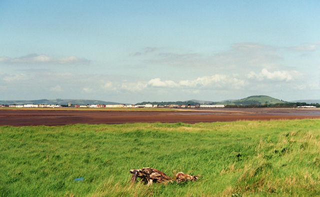
Mouth of the River Parrett. Taken from Steart, looking NE, showing the southern end of Steart Island with Burnham-on-Sea and Brent Knoll in the distance


