Ellesmere Port Walks Near and Around
![]()
![]() This Cheshire based town sits in an interesting position on the Manchester Ship Canal, the Shropshire Union Canal and the River Mersey. It's home to a fine museum and also includes canalside walking trails and a number of local country parks.
This Cheshire based town sits in an interesting position on the Manchester Ship Canal, the Shropshire Union Canal and the River Mersey. It's home to a fine museum and also includes canalside walking trails and a number of local country parks.
This walk explores the town's waterways museum before heading south along the Shropshire Union Canal to the neighbouring city of Chester.
The walk starts from the excellent National Waterways Museum at Ellesmere Port docks. It's located at the northern end of the Shropshire Union Canal at the point where it meets the Manchester Ship Canal and the River Mersey. The museum is concerned with the history of the UK's rivers and canals, with exhibits including canal boats, traditional clothing and steam engines. It's a nice place for a stroll with a number of surfaced footpaths to follow around the site. After exploring the museum you can pick up the canal towpath and follow it south through the Mersey Forest towards Croughton and Moston before coming into Chester. Here you can continue your walking by picking up the Chester Canal Walk or the Chester City Circular Walk. You can either return on the same paths to Ellesmere Port or you can catch a train back from Chester. It takes about 45 minutes and requires one change.
Postcode
CH65 4FW - Please note: Postcode may be approximate for some rural locationsEllesmere Port Ordnance Survey Map  - view and print off detailed OS map
Ellesmere Port Open Street Map  - view and print off detailed map
Ellesmere Port OS Map  - Mobile GPS OS Map with Location tracking
Ellesmere Port Open Street Map  - Mobile GPS Map with Location tracking
Pubs/Cafes
The Waterside Cafe at the museum is the ideal spot for some refreshments. You can sit outside on the terrace and enjoy views across the dock basin to the narrowboats passing through the locks. They serve a good range of meals and snacks and there's an associated shop where you can pick up maps, guides and canal history books.
Dog Walking
The museum and the canal are a lovely place for a dog walk. The area is very dog friendly as is the cafe mentioned above.
Further Information and Other Local Ideas
There are a few nice country parks in and around the town to visit. On the western outskirts there's Rivacre Valley Country Park to visit. It's a pretty place which is popular for its springtime bluebells and wildflower meadows.
If you head north along the River Mersey you will soon come to Eastham Country Park. There's some nice woodland trails and fine views across the Mersey Estuary here. The pretty Storeton Woods can also be found near here in Bebington.
The pretty Stanney Woods can also be found at the southern outskirts of the town.
The epic North Cheshire Way also starts near the town in Hooton.
For more walking ideas in the area see the Cheshire Walks page.
Cycle Routes and Walking Routes Nearby
Photos
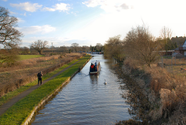
Shropshire Union Canal at Little Stanney. Little Stanney is a suburban village and civil parish in Cheshire, England located on the Wirral Peninsula and is located between Chester and Ellesmere Port. The village was originally part of the Stoak Parish in the Wirral Hundred. In 1894, Little Stanney became part of Chester Rural District. Part of the parish was transferred to the Municipal Borough of Ellesmere Port in 1967, the remainder becoming part of the City of Chester in 1974. The parish contains one building included in the National Heritage List for England and designated by English Heritage as a listed building. This is Rake Hall, which originated as a country house in the 17th century, and was later converted into a public house and restaurant.
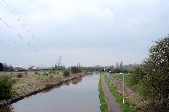
Chester - Shropshire Union Canal at Abbot's Meads Chester. View north along the Shropshire Union Canal (Ellesmere branch), seen from the disused Mickle Trafford railway bridge at Abbot's Meads, near Blacon. The rail track carries National Cycleway 5. At this bridge the Longster Trail extension (from Guilden Sutton to the east) leaves the cycleway to join the North Cheshire Way (Chester branch) on the towpath below; this runs north (as in the image) towards Stoak and south into Chester itself. The towpath also carries a branch of Cycleway 5 as the 'Canalside Trail'. The large Blacon housing estates lie out of sight to the left.


