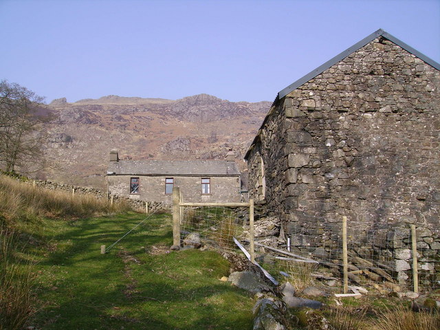
Harter Fell Walk
![]()
![]() An enjoyable climb to Harter Fell in the Eskdale area of the Western Lake District.
An enjoyable climb to Harter Fell in the Eskdale area of the Western Lake District.
You can start the walk from the car park at Birks Bridge, just over a mile to the east of the fell. From here you head west, crossing the River Duddon before a woodland section through Dunerdale Forest. Follow the trails through the woods to Birks, Buck Crag, Mart Crag and Maiden Castle. Soon after you will come to the 649m summit of Harter Fell.
Here you will find three rocky tors and wonderful views of the Duddon estuary, Morecambe Bay, the Irish Sea and the Isle of Man. Several fells are also in sight including Sca Fell, Scafell Pike, Broad Crag, Great End, Esk Pike, Bow Fell and Crinkle Crags.
To extend the walk you could continue north from the summit towards Demming Crag and Hardknott Pass which shares the title of steepest road in England along with Rosedale Chimney Bank in North Yorkshire. Here you can visit Hardknott Castle Roman Fort.
From the Birks car park you can head east and pick up trails to take you to Seathwaite Tarn where there's some good paths to follow around the water.
There's also nice waterside trails along the River Duddon which you can pick up from the same car park.
A few miles to the east you can enjoy a challenging climb to the Old Man of Coniston for more great views.
Our circular walk to Dow Crag and Seathwaite Tarn starts from the nearby village of Seathwaite. It's a lovely walk with fine views of the Scafells, Skiddaw, the Helvellyn range and two beautiful tarns that lie below the peak.
Postcode
LA20 6EG - Please note: Postcode may be approximate for some rural locationsHarter Fell Ordnance Survey Map  - view and print off detailed OS map
Harter Fell Open Street Map  - view and print off detailed map
Harter Fell OS Map  - Mobile GPS OS Map with Location tracking
Harter Fell Open Street Map  - Mobile GPS Map with Location tracking
Pubs/Cafes
Just to the north of the fell you will find the noteworthy Woolpack Inn which is a fine place to go for some refreshments after your walk. The inn also contains the Hardknott Cafe. It's located at the top of one of England’s most dramatic valleys, and the bottom of one of its most exciting roads – the Hardknott Pass. The inn has a good menu with cosy fires indoors to warm yourself next to. There's also a nice outdoor area for the summer and it is dog friendly too. You can find the pub on the pass at a postcode of CA19 1TH for your sat navs.
In nearby Seathwaite there's the 16th century Newfield Inn. The cosy interior includes a log burner to warm you up on colder days. Outside there's a nice garden area where you can watch the birds at the bird feeders and enjoy views of the surrounding fells. They do really nice food and have a good selection of Cumbrian beers. The pub is dog friendly and also provides accommodation if you need to stay over. You can find the pub at postcode LA20 6ED.
Further Information and Other Local Ideas
The fell is located just to the east of the River Duddon in the Duddon Valley. You can try our riverside circular walk here and also try some of the peaceful woodland trails in the adjacent Dunderdale Forest. It starts from the same car park as this walk.
Just to the north west is the worthy village of Eskdale Green. The pretty settlement includes a tarn, woods, a Japanese Garden, riverside trails and two fine historic pubs. There's also Eskdale Green station or Irton Road Station on the heritage Ravenglass and Eskdale Railway here.


