Martin Down Nature Reserve
![]()
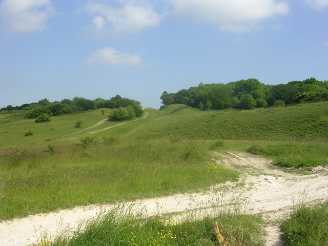
![]() This beautiful nature reserve on the Hampshire/Dorset border consists of 350 hectares of unspoiled chalk downland. It's a splendid area with miles of good footpaths taking you past wildflower meadows and sweeping grassland.
This beautiful nature reserve on the Hampshire/Dorset border consists of 350 hectares of unspoiled chalk downland. It's a splendid area with miles of good footpaths taking you past wildflower meadows and sweeping grassland.
This circular walk starts from the car park off the A354 near Bokerley Junction. You then follow good footpaths around the reserve, passing along the Bokerley Dyke which defines the border between the counties of Hampshire and Dorset.
The area is great for flora and fauna. Look out for birds such as Cuckoos, yellowhammers, and skylarks. In the summer months there are various butterflies including Adonis blue and the dark green fritillary. The area is covered with an abundance of pretty plants and flowers including several species of orchid.
If you would like to extend your walk then you could pick up the Jubilee Trail which starts from the reserve. You could follow the trail to the nearby Pentridge Hill for great views over the Hampshire and Dorset countryside. You could also head north to Vernditch Chase where there are some nice woodland walking trails to try.
Martin Down is located near to both Fordingbridge and Salisbury.
Martin Down Nature Reserve Ordnance Survey Map  - view and print off detailed OS map
Martin Down Nature Reserve Open Street Map  - view and print off detailed map
Martin Down Nature Reserve OS Map  - Mobile GPS OS Map with Location tracking
Martin Down Nature Reserve Open Street Map  - Mobile GPS Map with Location tracking
Explore the Area with Google Street View 
Further Information and Other Local Ideas
A few miles to the south west you will find the Dorset Cursus, an ancient Neolithic earthwork on Wyke Down. There's some excellent views over the countryside of the Cranborne Chase AONB to enjoy from here.
Cycle Routes and Walking Routes Nearby
Photos
To the right of this track is the Martin Down enclosure, a rectangular prehistoric earthwork excavated by General Pitt-Rivers in 1895.


