Merthyr Mawr Sand Dunes Walk
![]()
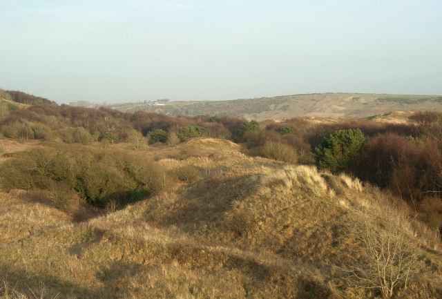
![]() This walk visits the lovely Merthyr Mawr Warren National Nature Reserve on the South Wales coast. The reserve includes miles of wonderful sand dunes including the 'Big Dipper', the highest dune in Wales. There's also some areas of woodland, saltmarsh, grassland with great coastal views to enjoy from the high points.
This walk visits the lovely Merthyr Mawr Warren National Nature Reserve on the South Wales coast. The reserve includes miles of wonderful sand dunes including the 'Big Dipper', the highest dune in Wales. There's also some areas of woodland, saltmarsh, grassland with great coastal views to enjoy from the high points.
The walk starts from the car park at Candleston Castle just a few miles south west of Bridgend. The ruined 14th-century castle sits right on the edge of the reserve. Wildfowl, butterflies, moths, autumn gentian, violets and orchids can be seen in the area around the castle.
From the Candleston car park you can pick up several waymarked trails of varying length. Highlights on the routes include views of the River Ogmore and a visit to the unusual limestone spring at Burrows Well. The 'Big Dipper Walk' will take you to the top of the huge dune. It's quite a challenging climb but when you get to the top there's splendid views over the reserve and the coast.
The area is great for flora and fauna with wildflowers attracting lots of butterflies including grizzled skippers, dark green fritillaries and small blues. Repltiles seen on the Warren include adders, common lizards, grass snakes and slow worms.
The Wales Coast Path runs across the eastern side of the reserve. You can pick up the long distance trail and follow it west to Newton Burrows and Portchcawl on our Porthcawl Coastal Walk. The walk runs to Ogmore where a visit to the 12th century Ogmore Castle is highly recommended. Just beyond Porthcawl you will find the Kenfig Nature Reserve near Port Talbot. The site includes more sand dunes and the Kenfig Pool, Glamorgan's largest lake.
The trail also runs through Ogmore by Sea and Merthyr Mawr so you could use these nearby villages as alternative start points to the walk.
Postcode
CF32 0LS - Please note: Postcode may be approximate for some rural locationsMerthyr Mawr Sand Dunes Walk Ordnance Survey Map  - view and print off detailed OS map
Merthyr Mawr Sand Dunes Walk Open Street Map  - view and print off detailed map
Merthyr Mawr Sand Dunes Walk OS Map  - Mobile GPS OS Map with Location tracking
Merthyr Mawr Sand Dunes Walk Open Street Map  - Mobile GPS Map with Location tracking
Pubs/Cafes
The Watermill is a notable pub located on the river Ewenny in Ogmore village. There's a lovely outdoor seating area with views of the picturesque countryside surrounding the pub. It's a great place to relax on summer days and watch the horses graze in the adjacent field. Indoors there's an attractive interior with a cosy atmophere. There's a very good menu and the pub is also very dog friendly. You can find it on the Ogmore Road at a postcode of CF32 0QP for your sat navs.
In Ogmore-by-Sea there's the delightful Hilary and Iain's Kitchen. This cafe bistro does great food and also has an outdoor seating area with fine sea views. You can find it at 87 Main Rd, with a postcode of CF32 0PW.
Further Information and Other Local Ideas
Also of interest is the Bridgend Circular Walk which runs through Merthyr Mawr. The long distance trail is a great way to explore the lovely countryside surrounding Bridgend. It explores the area around the town, passing close to Bryngarw Country Park at the northern tip. There's great walking trails here taking you to woodland, gardens, and an ornamental lake. Here you can also pick up the Garw Valley Railway Path. The shared cycling and walking path starts in the park and heads north along a disused railway line to Blaengarw alond the River Garw.


