Saddleworth Moor Walks
![]()
![]() Enjoy a walk across this atmospheric moor in the Peak District. You can start at the car park at Dovestone Reservoir and follow footpaths past Yeoman Hey Reservoir and Greenfield Reservoir. You then follow the Greenfield Brook to Raven Stones Brow with little waterfalls to enjoy on the way. After crossing the brook you then head up and across the moor. This is a challenging section with the moor reaching heights of around 1500ft. There are excellent views over the reservoirs to the surrounding Pennine Hills and some fascinating geological features to look out for on the way.
Enjoy a walk across this atmospheric moor in the Peak District. You can start at the car park at Dovestone Reservoir and follow footpaths past Yeoman Hey Reservoir and Greenfield Reservoir. You then follow the Greenfield Brook to Raven Stones Brow with little waterfalls to enjoy on the way. After crossing the brook you then head up and across the moor. This is a challenging section with the moor reaching heights of around 1500ft. There are excellent views over the reservoirs to the surrounding Pennine Hills and some fascinating geological features to look out for on the way.
From the high point on the moor you descend to Dovestone Reservoir and enjoy a woodland and waterside section taking you back to the car park.
To extend your walk you can pick up the Oldham Way and follow it south over the Chew Hills to Chew Reservoir. You could also reach the moor from nearby Mossley train station by following the Oldham Way.
Postcode
OL3 7NE - Please note: Postcode may be approximate for some rural locationsSaddleworth Moor Ordnance Survey Map  - view and print off detailed OS map
Saddleworth Moor Open Street Map  - view and print off detailed map
Saddleworth Moor OS Map  - Mobile GPS OS Map with Location tracking
Saddleworth Moor Open Street Map  - Mobile GPS Map with Location tracking
Pubs/Cafes
After your exercise head west into the village of Greenfield and enjoy refreshments at the King William IV Hotel on Chew Valley Rd, OL3 7DD. There's a great menu and a lovely beer garden to sit out and relax in when the weather is fine.
Dog Walking
The expansive moorland is a great place to take your dog for a walk.
Cycle Routes and Walking Routes Nearby
Photos
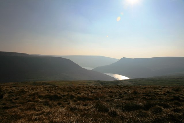
Windswept grass on the moor. Looking over the windswept grass of Saddleworth Moor with Raven Stones Brow to the left, Alderman's Hill to the right and Alphin Pike in the distance. Greenfield Reservoir in the centre.


