Salt Line
![]()
![]() This route follows a disused railway line near Alsager and Sandbach. The trail runs for just under 2 miles along a surfaced path, suitable for cyclists and walkers.
This route follows a disused railway line near Alsager and Sandbach. The trail runs for just under 2 miles along a surfaced path, suitable for cyclists and walkers.
Start the walk from the Salt Line and Borrow Pit Meadows car park at Smithy Grove. It's located just south of the Trent and Mersey Canal at Hassall Green (postcode for sat navs CW11 4YB). From here you can pick up the trail and follow it south east to Day Green and Lawton Heath End on the outskirts of Alsager. On the way you'll pass the Borrow Pit Meadows nature reserve where you'll find habitats including meadows, woodland, wetland, grassland, farmland and scrub. The reserve is a nice place for a stroll with lots of birdlife to look out for.
Postcode
CW11 4YB - Please note: Postcode may be approximate for some rural locationsSalt Line Ordnance Survey Map  - view and print off detailed OS map
Salt Line Open Street Map  - view and print off detailed map
Salt Line OS Map  - Mobile GPS OS Map with Location tracking
Salt Line Open Street Map  - Mobile GPS Map with Location tracking
Pubs/Cafes
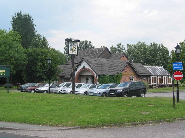
The Wilbraham Arms is nicely located at the end of the route. The pub takes its name from the prominent local family that owned the nearby Rode Hall. It is positioned on the site of a former Cheshire farmhouse and includes extensive grounds, with two separate drinks terraces as well as a lawn seating area. It's a lovely place to relax in the summer months and can be found at a postcode of ST7 2AX.
Dog Walking
The trail is a nice one to do with your dog and The Wilbraham Arms mentioned above is also dog friendly.
Further Information and Other Local Ideas
Just east of the trail you'll find the noteworthy Rode Hall. The Georgian country house is surrounded by lovely parkland with woodland, gardens and a large lake. It's a nice place to continue your walking during the spring and summer months. The Alsager Walk uses the trail and the canal to create a circular route which visits the hall.
Head north west along the canal and you can pick up another rail trail near Sandbach. The Wheelock Rail Trail is another flat surfaced path providing easy cycling and walking opportunites in the area.
For more walking ideas in the area see the Cheshire Walks page.
Cycle Routes and Walking Routes Nearby
Photos
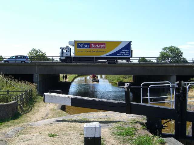
Hassall Green station near the start of the route. View SE, towards Harecastle: ex-North Stafford Harecastle - Sandbach branch. The station had been closed to passengers 28/7/30 (to goods 1/11/47), but the line remained in use for freight until 4/1/71. Ahead is the M6 Motorway.
Salt Line Alsager. The Salt Line is now a linear nature trail and cycleway starting near to the Wilbraham Arms in Alsager. It follows the old mineral line from the Potteries through to Sandbach and the salt towns of S Cheshire. Coal and limestone was carried into Cheshire where brine was heated in large open pans to leave white salt crystals which were then used in the making of washing soda, glass, soap and detergents. The trail is now in the ownership of Congleton Borough Council.
Wilbraham Arms Alsager. The first pub as you enter Alsager from the M6 at Sandbach. Built on the site of Cresswellshawe Farm and named after the Wilbraham family major landowners of part of Alsager in days gone by.


