Selsdon Wood
![]()
![]() This woodland and nature reserve in Croydon is criss crossed with a number of nice footpaths and walking trails. The reserve includes 200 acres of ponds, open meadows and ancient woodland including oak, beech, ash and sweet chestnut. There's two colour coded waymarked trails which you can pick up from the car park.
This woodland and nature reserve in Croydon is criss crossed with a number of nice footpaths and walking trails. The reserve includes 200 acres of ponds, open meadows and ancient woodland including oak, beech, ash and sweet chestnut. There's two colour coded waymarked trails which you can pick up from the car park.
The area is also known as the Bird Sanctuary with birds such as Blackcap, Buzzard, Cuckoo and Chiffchaff to look out for. Also keep your eyes peeled for Roe Deer, various insects and the rare White Squirrel.
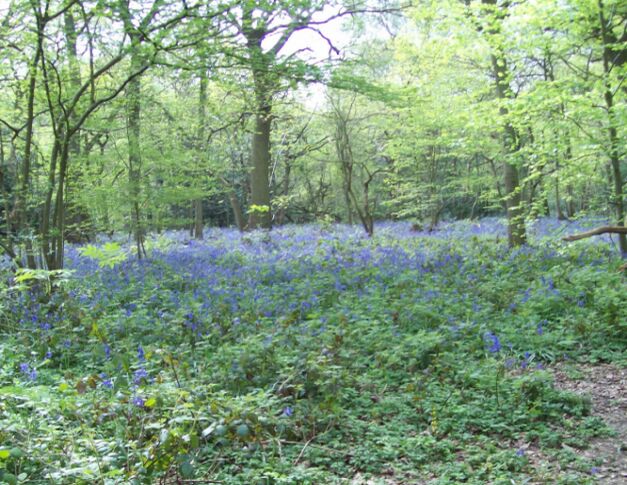
It's great for flora too with 130 flowering plants to see. These include Crocus, Red Campion, Bluebell and Cowslip.
The London Loop and the Vanguard Way pass through the wood so you can pick these long distance footpaths up and extend your walk. One option is to follow the trails north to Littleheath Woods and then on to Addington Hills. This lovely park includes London's largest area of heathland and a great viewpoint with views towards Parliament Hill and Docklands. Just to the west of Addington Hills is Croham Hurst Woods where you'll find ancient woodland and a climb to Breackneck Hill.
Heading east from Selsdon Wood will take you to Frith Wood and Frylands Wood.
Heading south will take you into Surrey, passing Greatpark Wood, Holt Wood and Chelsham.
For cyclists National Cycle Route 21 passes close to the woods at New Addington.
Postcode
CR0 9HU - Please note: Postcode may be approximate for some rural locationsPlease click here for more information
Selsdon Wood Ordnance Survey Map  - view and print off detailed OS map
Selsdon Wood Open Street Map  - view and print off detailed map
Selsdon Wood OS Map  - Mobile GPS OS Map with Location tracking
Selsdon Wood Open Street Map  - Mobile GPS Map with Location tracking
Pubs/Cafes
Just to the south there's the Harrow Inn in Farleigh. The historic inn dates to the 18th century and includes an ancient flint barn which is exclusively for diners. There's a charming old interior with flagstones, quarry tiles and wooden floorboards. Outside there's a large garden to relax in on warmer days. You can find them at postcode CR6 9EL for your sat navs.
Dog Walking
As you'd imagine the woodland trails are ideal for dog walking. As such you're likely to see plenty of other owners on a fine day. The Harrow Inn mentioned above is also dog friendly.
Further Information and Other Local Ideas
The circular Croydon Walk starts at the train station in the nearby town. It follows the London Loop to the Addington Hills before heading to Selsdon Wood and Croham Hurst.
If you follow the London Loop west it will take you to Riddlesdown Common in Kenley. The common covers 43 hectares and includes some good footpaths and the Riddlesdown Road bridleway which is suitable for cycling.
For more walking ideas in the area see the London Walks page.
Cycle Routes and Walking Routes Nearby
Photos
The 200-acre Selsdon Wood is owned by The National Trust, and managed by the London Borough of Croydon. The photo shows the eastern entrance and footpath, from the end of Courtwood Lane. Here you can see the information board which details the flora and fauna you can see at the reserve.


