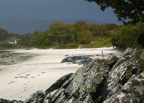
Silver Sands Of Morar Walk
![]()
![]() This walk visits a beautiful sandy beach in Morar on the west coast of The Rough Bounds of Scotland.
This walk visits a beautiful sandy beach in Morar on the west coast of The Rough Bounds of Scotland.
You can start the walk at the public car park at Toigal, south west of the village. From here there are nice paths down to the beach where you enjoy views across the River Morar to the Small Isles of Rum, Eigg, Muck and Canna.
You can continue your walking in the area by heading east to Loch Morar, the deepest freshwater body of water in the British Isles. To the north there's the Mallaig Circular Walk where you can enjoy views over Mallaig Harbour and across Loch Nevis to Knoydart. Arisaig and the historic Glenfinnan Viaduct are also nearby.
Silver Sands Of Morar Ordnance Survey Map  - view and print off detailed OS map
Silver Sands Of Morar Open Street Map  - view and print off detailed map
Silver Sands Of Morar OS Map  - Mobile GPS OS Map with Location tracking
Silver Sands Of Morar Open Street Map  - Mobile GPS Map with Location tracking
Further Information and Other Local Ideas
From nearby Mallaig you can catch the Knoydart ferry to Inverie where you can visit Britain's remotest Pub. The Knoydart and Inverie Walk will then take you through the mountains along the Old Road to Kingloch Hourn.


