Warburg Nature Reserve
![]()
![]() This delightful nature reserve near Henley-on-Thames has some lovely woodland trails to try. It's a splendid place for flora and fauna with lots of bluebells and wood anemones in the spring. In the summer months the site is rich with orchids including fly orchid and bird's-nest orchid. Look out for wildlife including rare butterflies and a variety of woodland birds. All in all over 2,000 species of plants, fungi and animals have been recorded here.
This delightful nature reserve near Henley-on-Thames has some lovely woodland trails to try. It's a splendid place for flora and fauna with lots of bluebells and wood anemones in the spring. In the summer months the site is rich with orchids including fly orchid and bird's-nest orchid. Look out for wildlife including rare butterflies and a variety of woodland birds. All in all over 2,000 species of plants, fungi and animals have been recorded here.
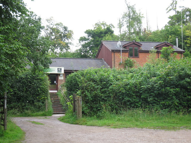
The reserve has good facilities with a visitors centre, a picnic area and two bird hides. There's also a car park where you can start your walk. You could also start off from the nearby village of Nettlebed and follow paths past Nettlebed Common to the site.
The Chiltern Way and the Oxfordshire Way both pass the reserve. You can easily pick up either of these long distance trails to extend your walk. Heading south will take you to Nettlebed Woods where there are more nice bluebell trails. If you follow the Oxfordshire way south east it will take you to Henley-on-Thames where you can enjoy a nice riverside walk. Our Turville Circular Walk also visits the reserve from the nearby village. It passes the famous Chitty Chitty Bang Bang Windmill and then takes you to the attractive 13th century Stonor Estate just to the east of the reserve.
Postcode
RG9 6BL - Please note: Postcode may be approximate for some rural locationsWarburg Nature Reserve Ordnance Survey Map  - view and print off detailed OS map
Warburg Nature Reserve Open Street Map  - view and print off detailed map
Warburg Nature Reserve OS Map  - Mobile GPS OS Map with Location tracking
Warburg Nature Reserve Open Street Map  - Mobile GPS Map with Location tracking
Pubs/Cafes
If you head east from the reserve you will soon come to the pretty village of Nettlebed. Here you could visit The White Hart for some post walk refreshments. It's a historic pub of some note, dating all the way back to the 14th century. Inside there's cosy log fires, while outside there's a nice garden area for warmer days. You can find them on the High Street with a postcode of RG9 5DD for your sat navs.
Dog Walking
The woods are a lovely place for a dog walk though you are asked to please keep them on leads. The White Hart pub mentioned above is also dog friendly.
Further Information and Other Local Ideas
The circular Nettlebed Walk visits the reserve from the nearby village. It then heads to the National Trust's Greys Court where there are woodland trails, beautiful gardens, a turf maze, a photogenic Chinese Bridge and a 19th century ice house.
Near here is the worthy village of Stoke Row where there are some interesting historical features. The village includes the distinctive Maharajah's Well, a pretty cherry orchard and a noteworthy 17th century pub reputed to be the former haunt of notorious highwayman Dick Turpin. Near here there's also Ipsden where you can explore the trails on Ipsden Heath and visit the 12th century Norman church.
For more walking ideas in the area see the Chilterns Walks page.
Cycle Routes and Walking Routes Nearby
Photos
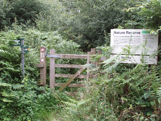
Entrance to Warburg Nature Reserve. This is the premier reserve of the Berkshire, Buckinghamshire and Oxfordshire Wildlife Trust. The signpost shows a public footpath ahead and a restricted byway to the left.


