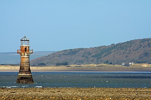
Whiteford Sands
![]()
![]() This beautiful nature reserve on the North Gower coast has lovely walking trails through woodland and sand dunes with nice coastal views.
This beautiful nature reserve on the North Gower coast has lovely walking trails through woodland and sand dunes with nice coastal views.
The area is fantastic for wildlife watching with several species of wading birds and wildfowl too look out for.
The walk starts from the parking area in Llanmadoc and heads through Cwm Ivy where there are some nice woodland trails and Cwm Ivy marsh. You continue to Berges Island where you can enjoy great views across the sands to the lighthouse at Whiteford Point.
If you'd like to continue your walking in the area then you could climb the sandstone ridge across Cefn Bryn. The climb to Cefn Bryn beacon offers fabulous views over the Gower.
Postcode
SA3 1DE - Please note: Postcode may be approximate for some rural locationsWhiteford Sands Ordnance Survey Map  - view and print off detailed OS map
Whiteford Sands Open Street Map  - view and print off detailed map
Whiteford Sands OS Map  - Mobile GPS OS Map with Location tracking
Whiteford Sands Open Street Map  - Mobile GPS Map with Location tracking
Pubs/Cafes
In the village of Llanmadoc you could head to the Britannia Inn for some post walk refreshments. The noteworthy pub is a well preserved late 17th Century Inn. The beams in the lounge of the inn are reputed to be from shipwrecks which were “lanterned” ashore by wreckers for their valuable cargo. The pub still has its original fireplace and bread oven. In addition in parts of the pub one can still see the original gas lamps.
It's also great in the summer months with good sized beer gardens surrounding the place. To the rear you can enjoy superb views of the Loughor Estuary and for the children there is a menagerie of small animals such as rabbits, and budgies. You can find it at postcode SA3 1DB for your sat navs.
Further Information and Other Local Ideas
For a longer walk in the area try the Llanmadoc Walk which starts from the same car park. It visits the reserve before climbing Llanmadoc hill for wonderful views over the area. Near here you can also vist Llangennith where you can enjoy trails through the beautiful sand dunes of Llangennith Burrows and fine views of Burry Holmes island.
To the east is the Llanrhidian Walk which takes you to the ruins of the 14th century Weobley Castle. The photogenic ruins are in a fine location overlooking the saltmarsh and Loughor estuary.
For more walking ideas in the area see the Gower Walks page.
Cycle Routes and Walking Routes Nearby
Photos
Dunes by Whiteford Sands. Superb 3 kilometre long stretch of gently shelving sands, backed by the dunes which are covered with marram grass and some conifer plantings.


