Falls of Dochart Walk
![]()
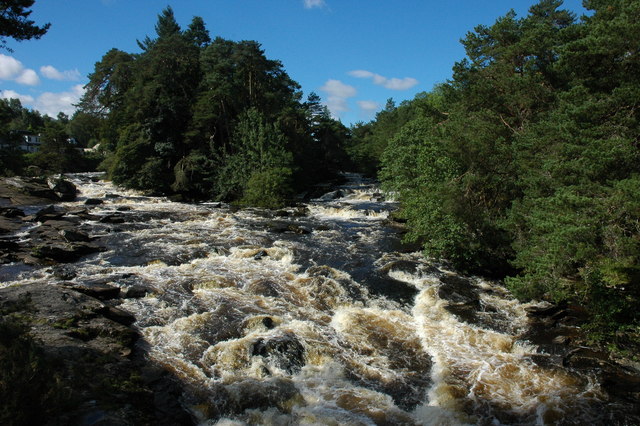
![]() This short walk takes you from the village of Killin to the beautiful Falls of Dochart. You start in the village centre and follow a footpath through the town and along the River Dochart to the falls. It's a lovely setting with the white water crashing against rocks and flowing around the pretty Islands of Inchbuie. The river is surrounded by attractive woodland, with the lovely backdrop of the Highland Mountains. You can also visit the old watermill and cross the pretty little bridge over the river for even better views in both directions.
This short walk takes you from the village of Killin to the beautiful Falls of Dochart. You start in the village centre and follow a footpath through the town and along the River Dochart to the falls. It's a lovely setting with the white water crashing against rocks and flowing around the pretty Islands of Inchbuie. The river is surrounded by attractive woodland, with the lovely backdrop of the Highland Mountains. You can also visit the old watermill and cross the pretty little bridge over the river for even better views in both directions.
The Falls are located at the western end of Loch Tay so it's easy to extend your walk and visit the loch from Killin. The long distance Rob Roy Way walk also runs past the falls so you could pick this up to extend your outing.
Postcode
FK21 8SL - Please note: Postcode may be approximate for some rural locationsFalls of Dochart Ordnance Survey Map  - view and print off detailed OS map
Falls of Dochart Open Street Map  - view and print off detailed map
Falls of Dochart OS Map  - Mobile GPS OS Map with Location tracking
Falls of Dochart Open Street Map  - Mobile GPS Map with Location tracking
Explore the Area with Google Street View 
Pubs/Cafes
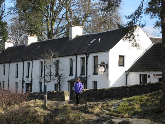
Head to the aptly named Falls of Dochart Inn for some post walk refreshments. The inn is set in a great location next to the falls. You can sit outside and relax listening to the rushing water. Inside there's a cosy interior with a wood burning fire for colder weather. The inn has some history too, dating all the way back to the 1700s when it was previously a blacksmiths. You can find the inn at postcode FK21 8SL for your sat navs.
Further Information and Other Local Ideas
The Killin to Callander Cycle Route starts in the town and passes the falls. The route runs along a disused railway line through beautiful Glen Ogle. As such most of the route is also suitable for walkers. Pick it up at the falls and then head south west through the forest towards the pretty Lochan Lairg Cheile to extend your exercise. There's also the Killin Railway Viaduct Walk which starts near the falls and heads north east to the old viaduct and the ruins of Finlarig Castle.
To the north you can explore the beautiful and peaceful Glen Lyon. The route takes you along the River Lyon to Loch Lyon with a visit to the lovely post office cafe in Bridge of Balgie at the start.
For more walking ideas in the area see the Loch Lomond and the Trossachs Walks page.


