Usk Valley Walk
![]()
![]() This super waterside walk follows the River Usk, the Monmouthshire and Brecon Canal and the Brecon and Newport Canal from Caerleon to Brecon. The walk passes through Abergavenny and Usk and is enclosed by beautiful hills for the whole of its length.
This super waterside walk follows the River Usk, the Monmouthshire and Brecon Canal and the Brecon and Newport Canal from Caerleon to Brecon. The walk passes through Abergavenny and Usk and is enclosed by beautiful hills for the whole of its length.
There are also splendid views of the Brecon Beacon mountains, particularly towards the end of the walk. The route is relativley flat as much of it takes place alongside the river or the canals, so there are only a few notable climbs.
The walk is waymarked using a white symbol of an otter's head, an animal you may well see on the river.
Usk Valley Walk Ordnance Survey Map  - view and print off detailed OS map
Usk Valley Walk Open Street Map  - view and print off detailed map
Usk Valley Walk OS Map  - Mobile GPS OS Map with Location tracking
Usk Valley Walk Open Street Map  - Mobile GPS Map with Location tracking
Pubs/Cafes
In the pretty Powys village of Llangynidr you could enjoy a pit stop at the Coach and Horses. This fine old coaching inn has an appealing interior with old beams, oak panelling and flagstone floors. Outside there's a peaceful garden overlooking the canal with stunning views over the local countryside. It's a great place to relax on a summer day after your exercise. You can find them on Cwm Crawnon Road with a postcode of NP8 1LS.
In Usk itself there's The Castle Inn. The inn includes an intimate dining area and a lovely outside garden and patio area for those summer days. They are located in a pleasant spot at 7 Twyn Square, NP15 1BH.
Just south of Usk there's the village of Newbridge on Usk where you can visit the Newbridge Inn. The inn sits in a fine riverside location with a excellent restaurant and good quality rooms if you need to stay overnight. You can find them at postcode NP15 1LY.
Further Information and Other Local Ideas
At the end of the route in Brecon you can enjoy a climb to the ancient Iron Age Hillfort and viewpoint at Pen y Crug, just to the north of the town. There's some excellent views over the River Usk Valley and the Brecon Beacons mountains from here.
Cycle Routes and Walking Routes Nearby
Photos
The Usk Valley Walk to the north of the town of Usk, the river is just the other side of the trees on the left. The route runs for about 48 miles so needs between 3 and 5 days for completion.
For part of the route between Llantrisant and Llanllywell the Usk Valley Walk follows the east bank of the river.
The ruin of a stone building beside the Usk Valley Walk near Pencelli.
Caerleon and the River Usk. A view over the valley and the town which marks the start point for the walk. There are a number of ancient Roman sites to explore in the town. The town is also not far from the rivermouth at Uskmouth which lies just to the south of Newport.
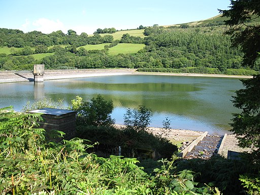
Talybont Reservoir. The trail passes just north of this large reservoir near Llangynidr. There are wonderful views of the Brecon Beacons and the Black Mountains around here.
Elevation Profile


