Benson Walks - River Walk
![]()
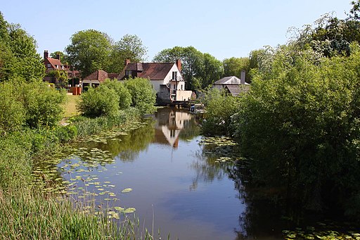
![]() This pretty South Oxfordshire village is in a great spot for riverside walks and exploring the Chilterns Hills AONB. There's also a noteworthy Norman church and an 18th century pub for refreshments after your exercise.
This pretty South Oxfordshire village is in a great spot for riverside walks and exploring the Chilterns Hills AONB. There's also a noteworthy Norman church and an 18th century pub for refreshments after your exercise.
This walk from the village follows a lovely section of the Thames Path to the neighbouring settlements of Shillingford, Little Wittenham and Dorchester. The walk runs for just under 6 miles, following a flat riverside path for most of the way.
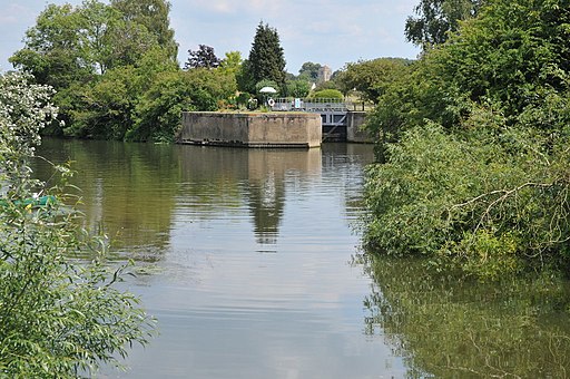
Highlights include the delightful Benson Lock, a peaceful spot where you can watch the boats pass through the village. There's also picturesque bridges, weirs and some lovely countryside views to enjoy on the way.
To continue your walking around Benson head south along the river to visit neighbouring Wallingford. The historic town is a fine place for a stroll with an interesting local musuem and a 15th century Town Hall and the ruins of the 11th century Wallingford Castle.
Postcode
OX10 6RP - Please note: Postcode may be approximate for some rural locationsBenson Ordnance Survey Map  - view and print off detailed OS map
Benson Open Street Map  - view and print off detailed map
Benson OS Map  - Mobile GPS OS Map with Location tracking
Benson Open Street Map  - Mobile GPS Map with Location tracking
Walks near Benson
- Dorchester Circular Walk - The delightful Oxfordshire town of Dorchester on Thames has some lovely footpaths to follow through the surrounding countryside and woodland
- Wallingford Circular Walk - This circular walk explores the countryside surrounding the riverside Oxfordshire town of Wallingford
- Stoke Row - This walk takes you around the pretty Oxfordshire village of Stoke Row
- Ewelme - This delightful Oxfordshire village sits in a lovely spot in the Chiltern Hills, close to the River Thames.
- Greys Court - This walk explores the area around the National Trust's Greys Court in Henley-on-Thames, Oxfordshire.
- Henley-on-Thames - The popular market town of Henley-on-Thames has a number of excellent waymarked trails to try
- Henley via Stonor Circular Walk - A circular walk from Henley visiting Stonor, Middle Assendon and the National Trust's Greys Court
- Nettlebed - This Oxfordshire village is surrounded by several large areas of woodland and some lovely Chilterns countryside
- Warburg Nature Reserve - This delightful nature reserve near Henley-on-Thames has some lovely woodland trails to try
- Oxfordshire Way - Take a trip through Oxfordshire and enjoy rivers, canals, pretty villages and beautiful countryside on this lovely trail
- Chiltern Way - This is the original 125 mile circuit of the Chilterns AONB taking you through Hemel Hempstead, Chalfont St Giles, Marlow, Hambleden, Turville, Fingest, Bix Bottom, Ewelme, the Ridgeway, Stokenchurch, Great Hampden, Aldbury, the Dunstable Downs Country Park, Sharpenhoe Clappers and Harpenden
- Turville - This circular walk explores the countryside surrounding the Chilterns village of Turville
- Fingest - This pretty little Buckinghamshire village is located in the Chilterns near Henley on Thames
- Ibstone - This Buckinghamshire based village is located in a pleasant rural spot in the Chiltern Hills, on the border with Oxfordshire
- Ipsden - This pretty little South Oxfordshire village is located in the Chiltern Hills near the town of Wallingford.
- The Ridgeway - Step back in time on this wonderful 85 mile route which follows an ancient chalk ridge route used by prehistoric man
Pubs/Cafes
The Crown Inn dates back to the 1700s and is a Grade II-listed, timber-framed former coaching inn. They have an outdoor seating area and also provide rooms if you would like to stay in the area. You can find them on the High Street at postcode OX10 6RP for your sat navs.
Further Information and Other Local Ideas
To the south east there's neighbouring Ipsden where you can explore the trails on Ipsden Heath and visit the 12th century Norman church.
Photos
View into Castle Square from the Oxford Road-Church Road junction. The village is often confused with RAF Benson, which is a well-known RAF station and airfield. The airfield boundary is adjacent to the village, and the aerodrome's construction closed the former "London Road". The RAF buildings are on the opposite side of the airfield to Benson village, adjacent to the village of Ewelme.


