Budworth Mere
![]()
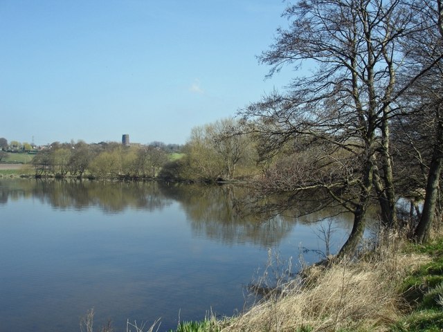
![]() This walk takes you along the boardwalk at Budworth Mere in Marbury Country Park. You can start the walk from the car park at the park and then head up to the eastern side of the lake. Here you'll find a boardwalk through the reed beds to a bird hide where you can look out for a variety of water loving birds.
This walk takes you along the boardwalk at Budworth Mere in Marbury Country Park. You can start the walk from the car park at the park and then head up to the eastern side of the lake. Here you'll find a boardwalk through the reed beds to a bird hide where you can look out for a variety of water loving birds.
The route then follows a footpaths along the southern side of the lake before returning to the car park.
The Great Budworth Walk starts from the nearby village and visits the mere before heading to the canal to the south.
Budworth Mere Ordnance Survey Map  - view and print off detailed OS map
Budworth Mere Open Street Map  - view and print off detailed map
Budworth Mere OS Map  - Mobile GPS OS Map with Location tracking
Budworth Mere Open Street Map  - Mobile GPS Map with Location tracking
Further Information and Other Local Ideas
The epic North Cheshire Way passes the park. You could pick it up and follow it north to Arley Hall where there's a fine stately home surrounded by beautiful gardens.
To the south is the splendid Anderton Boat Lift. This remarkable feat of engineering is located on the Trent and Mersey Canal and is one of the highlights of the area.
Just a couple of miles to the east you'll find Pickmere Lake. The pretty lake is a popular spot with swimmers and also has some nice footpaths along the southern side of the water.
For more walking ideas in the area see the Cheshire Walks page.


