Holt Heath National Nature Reserve
![]()
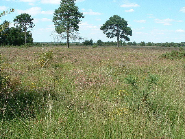
![]() Enjoy a walk through beautiful Dorset heathland in this delightful National Nature Reserve near Wimborne Minster. There are miles of good walking tracks taking you through over 1000 acres of woodland and heathland. In the summer the purple heather and gorse are really beautiful. The area is also fantastic for wildlife - look out for New Forest Ponies, Dartford warbler, Curlews, various reptiles and a variety of butterflies.
Enjoy a walk through beautiful Dorset heathland in this delightful National Nature Reserve near Wimborne Minster. There are miles of good walking tracks taking you through over 1000 acres of woodland and heathland. In the summer the purple heather and gorse are really beautiful. The area is also fantastic for wildlife - look out for New Forest Ponies, Dartford warbler, Curlews, various reptiles and a variety of butterflies.
This circular walk starts at the Whitesheet car park and follows footpaths across the heath to Cock's Moor Pond and Newman's Lane. You then pick up the Ferndown, Stour and Forest Trail to take you back to the car park through peaceful woodland.
If you'd like to continue your walking in the area then you could pick up the Castleman Trailway and head into the nearby Ferndown Forest for more peaceful woodland trails.
Postcode
BH21 7JZ - Please note: Postcode may be approximate for some rural locationsHolt Heath National Nature Reserve Ordnance Survey Map  - view and print off detailed OS map
Holt Heath National Nature Reserve Open Street Map  - view and print off detailed map
Holt Heath National Nature Reserve OS Map  - Mobile GPS OS Map with Location tracking
Holt Heath National Nature Reserve Open Street Map  - Mobile GPS Map with Location tracking
Explore the Area with Google Street View 
Further Information and Other Local Ideas
Just to the north of Wimborne there's the pretty village of Witchampton where you can visit the 19th century watermill on the River Allen. It's a picturesque spot with a 15th century church and the nearby Crichel Park to see as well.
Just to the north east is the nearby town of Verwood. Here you can enjoy a walk around Verwood Forest, the Cranborne Common Nature Reserve and the Stephen's Castle Nature Reserve where there's a lovely viewpoint.
For more walking ideas in the area see the Dorset Walks page.
Cycle Routes and Walking Routes Nearby
Photos
Holt Heath National Nature Reserve in late summer. View looking north from the Ferndown, Stour and Forest Trail.
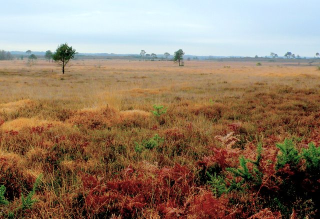
View across the north side of the heath from close to the road from Mannington to Holt. This is one of the largest tracts of heathland left in Dorset, now owned by the national Trust. Only 15 per cent of the original acreage of this rare habitat now remains in Dorset. Originally the local commoners' practice of grazing stock and gathering firewood kept the heath in this condition. Nowadays this has to be done artificially to preserve the heath and it rare flora and fauna. Thomas Hardy made this kind of heathland famous in his books such as Return of the Native.
Bull Barrow Tumulus SW of Crooked Withies. The tumulus almost merges into the hillside, although it is easier to see now they have cut down the gorse and other bushes that grew on it.


