Loch Kinord and Muir of Dinnet Walk
![]()
![]() Enjoy an easy circular walk around this delightful loch and nature reserve in the Cairngorms. There is a waymarked trail taking you through the woodland and along the loch situated in the Muir of Dinnet National Nature Reserve. The reserve is a wonderful place for flora and fauna with otters, goldeneye ducks, migrating geese and other wildfowl to look out for. There are also lots of interesting plants around the water including water lobelia, quillwort and shoreweed.
Enjoy an easy circular walk around this delightful loch and nature reserve in the Cairngorms. There is a waymarked trail taking you through the woodland and along the loch situated in the Muir of Dinnet National Nature Reserve. The reserve is a wonderful place for flora and fauna with otters, goldeneye ducks, migrating geese and other wildfowl to look out for. There are also lots of interesting plants around the water including water lobelia, quillwort and shoreweed.
Just to the north you can extend the walk by visiting Loch Davan. To the south you can pick up the Deeside Way in Dinnet. The shared cycling and walking route runs along a disused railway between Aberdeen and Ballater.
Postcode
AB34 5NB - Please note: Postcode may be approximate for some rural locationsLoch Kinord Ordnance Survey Map  - view and print off detailed OS map
Loch Kinord Open Street Map  - view and print off detailed map
Loch Kinord OS Map  - Mobile GPS OS Map with Location tracking
Loch Kinord Open Street Map  - Mobile GPS Map with Location tracking
Pubs/Cafes
Just to the east in Dinnet you can enjoy some post walk refreshments in the Loch Kinord Hotel. They serve high quality food and have a lovely garden area to sit out in if the weather is fine. You can find them on Ballater Road at postcode AB34 5LW.
Dog Walking
The loch and surrounding woodland is ideal for a dog walk.
Further Information and Other Local Ideas
Just a few miles to the east there's another nice trail along the Loch of Aboyne. Near here there's a bit of a hidden gem at the Dess Waterfall. The peaceful spot includes some nice woodland walks along the Dess Burn with picturesque falls to admire as well.
Head west to Ballater and you could pick up the popular 7 Bridges Walk.
A few miles to the south east there's the beautiful Glen Tanar to explore.
To the west there's the Cambus O May Forest where there's serene pine woodlands and picturesque lochans.
For more walking ideas in the area see the Cairngorms Walks page.
Cycle Routes and Walking Routes Nearby
Photos
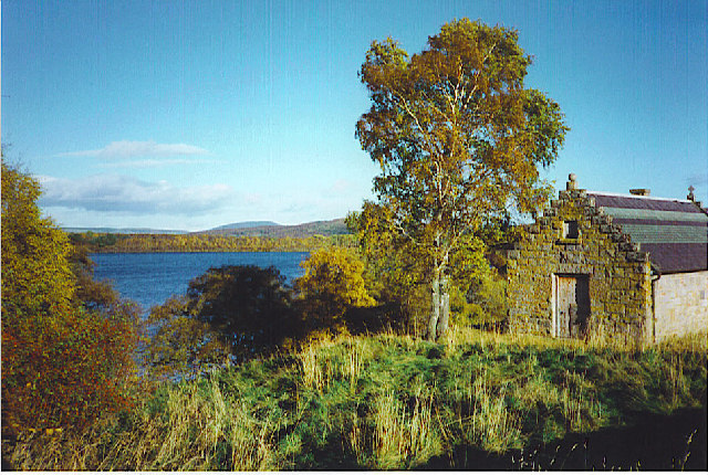
Meikle Kinord with the Loch beyond. Meikle Kinord is the group of buildings to the left. Loch Kinord beyond is a textbook example of a kettle hole. It was formed when a large block of ice became separated from a melting glacier and was buried by sand and gravel. When that ice finally melted, the sand and gravel that once lay on top of the ice collapsed, leaving a hollow (kettle hole) on the ground surface which later filled with water. The loch is relatively shallow with an average depth of about 2 metres.
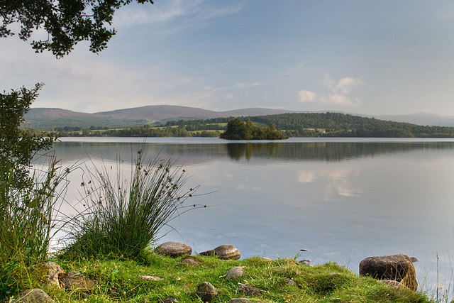
Loch view and the Crannog. The vegetation at the edge of the loch has been flattened in places by recent visitors. Through the gap can been seen a crannog. This is an artificial island created around 2,000 years ago. The island was created by pushing large oak trunks into the loch bed and piling layers of stone, earth and timber on top to form the base. A large hut was then built on stilts above the water. Its purpose was defensive. Normally, a causeway would lead from the crannog to the mainland. However, in times of attack, the causeway would be destroyed, leaving the occupants on the island on the loch and the attackers on the mainland. It is thought that many of the lochs in Scotland would have had such dwellings on them, but very few have survived.
Loch Kinord and the nearby Loch Davan were both formed when the last glaciers melted here more than 10.000 years ago. They are textbook examples of kettle holes. These were formed when large blocks of ice became separated from the melting glacier and were buried by sand and gravel. When that ice finally melted, the sand and gravel that once lay on top of the ice collapsed, leaving a hollow (kettle hole) on the ground surface which later filled with water. The lochs are relatively shallow. Loch Kinord has an average depth of about 2 metres. The shallow depth means that light can penetrate to the loch floor. Consequently, the loch has a rich flora with many species of aquatic plants recorded.
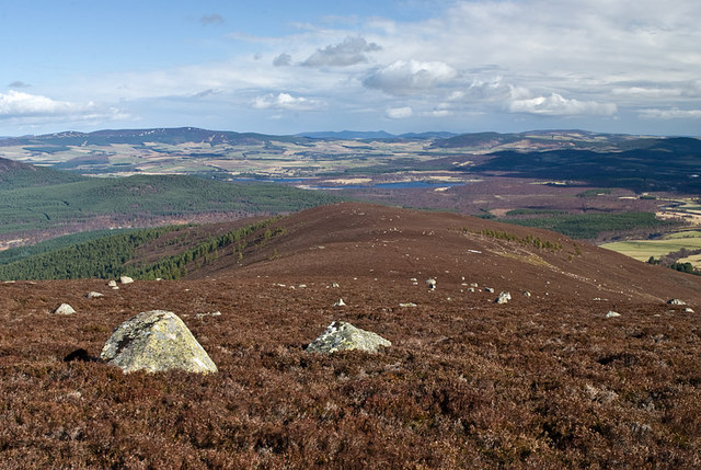
Little Tulloch. The house at Little Tulloch as seen from the track over to Glen Tanar. The loch lies beyond.


