Lough Leane And Ross Castle Walk
![]() This walk visits the historic Ross Castle on Lough Leane in the Killarney National Park, County Kerry.
This walk visits the historic Ross Castle on Lough Leane in the Killarney National Park, County Kerry.
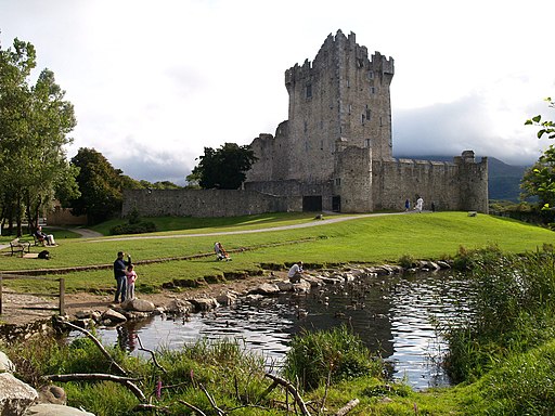
The impressive castle dates from the 15th century and has a fascinating history. You can enjoy a walk around the castle grounds and along the lakeside with wonderful views over the water to the surrounding mountains.
The lough is the largest of the three lakes of Killarney. Muckross Lake is the deepest and lies just to the south. It includes a fine 14km (8.7 mile) circular trail with views back to Lough Leane.
Lough Leane And Ross Castle Open Street Map  - view and print off detailed map
Ireland Walking Map - View All the Routes in the Country>>
Lough Leane And Ross Castle Open Street Map  - Mobile GPS Map with Location tracking
Further Information and Other Local Ideas
Just to the east there's Lough Guitane where there's a nice walking trail on the eastern side of the scenic lough.
To the north west there's Annascaul Lake on the Dingle Peninsula in County Kerry. The picturesque lake sits in a wonderful remote spot surrounded by mountains and a beautiful river valley. Here you can also pick up the Dingle Way, an epic circular walk classified as one of Ireland's National Waymarked Trails.
Also of interest is the popular climb to Carrauntoohil in the MacGillycuddy's Reeks mountain range. Here you can climb to the highest mountain in Ireland and enjoy some incredible views from the summit.
Just east of the lake you can pick up the Killarney to Kenmare Old Road Walk. The historic Old Road offers a sense of stepping back in time as you traverse the same route once used by travellers and traders.
Cycle Routes and Walking Routes Nearby
Photos
Ross castle, from Lough Leane. Ross Castle was built in the late 15th century by local ruling clan the O'Donoghues Mór (Ross), though ownership changed hands during the Second Desmond Rebellion of the 1580s to the MacCarthy Mór. He then leased the castle and the lands to Sir Valentine Browne, ancestor of the Earls of Kenmare.
The castle was amongst the last to surrender to Oliver Cromwell's Roundheads during the Irish Confederate Wars, and was only taken when artillery was brought by boat via the River Laune. Lord Muskerry (MacCarthy) held the castle against Edmund Ludlow who marched to Ross with 4,000 foot-soldiers and 200 horse; however, it was by water that he attacked the stronghold.
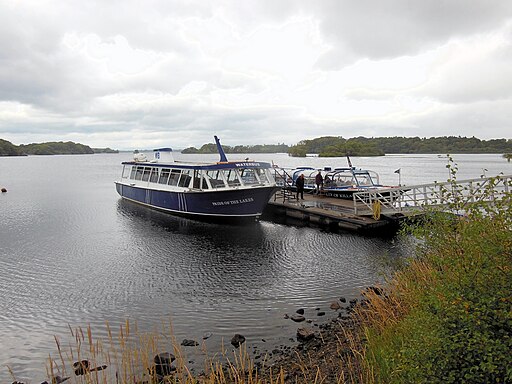
Pleasure Boats at the castle's pier. At the end of the wars, the Brownes were able to show that their heir was too young to have taken part in the rebellion and they retained the lands. By about 1688, they had erected a mansion house near the castle, but their adherence to King James II of England after the Glorious Revolution caused them to be exiled. The castle became a military barracks, which remained so until early in the 19th century. The Brownes did not return to live at Ross but built Kenmare House near Killarney.


