Torc Mountain
![]() Climb to Torc Mountain on this popular climb in the Killarney National Park.
Climb to Torc Mountain on this popular climb in the Killarney National Park.
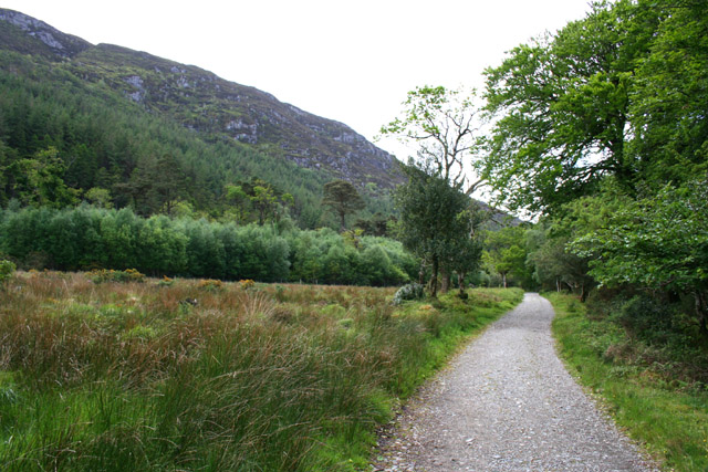
The mountain gets its name from the Irish word 'torc', meaning boar, after an enchanted boar was killed there by the legendary hero, Fionn mac Cumhaill. The hike to the summit takes place on good, waymarked paths with wooden sleepers near the mountain top. As such it's a very popular route that will suit most abilities.
This walk starts from the car park on the N71, near the south eastern edge of Muckross Lake. You could also start from Killarney town and follow the long distance Kerry Way to the mountain.
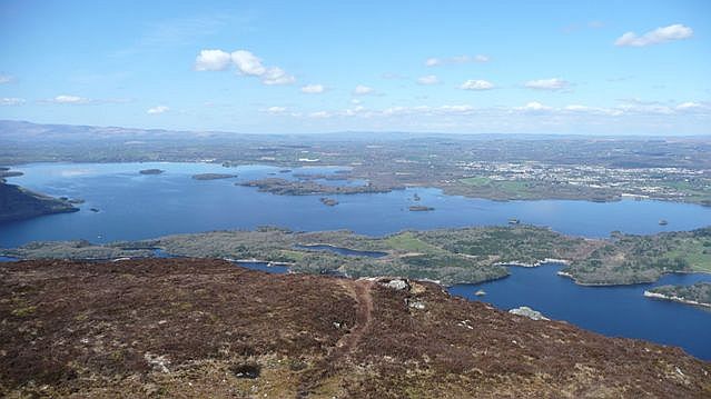
The route begins by heading south from the car park, passing along the Owengarriff River and the beautiful Torc Waterfall. You continue through pleasant, riverside woodland before coming off the Kerry Way and turning north along a path to the summit. From the 535m (1,755 ft) high point there are wonderful views over County Kerry, the three Lakes of Killarney and the town of Killarney. It really is a stunning sight and well worth the climb.
After taking in the views the route then descends back to the car park on the same paths.
After your exercise you could head to Muckross House and enjoy some well earned refreshments at the cafe. There's also the option to stroll around the pretty parkland which includes a lovely walled garden.
To extend your walking in the area try the circular trail around Mucross Lake. You can pick this up from the same car park and enjoy waterside sections along Lough Leane and Doo Lough. The Lough Leane And Ross Castle Walk visits an historic 15th century castle on the shores of the lough in this area too.
Torc Mountain Open Street Map  - view and print off detailed map
Ireland Walking Map - View All the Routes in the Country>>
Torc Mountain Open Street Map  - Mobile GPS Map with Location tracking
Further Information and Other Local Ideas
Just to the east there's Lough Guitane where there's a nice walking trail on the eastern side of the scenic lough.
Near the mountain you can pick up the Killarney to Kenmare Old Road Walk. The historic Old Road offers a sense of stepping back in time as you traverse the same route once used by travellers and traders.


