Harcamlow Way
![]()
![]() This long distance walk takes you to some of the most beautiful countryside, interesting historical sites and delightful country parks in the counties of Cambridgeshire, Essex and Hertfordshire.
This long distance walk takes you to some of the most beautiful countryside, interesting historical sites and delightful country parks in the counties of Cambridgeshire, Essex and Hertfordshire.
The route is a figure-of-eight, starting in Harlow and first heading to Saffron Walden where you will pass the splendid Jacobean mansion and gardens at Audley End. You continue through the Bartlow Hills, Horseheath, the Fleam Dyke and Milton Country Park to Cambridge. You return passing along the Wimpole Way where you pass the splendid Wimpole Hall and park. This 17th century country house has 3,000 acres (12 km˛) of parkland and farmland and is owned by the National Trust. You continue through Melbourn and Chrishall to Newport , and then on to Debden, Thaxted and Takeley. You then pass through the expansive Hatfield Forest.
There's over 1000 acres of footpaths and resident deer in this popular woodland area. The route then returns to the finish point at Harlow. Cyclists can enjoy the sections along the towpath on the River Stort and through Hatfield Forest.
Harcamlow Way Ordnance Survey Map  - view and print off detailed OS map
Harcamlow Way Open Street Map  - view and print off detailed map
Harcamlow Way OS Map  - Mobile GPS OS Map with Location tracking
Harcamlow Way Open Street Map  - Mobile GPS Map with Location tracking
Pubs/Cafes
In Harlow The Moorhen is located in a great spot. The riverside pub has a nice garden area where you can sit out and enjoy views over the river. They also do good food at reasonable prices. You can find them on Burnt Mill Lane with a postcode of CM20 2QS for your sat navs.
The historic town of Saffron Walden is a good place for a pit stop and a stroll. Here you could visit the Old English Gentleman which dates from the 19th century and was named CAMRA Regional Pub of the Year 2012. The pub includes a charming interior with a cosy fire and wood burner. Outside there's a sun trap patio garden for warmer days. You can find them on Gold Street with a postcode of CB10 1EJ for your sat navs. While in the town you could also take a small detour to visit the splendid Bridge End Gardens. There are seven interlinked 19th-century gardens here including a particularly fine Dutch garden. You can find them on Castle Street with a postcode of CB10 1BE for your sat navs.
In the attractive town of Thaxted there's The Maypole. The stylish pub does a great Sunday roast and has a nice garden area to sit out in on warmer days. You can find them at 31 Mill End with postcode CM6 2LT for your sat navs. The town is also worth exploring with a number of historic half timbered houses, a 14th century Guildhall, 16th century almshouses and a picturesque windmill.
Further Information and Other Local Ideas
At the start of the walk in Harlow the trail links with the Stort Valley Way. Here you can enjoy easy walking along the river/canal with a visit to the pretty Pishiobury Park near Sawbridgeworth. See the Harlow Walk for more details.
For more walking ideas in the area see the Cambridgeshire Walks, Essex Walks and Hertfordshire Walks pages.
Cycle Routes and Walking Routes Nearby
Photos
Part of the 140 mile figure of 8 walk starting and finishing in Harlow. This path leaves Thaxted by John Webb's windmill and heads south to Dutton Hill about 5 miles away
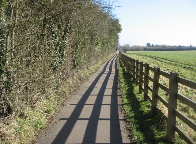
A metalled cycleway to the west of Cambridge. The tower of the University Library can be seen in the distance, as is often the case.


