Graiguenamanagh to St Mullins Walk
![]() This walk follows a popular section of the Barrow Way from Graiguenamanagh to St Mullins in County Carlow.
This walk follows a popular section of the Barrow Way from Graiguenamanagh to St Mullins in County Carlow.
The route starts in Graiguenamanagh and heads south, running along the River Barrow for a distance of just under 8km (4.5 miles). It's a particularly scenic stretch of the river which inlcudes the Barrow Navigation Canal where there are some pretty locks. It's a fairly flat path with some sections suitable for cycling.
The walk finishes at the historic village of St Mullins which also marks the end of the Barrow Way.
Graiguenamanagh to St Mullins Walk Open Street Map  - view and print off detailed map
Ireland Walking Map - View All the Routes in the Country>>
Graiguenamanagh to St Mullins Walk Open Street Map  - Mobile GPS Map with Location tracking
Further Information and Other Local Ideas
To the west is the city of Kilkenny where you can try the Kilkenny River and Canal Walk. The easy waterside walk also takes you past the 12th century castle with its lovely grounds and gardens.
You can also pick up the waymarked Nore Valley Walk starts in the city.
The Brandon Hill Loop starts in Graiguenamanagh. The circular waymarked trail climbs to the summit of the the highest mountain in County Kilkenny. There are great views over the countryside to the coast from this fine vantage point.
Cycle Routes and Walking Routes Nearby
Photos
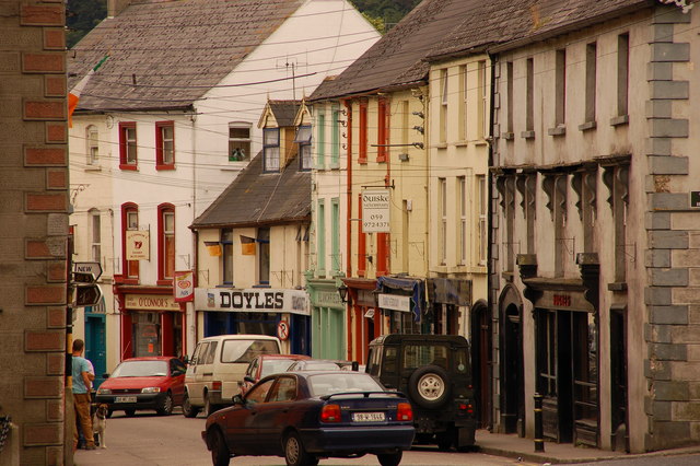
Upper Main Street, Graiguenamanagh. Graiguenamanagh dates from 1204 and the foundation of Duiske Abbey by Cistercian monks. Today it is a small town, with narrow streets, on the road from New Ross to Bagenalstown. This is Upper Main Street looking towards Tinnahinch.
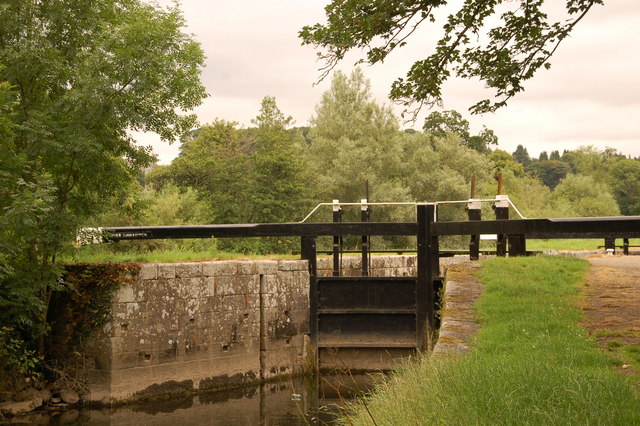
Upper Tinnahinch lock, Barrow navigation. There are a number of locks on the Barrow navigation. This is entrance to Upper Tinnahinch looking towards Graiguenamanagh.
The Barrow river at Saint Mullins. The village is named after Saint Moling (or Mo Ling, 614–697), who founded a monastery there in the early 7th century. The monastery was said to have been built with the help of "Gobán Saor", the legendary Irish builder.
As well as being visited by anglers, St. Mullins is one of the stop-off points for pleasure barges and cruisers who transit the River Barrow. The building of the canal on the Barrow began here in 1750 and the Old Grain Store was built to store goods coming up the river from the sailing ships in New Ross.
Saint Muilins Monastery. A fantastic old Monastery and graveyard situated in the Barrow valley, not far from Graiguemanagh village. This site contains many interesting items to see.
A 9th-century high cross, showing the crucifixion and a Celtic spiral pattern, stands outside the remains of the abbey. There are also the remains of a Norman motte and some domestic medieval buildings, including one that has an unusual diamond-shaped window. St Moling's Mill and St Moling's Well are closeby.


