Brandon Hill Loop
![]() This circular walk climbs to Brandon Hill from the town of Graiguenamanagh in County Kilkenny.
This circular walk climbs to Brandon Hill from the town of Graiguenamanagh in County Kilkenny.
The hill is the highest mountain in County Kilkenny and provides some wonderful views over the landscape. You can see as far as Hook Head to the south and the Comeraghs in the distance to the west.
The trail runs for about 16km, starting in Graiguenamanagh and then heading south through woodland to the hill top.
The Barrow Way and the South Leinster Way long distance trails both pass the hill. You could pick up these long distance trails to extend your walk.
Brandon Hill Loop Open Street Map  - view and print off detailed map
Ireland Walking Map - View All the Routes in the Country>>
Brandon Hill Loop Open Street Map  - Mobile GPS Map with Location tracking
Cycle Routes and Walking Routes Nearby
Photos
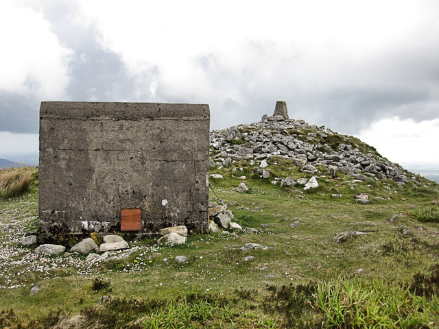
Brandon Hill Summit. The hill marks the conclusion of the chain of granitic mountains that emerge from the shores of Dublin Bay. The base of Brandon Hill, extending from the side of the River Barrow to Graigue, is predominantly composed of schist rock. This schistus, characterized by its blackish hue and siliceous nature, occasionally contains quartz grains. When fractured, it exhibits a shivery texture and possesses sufficient hardness to scratch glass. Additionally, there are several layers of marble and limestone gravel situated near the mountain's base.
Goats and Blackstairs. Findings concerning the early inhabitation of the Brandon Hill uplands emerged following ground and aerial surveys conducted by Michael Gibbons, an archaeologist affiliated with the Board of Works, in 1989. The surveys revealed that the slopes of Brandon were settled over four thousand years ago. Various prehistoric remnants, including cairns, house sites, field systems, and a substantial ritual enclosure, were identified on its slopes. Additionally, the surveys uncovered two Norman moated sites located on the lower slopes in the Ballyogan townland area. These sites featured long rectangular buildings and were likely granges or farms associated with Duiske Abbey, estimated to be around 600 years old.


