Lough Dan Walk
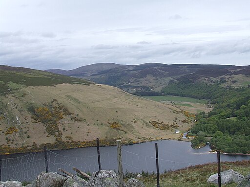
![]() This walk visits the beautiful Lough Dan near Roundwood in County Wicklow. The ribbon shaped lake is a popular venue for walkers with nice woodland trails and views of the surrounding mountains.
This walk visits the beautiful Lough Dan near Roundwood in County Wicklow. The ribbon shaped lake is a popular venue for walkers with nice woodland trails and views of the surrounding mountains.
Start the walk from one of the parking areas on the R759, just to the east of Lough Tay. From here you can pick up tracks heading west along the northern side of the Cloghoe River to the lake. You could also follow the Ballinrush Track on the southern side of the river if you prefer. This can be seen on the map link below.
The trails lead to the north western end of the lake which is part of the Wicklow National Park. Here you can enjoy views of the Inchavore river which flows into the reservoir.
The lake and surrounding area are great for wildlife watching too. The Inchavore River attracts Dippers and Grey Wagtails while Herons and Cormorants roost near the mouth of the Cloghoge River. Also look out for Peregrine Falcon sites on the steep cliffs overlooking the lake on the eastern side.
and some lovely broad-leaved woodland in the Inchavore Valley.
If you'd like to extend the walk you could climb to Knocknacloghoge mountain just to the north of the water. There's splendid views over the area from this elevated position. The climb to Luggala Mountain also starts from the same car park. There's more great views over the Lough from the summit.
To continue your lakeside walking in the area, just head east to visit Vartry Reservoir. There's some good surfaced trails around the upper and lower reservoirs with lots of wildlife to look out for on the way.
Also nearby is the Lough Bray Loop, Crone Woods and Powerscourt Waterfall. It's located in a beautiful spot on the River Dargle and is the highest waterfall in Ireland.
Lough Dan Open Street Map  - view and print off detailed map
Ireland Walking Map - View All the Routes in the Country>>
Lough Dan Open Street Map  - Mobile GPS Map with Location tracking
Further Information and Other Local Ideas
Just to the east of Luggala there's the expansive Ballinastoe Forest where there are miles of walking and mountain bike trails to try. The boardwalk trail will take you to the wonderful Luggala Estate View Point and the J B Malone Memorial. Malone was an Irish hill-walking enthusiast who popularised the pastime through his television programmes and books. From here you can also continue up to Djouce Mountain for some excellent views over the Wicklow Mountains.
The epic Wicklow Way passes the lough. You could pick up this waymarked trail to further explore the area.
To the south west is the beautiful heart shaped lake of Lough Ouler. In this area you can also visit the Glenmacnass waterfall and enjoy a climb to the stunning viewpoint at Tonelagee.
Cycle Routes and Walking Routes Nearby
Photos
View of the valley between Lough Tay and Lough Dan. This is the view just to the north east of the lough as seen from J.B Malone memorial on Djouce. Visible in the picture is Lough Tay in the bottom right, the slopes of Luggala and Knocknacloghoge on the right hand side, Kanturk in the above right and Ballinafunshoge in the above left. Also visible is the rock in which the J.B Malone memorial is situated on, and the tourist viewing area of Lough Tay.


