Waterford Greenway Map - Cycle and Walking Route
![]() Enjoy a cycle or walk along this disused railway line between Waterford and Dungarvan.
Enjoy a cycle or walk along this disused railway line between Waterford and Dungarvan.
The route runs for about 46km along a multi user path with fine views of the River Suir, the River Mahon and the coast to enjoy.
Starting in Waterford the route runs past Mount Congreve, Kilmeaden and Kilmacthomas. This interesting town lies on the River Mahon and includes the noteworthy Kilmacthomas Viaduct. The final section runs along the beautiful Copper Coast, a geopark which extends for some 17 km from Kilfarrasy in the east to Stradbally in the west.
Waterford Greenway Open Street Map  - view and print off detailed map
Ireland Walking Map - View All the Routes in the Country>>
Waterford Greenway Open Street Map  - Mobile GPS Map with Location tracking
Further Information and Other Local Ideas
Also in the city is the May Park Trail Waterford River Walk. The easy trail runs along a surfaced path to the south east of the harbour.
Head south to the coast and you could pick up the popular Dunmore East Cliff Walk. This wonderful cliff top trail takes you to Portally Cove, Rathmoylan Cove and Ballymacaw Cove on a well maintained path. Near here there's also the Doneraile Cliff Walk in Tramore. The coastal village includes a nice sandy beach with dunes as well. Just east of here you can also see the oldest working lighthouse in the world at Hook Head. It's well worth a visit with guided tours and a maritime exhibition to see. The walk also visits the historic Slade Harbour and castle, which dates back to the 15th century.
To the west are the stunning Comeragh Mountains where you can try the popular Coumshingaun Lake Loop Walk or visit the picturesque Mahon Falls.
Head west from Waterford to Carrick-on-Suir and you could pick up the Suir Blueway. This shared cycling and walking trail runs along the River Suir between Carrick-on-Suir and Clonmel.
Cycle Routes and Walking Routes Nearby
Photos
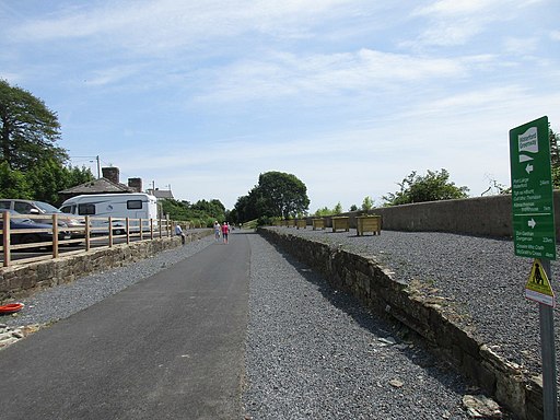
The remains of the former Durrow and Stradbally station.
Built by the Waterford, Dungarvan and Lismore Railway Company and opened in 1872. The line was closed completely in 1967 but this section was then reopened to serve a magnesite factory at Ballinacourty finally closing in 1987 though regular traffic had ceased a few years earlier. The trackbed now forms the Waterford Greenway cycle and walking route.


