Lahinch Beach and Cliff Walk
![]() This walk visits the town of Lahinch on Liscannor Bay, on the northwest coast of County Clare. The walk first takes you along the beach before following the Burren Way to the Cliffs of Moher, one of the walking highlights of the area.
This walk visits the town of Lahinch on Liscannor Bay, on the northwest coast of County Clare. The walk first takes you along the beach before following the Burren Way to the Cliffs of Moher, one of the walking highlights of the area.
The walk starts at the car parking area on the seafront in Lahinch. You can then stroll north along the promenade and the beach with the golf course on your right. The route then crosses the Inagh River on O'Brien's Bridge before heading through the countryside to Liscannor with fine views over Liscannor Bay.
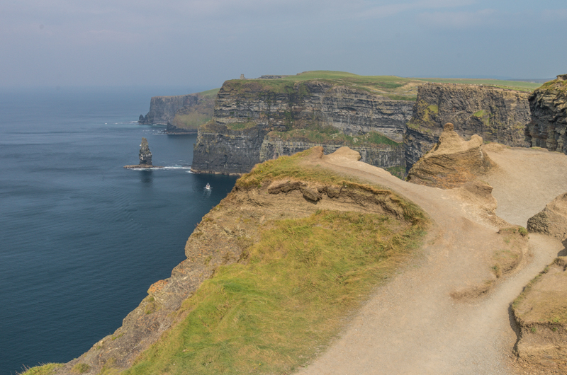
The route then continues north west to the coast where you pick up the Doolin Cliff Walk which will takes you along the Cliffs of Moher. On the wonderful cliff top path there's fabulous views over the Atlantic coast and a large variety of sea birds to look out for.
After exploring the cliffs you can then catch a bus back to Lahinch from the Cliffs of Moher coach park.
Lahinch Beach and Cliff Walk Open Street Map  - view and print off detailed map
Ireland Walking Map - View All the Routes in the Country>>
Lahinch Beach and Cliff Walk Open Street Map  - Mobile GPS Map with Location tracking
Further Information and Other Local Ideas
To the south you can pick up the popular Kilkee Cliff Walk. The coastal path provides views of the Aran Islands to the North, Kerry to the South and back to Loop Head to the south west.
Head east into the heart of the Burren National Park and you could try the Lough Avalla Farm Loop. Another well trodden path it winds through the historic site of an ancient Celtic farm and briefly follows the picturesque shoreline of Lough Avalla. Near here there's also Lough Bunny, a Special Area of Conservation with stunning views of Mullaghmore Mountain.
Also nearby is the delightful village of Spanish Point where you can enjoy a walk along the fine local beach.
Head east and you can pick up the Clareabbey River Walk. The trail takes you along the River Fergus with fine views of the ancient Augustinian monastery. There's also the Ennis River Fergus Walk in the nearby town of Ennis. To the north of Ennis you'll also find the pretty Ballyalla Lake. There's a nice lakeside walk, picnic areas and kayaks to hire in this delightful scenic spot.
The Ennistymon Falls Walk can be found in the neighbouring village of Ennistymon. Here you'll find a series of pretty cascades on the River Inagh.
Cycle Routes and Walking Routes Nearby
Photos
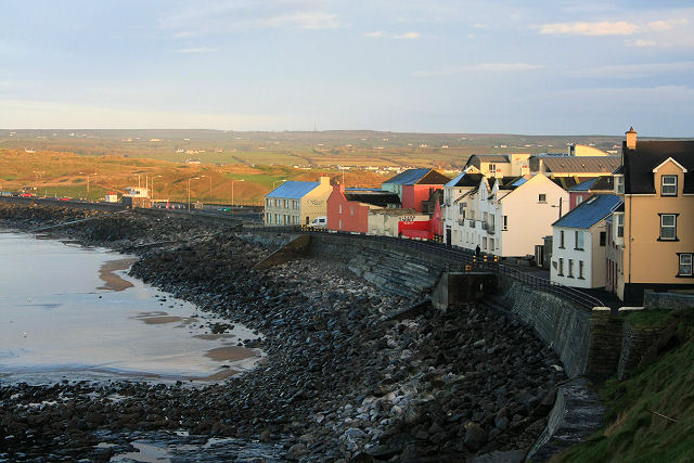
Lahinch seafront. The Ordnance Survey of Ireland and Clare County Council appear unable to agree on the spelling of this small town on the coast of Liscannor Bay. Locals are convinced it should be 'Lahinch', but some signs and most maps state 'Lehinch'. This view of the multi-coloured houses on the seafront is taken from the road leading south towards Milltown Malbay.


