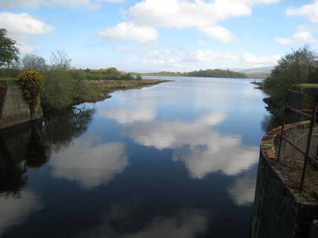
Lough Allen
![]() This walk takes you around the lovely Lough Allen in County Leitrim. It uses the Leitrim Way and the Miner's Way long distance footpaths to create a long circular walk around the Lough. You'll pass through some nice countryside above the Lough with some waterside sections and views of the River Shannon to enjoy also.
This walk takes you around the lovely Lough Allen in County Leitrim. It uses the Leitrim Way and the Miner's Way long distance footpaths to create a long circular walk around the Lough. You'll pass through some nice countryside above the Lough with some waterside sections and views of the River Shannon to enjoy also.
The walk starts from the small town of Drumshanbo at the southern end of the lough. From here you can pick up the Leitrim Way and follow it north through the countryside to the east of the water. Shortly after passing Dowra you turn south west along a section of the Miner's Way. This will take you to the village of Drumkeeran, located at the foot of Corry Mountain at the north western end of the lake. Here you turn south passing Seltannasaggart Mountain part of the Arigna Mountains. It's located on the border of County Roscommon and County Leitrim in Ireland and is the highest point of County Roscommon.
You continue south past the moorland of Ardlougher to the village of Arigna. The village has a long association with the mining industry. Mining was carried out in Arigna for over 400 years until the mines were shut in 1990.
The final section takes along the Arigna River to the lough side where you cross the River Shannon before returning to Drumshanbo.
The route runs for just over 30 miles so is best completed over two days. It's a reasonably level trail for most of the way, though there are some moderate climbs too.
At the southern end of the lake near Drumshanbo you can pick up another waterside footpath along the Lough Allen Canal to Acres Lough and Leitrim. See the Drumshanbo to Leitrim Walk for more details.
Lough Allen Open Street Map  - view and print off detailed map
Ireland Walking Map - View All the Routes in the Country>>
Lough Allen Open Street Map  - Mobile GPS Map with Location tracking
Further Information and Other Local Ideas
Head north into Donegal and you could visit one of the highlight's of the area at Slieve League. Here you'll find a spectacular coastal path along some of the highest cliffs in Europe.
To the south there's more nice waterside trails around the grounds of Lough Rynn Castle. The castle has 350 acres of parkland and gardens to explore.
Head west and there's a splendid historical highlight at Carrowkeel in the Bricklieve Mountains. The site includes a cluster of Neolithic passage tombs dating from the 4th millennium BC.
To the north west there's Lough Gill where there's some pleasant lakeside trails, woodland paths and lots of birds to look out for on the lough's islands. You can pick up the long distance Sligo Way here too.
To the north you can pick up the Cavan Way in Dowra. The waymarked walk will take you through the wonderful Cavan Burren Park with its fascinating geological features.
To the east there's pleasant waterside walking on the Ballyconnell Canal Walk. The easy walk runs along the canalised section of the Woodford River. There's also the Ballinamore Canal Walk where you can enjoy a stroll along the Shannon Erne Waterway.
Just south of Leitrim you can enjoy some pleasant waterside walking along the River Shannon in the historic town of Carrick On Shannon.
To the south west you'll find Lough Key Forest Park. The park includes lakeside walks and several nature trails, including the popular Tree Canopy Walk, an elevated walkway through the trees.


