Cheshire Cycle Routes
Cheshire has some splendid scenery and plenty of attractive villages to visit.
Some of the best cycling in the county can be found on the Cheshire Cycleway which runs for 176 miles through some of the prettiest villages and most attractive scenery in Cheshire.
Use the links to view full route information including elevation profiles, interactive maps and GPS downloads.
You can also view an overview map of all the routes in the using the Cheshire Cycle Map>>
There are several National Cycle Networksigned routes in the county many of which have been mapped and can be viewed and downloaded below.
For more information on cycle routes in Cheshire including tips, advice and free cycle maps please click here
*New* - Walks and Cycle Routes Near Me Map - Waymarked Routes and Mountain Bike Trails>>
| Route Name | Photo | Distance | Description |
| Along the River Dee from Chester to Connah's Quay | 6.2 miles (10 km) | Follow the River Dee from England into Wales on this easy waterside walk or cycle. The route starts on the England and Wales border at Chester and follows a good riverside path to Connah's Quay in Wales. You'll pass Saltney Bridge and Queensferry Bridge before finishing at Hawarden Bridge at Connah's Quay. It's a good surfaced path which is great for cyclists looking for a safe, traffic free ride. It runs along National Cycle Route 568 with nice views of the surrounding countryside. Near the end of the route you'll find the delightful Wepre Park. You could extend your exercise by exploring the 160 acre country park with its river, waterfall and the 12th century ruins of Ewloe Castle. Also nearby is the fascinating ruins of Flint Castle with views over the Dee Estuary. In Chester you can explore the city on the Chester Walls Walk. There's much to enjoy with more views of the River Dee and a visit to a number of interesting historical sites. View Full Details>> | |
| Biddulph Valley Way | 13.7 miles (22 km) | This circular route starts in Congleton and first follows the Biddulph Valley Way (a traffic free disused railway path) before turning round to return to Congleton. The route runs for just over 12 miles with views of the Macclesfield Canal and the Cheshire countryside. You'll also pass close to Biddulph Grange Country Park and Greenway Bank and Knypersley Reservoir which are well worth a small detour from the route. View Full Details>> | |
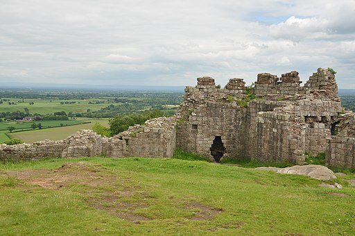
| Bishop Bennet Way | 32.3 miles (52 km) | The Bishop Bennet Way is a shared walking and cycling path running from Beeston in Cheshire to Wirswall on the Shropshire borders.
The route starts at the 13th century Beeston Castle and proceeds through Milton Green, Churton and Shocklach where you will pass the Grade I listed Norman church. View Full Details>> | |
| Burton Marshes Greenway | 6.6 miles (10.6 km) | This route in Cheshire follows a dismantled railway and National Cycle Route 568 from Neston to the Deeside Industrial Park. View Full Details>> | |
| Buxton to Marple | 19.9 miles (32 km) | Follow National Cycle Route 55 and Cycle Route 68 from Buxton in the Peak District to the lovely town of Marple in Cheshire. Highlights on this route include the beautiful Peak District scenery and the Middlewood Way - an off road path passing by the Macclesfield Canal. View Full Details>> | |
| Cheshire Cycleway | 182.1 miles (293 km) | This popular long distance circular cycle route explores the county of Cheshire on a series of country lanes. View Full Details>> | |
| Chester Loop | 6.2 miles (10 km) | A lovely short circular route around the attractive county town of Chester. View Full Details>> | |
| Chester Millennium Greenway | 7 miles (11.3 km) | This shared cycling and walking trail runs along an old railway line from Chester to the Wharf at Connah's Quay. View Full Details>> | |
| Chester to Ellesmere Port | 7.5 miles (12 km) | Follow the Shropshire Union Canal and National Cycle Route 5 from Chester to Ellesmere Port on this short easy ride. On the route is the excellent Chester Zoo which is well worth a visit. The ride finishes by the Manchester Ship Canal and the River Mersey so is perfect if you enjoy water based rides. View Full Details>> | |
| Chester to Frodsham | 17.4 miles (28 km) | Follow National Cycle Route 5 on this fairly easy short route through Cheshire which passes the impressive Chester Zoo. View Full Details>> | |
| Chester to Llandudno | 49.7 miles (80 km) | This super cycle ride takes you from England into Wales along National Cycle Route 5. The route runs for about 50 miles with long coastal runs and traffic free sections. The ride starts in Chester and begins with a nice waterside run along the Shropshire Union Canal to Abbot Meads. Here you pick up the trackbed of an old disused railway to take you west through Blacon. The traffic free path takes you all the way to Connah's Quay with views of the River Dee. The next section follows quiet roads to Bagillt, where you leave the river to head inland to Holywell Common and Brynford. You continue west to Whitford and Gronant where you pick up the coastal trail. There's a nice traffic free path to follow through Prestatyn, Rhyl, Colwyn Bay before passing Little Orme and finishing in Llandudno. View Full Details>> | |
| Chester to Neston | 13.7 miles (22 km) | Follow the Cheshire Cycleway from Chester to Neston on this short easy route. The route follows quiet roads and some off road paths which include a stretch along the Shropshire Canal and the Wirral Way. View Full Details>> | |
| Chester to Northwich | 31.1 miles (50 km) | This ride follows National Cycle Route 5 through Cheshire which passes the impressive Chester Zoo. View Full Details>> | |
| Chester to Rhyl | 34.2 miles (55 km) | Travel from England to Wales along National Cycle Route 5 on this attractive and fairly flat ride. You start off in Chester with a lovely long traffic free section which takes you along the Shropshire Union Canal to Blacon where you join a dismantled railway line taking you to Connah's Quay on the River Dee. You then follow the river to Bagilt where you'll pass Flint Castle and the Dee Estuary, before heading through the North Wales countryside to Gronant on the coast. The ride finishes with a lovely traffic free section along the coast passing through Prestatyn and finishing at Rhyl on the seafront. The ride is easily accessible with train stations at either end of the route. You can also link up with National Cycle Route 84 in Rhyl - it will take you along the River Clwyd to St Asaph. View Full Details>> | |
| Chester to Runcorn | 26.1 miles (42 km) | This ride follows National Cycle Route 5 through Cheshire which passes the impressive Chester Zoo. View Full Details>> | |
| Delamere Forest | 3.1 miles (5 km) | Enjoy miles of walking and cycling trails in this 2,400 acre forest on the Cheshire Plain, near Frodsham. For walkers there's several easy waymarked trails to try. Cyclists can enjoy challenging mountain bike trails or easy family trails. The trails are well marked and cycle hire is available from TRACS (UK) situated just the left-handside of the forest centre car park. You can see details of all the trails on the open street map link below. This circular walk starts from the Linmere car park and takes you around Blakemere Moss Lake. Look out for wildlife including greater spotted woodpecker, black headed gulls, dragonfly and various butterflies. View Full Details>> | |
| Knutsford to Macclesfield | 17.4 miles (28 km) | This route follows quiet country lanes and the Cheshire Cycleway before a lovely off road stretch on the Middlewood Way takes you into Macclesfield. On the way you will pass the Macclesfield Canal and the town of Bollington. In Knutsford you can also enjoy miles of good cycling trails at Tatton Park. Cycle hire is available here too. View Full Details>> | |
| Liverpool to Neston | 26.1 miles (42 km) | Follow National Cycle Route 56 on this interesting and varied ride. You start in Sefton Park and head towards the river where a riverside path takes you past Albert Dock to the Seacombe Ferry. Here you cross the Mersey and join another off road section taking you past New Brighton, Wallasey and into Birkenhead. The route continues through the Wirral on a mixture of quiet roads and traffic free paths before finishing at Neston railway. View Full Details>> | |
| Liverpool to Warrington | 28 miles (45 km) | This ride takes you along National Cycle Route 62 and the Trans Pennine Trail from Liverpool to Warrington via Widnes. View Full Details>> | |
| Llangollen Canal | 49.1 miles (79 km) | Enjoy a waterside walk or cycle along the Llangollen Canal. The canal runs from Llangollen in Wales to Hurleston Reservoir near Nantwich in Cheshire. You can walk along the canal towpath from start to finish, while cyclists can enjoy the section from Llangollen to Chirk using National Cycle Network routes 85 and 84. This first section starts at the wonderful Horseshoe Falls just to the west of Llangollen. You then head through Llangollen to the wonderful Pontcysyllte Aqueduct where the canal is carried over the valley of the River Dee. The magnificent structure is the longest and highest aqueduct in Britain and a World Heritage Site. There are wonderful views of the Dee Valley and up to the medieval Castell Dinas Bran from this major highlight on the route. You can explore the Aqueduct by clicking on the google street view link below. You continue to Chirk where you will pass the National Trust owned Chirk Castle. The castle has award-winning gardens and a 460 acre estate to explore so is well worth the small detour from the canal. The next section runs to Ellesmere passing Hindford and the pretty Frankton Locks on the way. At Frankton Junction you can pick up the Montgomery Canal which runs to Newton. When you reach Ellesmere you will pass close to the lovely Ellesmere Lake where you can enjoy lakeside and woodland walks. You continue east to Whitchurch passing the delightful Colemere Country Park, the Ellesmere Canal and Bettisfield on the way. View Full Details>> | |
| Macclesfield to Congleton | 21.7 miles (35 km) | This lovely ride follows the Cheshire Cycleway through Cheshire. You start in Macclesfield and head to Congleton on country roads with views of the Macclesfield canal and the River Dane as you go. You will also pass the 15th century Gawsworth Hall, Redesmere, and Astbury Mere Country Park on this route. View Full Details>> | |
| Macclesfield to Marple - Middlewood Way | 11.2 miles (18 km) | Follow the Middlewood Way - a lovely off road cycle and walking path running from Macclesfield to Marple and passing by the Macclesfield Canal. View Full Details>> | |
| Macclesfield to Stoke-on-Trent | 28.6 miles (46 km) | This lovely ride follows National Cycle Route 55 through Cheshire to Staffordshire. View Full Details>> | |
| Manchester to Buxton | 36 miles (58 km) | Follow National Cycle routes 6, 62 and 55 through Manchester, Cheshire and Derbyshire on this lovely ride. You start by Manchester Oxford Road station heading south through Chorlton to the River Mersey. Here you join a lovely traffic free section along the Trans Pennine Trail which takes you to Stockport. You then pass through Bredbury where you join another off road stretch by the River Goyt taking you onto Marple where you join the Middlewood Way - a lovely off road cycle path running along the Macclesfield Canal to Bollington and Macclesfield. View Full Details>> | |
| Manchester to Liverpool | 46.6 miles (75 km) | This ride takes you along National Cycle Route 62 and the Trans Penine Trail between these two major Northern cities. You start by Manchester Oxford Road station heading south through Chorlton to the River Mersey. A lovely off road section along the river follows, passing Sale Water Park on the way. More off road paths and quiet roads take you through Trafford to Altrincham where you join a lovely traffic free section along the trail and the River Mersey which takes you through Warrington and Widnes. View Full Details>> | |
| Manchester to Macclesfield | 28 miles (45 km) | Follow National Cycle routes 6, 62 and 55 through Manchester and Cheshire on this lovely ride. You start by Manchester Oxford Road station heading south through Chorlton to the River Mersey. Here you join a lovely traffic free section along the Trans Pennine Trail which takes you to Stockport passing Chorlton Water Park on the way. You then pass through Bredbury where you join another off road stretch by the River Goyt which takes you to Marple. At Marple you then join the Middlewood Way - a lovely off road cycle path running from Macclesfield to Marple and passing by the Macclesfield Canal and the town of Bollington. View Full Details>> | |
| Manchester to Marple | 17.4 miles (28 km) | Follow National Cycle routes 6, 62 and 55 through Manchester and Cheshire on this lovely ride. View Full Details>> | |
| Manchester to Warrington | 23.6 miles (38 km) | This ride takes you along National Cycle Route 62 and the Trans Penine Trail from Greater Manchester into Cheshire. You start by Manchester Oxford Road station heading south through Chorlton to the River Mersey. A lovely off road section along the river follows, passing Sale Water Park on the way. More off road paths and quiet roads take you through Trafford to Altrincham where you join a lovely traffic free section along the trail and the Bridgwater Canal to Lymm. The final stretch into Warrington follows the Manchester Ship Canal, finishing at the tourist information centre. View Full Details>> | |
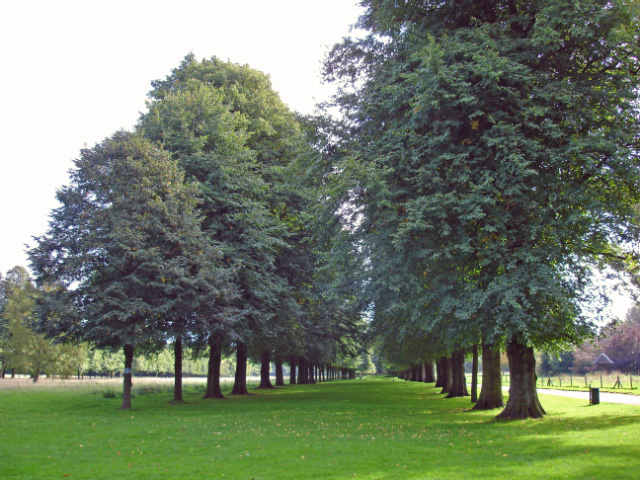
| Marbury Country Park | 1.9 miles (3 km) | This splendid country park is in a beautiful location in Northwich, Cheshire. The park contains magnificent Lime avenues, an Arboretum and the delightful Budworth Mere. The Trent and Mersey Canal also runs through the park so there is scope for continuing your walk or cycle here. Marbury is also very close to Dairy House Meadows Park, Anderton Nature Park and the splendid Anderton Boat Lift. This remarkable feat of engineering is located on the canal and is one of the highlights of the area. The park is located just to the north of Northwich town centre and forms part of the wider Northwich Community Woodlands, an area of countryside with 11km (7 miles) of cycling and walking paths. View Full Details>> | |
| National Cycle Route 451 | 10.6 miles (17 km) | National Cycle Route 451 runs from Wrenbury to Nantwich and Crewe. View Full Details>> | |
| National Cycle Route 55 | 134.8 miles (217 km) | This signed Sustrans Cycle Route runs from Ironbridge to Preston via Cheshire and Greater Manchester. View Full Details>> | |
| National Cycle Route 563 | 7.6 miles (12.2 km) | This signed Sustrans cycle route connects Connah's Quay and the Chester Railway Path near Ellesmere Port. View Full Details>> | |
| National Cycle Route 568 | 29.8 miles (48 km) | This signed Sustrans cycle route follows NCN route 568 from the Wirral to Chester via Hawarden Bridge. View Full Details>> | |
| Northwich to Knutsford | 11.2 miles (18 km) | This route follows quiet country lanes and the Cheshire Cycleway from Northwich to Knutsford. The route includes a pleasant spell through Marbury Country Park with views of the Trent and Mersey Canal (below). In Knutsford you can also enjoy miles of good cycling trails at Tatton Park. Cycle hire is available here too. View Full Details>> | |
| Northwich to Sandbach | 16.8 miles (27 km) | This lovely short route starts by the tourist information centre in Northwich and follows National Cycle Route 5 to Sandbach. Leaving Northwich you follow the River Weaver along the Weaver Valley Cycleway to Winsford. There is then a short stretch along the Shropshire Union Canal towards Middlewich before country roads take you onto Sandbach, finishing by the rail station. View Full Details>> | |
| Northwich to Winsford | 6.8 miles (11 km) | This pleasant short route follows the Weaver Valley Cycleway along the Weaver Navigation Canal. View Full Details>> | |
| Runcorn to Northwich | 15.5 miles (25 km) | Follow National Cycle Route 5 on this short pleasant route through Cheshire. The route starts by the tourist information centre in Runcorn and heads to Aston largely on traffic free paths. Another lovely traffic free section then takes you along the River Weaver to Weaverham. The route continues on road to Northwich finishing by the tourist information centre. View Full Details>> | |
| Sankey Valley Park | 2.5 miles (4 km) | Enjoy a super, waterside cycle or walk in this country park in Warrington. The valley follows the course of Sankey Brook and the now disused Sankey Canal. The park also contains children's play areas, a maze and a lawned area for families. There is also a meadow, mature woodland and a wetland nature reserve with a variety of birdlife. View Full Details>> | |
| Stoke-On-Trent to Northwich | 32.3 miles (52 km) | This route starts at the train station in Stoke-On-Trent and follows National Cycle Route 5 to Northwich. View Full Details>> | |
| Tatton Park | 5.3 miles (8.5 km) | Explore the wonderful 1000 acre deer park on this walk or cycle in Knutsford, Cheshire. View Full Details>> | |
| Tegg's Nose Country Park | 2.5 miles (4 km) | This lovely country park in Macclesfield has splendid views of the Peak District National Park and the Cheshire plain. You can also see Macclesfield Forest, the summit of Shutlingsloe (the second highest point in Cheshire), the Telecoms Tower on Sutton Common and the Macclesfield Canal. This circular walk starts at the car park at the northern end of the park and heads south to the viewpoints. At the southern end you'll descend to Teggsnose Wood, Tegg's Nose Reservoir and Bottoms Reservoir. There's some nice waterside trails to try here before returning to the car park on other footpaths on the eastern side of the park. The landscape includes meadow, moorland and woodland while there is also a waterside section aroung Tegg's Nose Reservoir. The park has a very good Visitors Centre where you can find out details of the cycle and walking routes in the park. Click here to see the Tegg's Nose to Parkgate cycle route details. The Gritstone Trail walking route also runs through the park so there is scope for continuing your walk. Macclesfield Forest and Trentabank Reservoir lie just to the east where you will find more good walking trails. View Full Details>> | |
| Trans Pennine Trail | 215 miles (346 km) | This terrific walking and cycling trail runs from coast to coast across northern England entirely on surfaced paths. It starts on the Yorkshire coast at Hornsea and passes through Yorkshire, Derbyshire and Greater Manchester before finishing on the Merseyside coast at Southport. View Full Details>> | |
| Trent and Mersey Canal | 95.1 miles (153 km) | Follow the Trent and Mersey Canal through Derbyshire, Staffordshire and Cheshire on this long distance waterside walk. The route starts at Shardlow near Long Eaton in Derbyshire and heads through Weston-on-Trent and Willington to Burton Upon Trent where you will pass Mercia Marina and the lovely Branston Water Park with its woodland, wetland and meadow. You continue to Alrewas where you will pass the National Memorial Arboretum. The Arboretum contains over 50,000 trees with nearly 300 memorials for the armed forces, civilian organisations and voluntary bodies who have played a part in serving the country. The next stage takes you through Handsacre to Rugeley where you will pass the wonderful Cannock Chase Country Park. It's worth taking a short detour to explore the Cannock Chase AONB with miles of woodland walking and cycling trails, lakes, ponds and wildlife including deer and various birds to look out for. You continue through the beautiful Trent Valley passing the National Trust Owned Shugborough Park at Great Haywood. It is worth a visit with a grand hall, museum, kitchen garden, model farm and extensive parkland with follies, woodland and a Chinese House with two Chinese-style bridges. The route continues through Weston to Stone before coming to the outskirts of Stoke-on-Trent where you will pass the splendid Trentham Gardens. Also in Stoke you will pass Westport Lake which is worth a small detour. You continue north to Kidsgrove where you will find the Grade II* listed Rode Hall, surrounded by parkland and formal gardens. The hall and gardens are open to the public from April to September and are well worth a small detour from the canal. The canal continues through Cheshire to Sandbach where you will pass close to the Watch Lane Flash Nature Reserve. Onward to Middlewhich and Northwhich where you will pass Marbury Country Park. View Full Details>> | |
| Whitchurch to Chester | 36 miles (58 km) | This route starts by the railway station in Whitchurch and follows National Cycle Route 45 through Shropshire and into Cheshire. You will first head north east towards Wrenbury where you cross the Llangollen Branch of the Shropshire Union Canal. The route then continues east towards the lovely Cholmondeley Castle which is well worth a visit and an ideal place to stop for refreshments. From there the ride continues on road to Bickerton and Peckforton where you will pass Beeston Castle, Bickerton Hill and Peckforton Castle and Peckforton Hills. View Full Details>> | |
| Whitegate Way | 6.2 miles (10 km) | A lovely, short cycle or walk on a disused railway line, running from Cuddington to Winsford through the Cheshire countryside. View Full Details>> | |
| Wirral Way | 11.8 miles (19 km) | This is a terrific walk or cycle ride that runs along a pleasant traffic free path through the Wirral Countryside and along the coastal estuary of the River Dee. It follows the track bed of part of the former Birkenhead Railway route from Hooton to West Kirby. You start off at Hooton Railway Station near Ellesemere Port and head towards Neston entering the lovely Wirral Country Park on the way. The path then heads along the beautiful Wirral coastline passing Heswall and Thurstaston before finishing at West Kirby. Along the route you'll pass very close to Royden Park and Caldy Hill, both of which are worth a small detour if you have time. At Royden Park you will find woodlands, meadows, heathland and two meres with an abundance of birdlife. You can also explore Thurstaston Common and climb Thurstaston Hill here. At West Kirby you'll pass Caldy Hill where there are nice woodland trails and views over the River Dee, Hilbre Island and the Irish Sea. Near Neston you pass the pretty coastal village of Parkgate which is well worth a visit. From the attractive coastal parade there are views across the marshland of the Dee and huge variety of birdlife to look out for. The long distance Wirral Circular Trail also passes the area. Pick up this 37 mile trail to explore the rest of the peninsula. View Full Details>> | |
| Wizard Trail | 10.9 miles (17.5 km) | This lovely trail takes you through some attractive Cheshire countryside and is ideal for an afternoon's cycle. Starting at Alderley Edge highlights on the route include the Wizard's well, the 15th century Alderley mill and National Trust owned Hare Hill. View Full Details>> |
Your Submitted Routes
| Route Name | Distance | Difficulty |
| Chester to Beaumaris | 93 miles (150 km) | ** |
| Runcorn Loop Cycleway | 10 miles (16 km) | ** |


